Toggle navigation
LMEC Home
Exhibitions
Georeferencing
Tools for Teachers
Collections
My Favorites
Sign Up / Log In
Search
Search the map portal
Map Collection
Map Collection
Map Sets
Search
Search
Search for
Search In
All Fields
Creator
Title
Subject
Place
Search All Digital Collections
Advanced Search
170 Results
My Search
Start Over
More Like
commonwealth:zw131t38b
Remove constraint More Like: commonwealth:zw131t38b
Filter your Search
Place
North and Central America
170
United States
167
Middlesex (county)
52
Suffolk (county)
40
Boston
38
Newton
30
Essex (county)
28
Norfolk (county)
14
more
Place
»
Topic
Landowners--Massachusetts--Boston--Maps
35
Real property--Massachusetts--Boston--Maps
35
Buildings--Massachusetts--Boston--Maps
34
Newton (Mass.)--Maps
29
Real property--Massachusetts--Newton--Maps
21
Landowners--Massachusetts--Newton--Maps
20
Boston (Mass.)--Maps
12
Buildings--Massachusetts--Brookline--Maps
9
more
Topic
»
Date
Date range begin
–
Date range end
Current results range from
1830
to
1987
View distribution
Creator
Bromley, George Washington
38
Bromley, Walter Scott
38
G.W. Bromley & Co.
38
Geo. H. Walker & Co.
24
Hopkins, Griffith Morgan, Jr.
20
L.J. Richards & Co.
15
Richards Map Company
7
Walker Lith. & Pub. Co.
7
more
Creator
»
Format
Maps/Atlases
170
Manuscripts
1
Georeferenced
Yes
1
No
169
Collection
Massachusetts Real Estate Atlases
143
Norman B. Leventhal Map Center Collection
26
Boston and New England Maps
24
Urban Maps
24
Boston Redevelopment Authority Collection
1
Available to use
No known restrictions
27
Search Constraints
Sort by date (asc)
relevance
title
date (asc)
date (desc)
Number of results to display per page
20 per page
10
per page
20
per page
50
per page
100
per page
View results as:
grid view
map view
Search Results
1.
Plan of Newton & Needham
2.
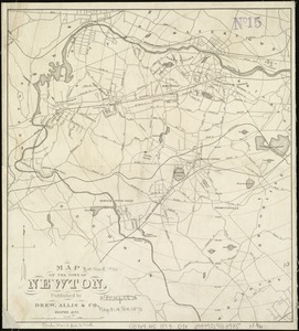
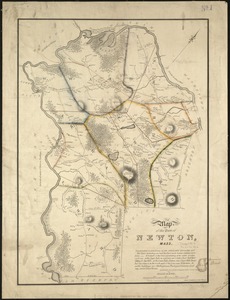
Map of the town of Newton, Mass
3.
Plan of Woodland Vale, in Newton, belonging to Wm. Kenrick
4.
Plan of lots in North Auburn Dale, Newton, Mass
5.
Plan of Briggs Place, in Newton
6.
Plan of house lots in West Newton, belonging to Chester Judson, to be sold by public auction, on Thursday August 12th at 4...
7.
Plan of land belonging to William Kenrick : near the depot of Newton Corner
8.
Plan of lots to be sold at auction in West New[ton] on Friday, September 23d, 1853, at 3 o'clock, p.m : by the foot & by the acre
9.
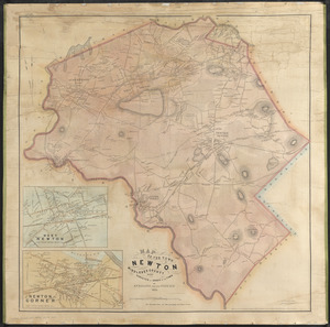
Map of the town of Newton, Middlesex County, Mass.
10.
Plan of house lots at Newton Corner near the residence of Dr. Hitchcock, lately belonging to W.S. Tuckerman
11.
Plan of Chestnut Hill, in Brookline & Newton : August 1856
12.
Plans of estates of William C. Barstow
13.
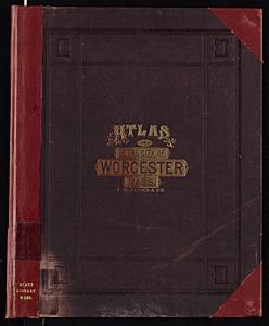
Atlas of the city of Worcester, Worcester County, Massachusetts
14.
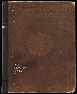
Atlas of Worcester County, Massachusetts
15.
Atlas of Franklin Co., Massachusetts : from actual surveys
16.
Official topographical atlas of Massachusetts : from astronomical, trigonometrical and various local surveys
17.
Atlas of the city of Cambridge, Middlesex Co., Massachusetts
18.
Atlas of the county of Suffolk, Massachusetts, vol. 2 : late city of Roxbury, now wards 13-14 and 15, city of Boston
19.
County atlas of Hampshire, Massachusetts
20.
Map of the town of Newton
‹ Prev
Next ›
1
2
3
4
5
…
8
9


![Plan of lots to be sold at auction in West New[ton] on Friday, September 23d, 1853, at 3 o'clock, p.m](https://bpldcassets.blob.core.windows.net/derivatives/images/commonwealth:x059c971d/image_thumbnail_300.jpg)