Toggle navigation
LMEC Home
Exhibitions
Georeferencing
Tools for Teachers
Collections
My Favorites
Sign Up / Log In
Search
Search the map portal
Map Collection
Map Collection
Map Sets
Search
Search
Search for
Search In
All Fields
Creator
Title
Subject
Place
Search All Digital Collections
Advanced Search
257 Results
My Search
Start Over
More Like
commonwealth:zg64x938j
Remove constraint More Like: commonwealth:zg64x938j
Filter your Search
Place
North and Central America
257
United States
254
Middlesex (county)
138
Massachusetts
118
Suffolk (county)
54
Boston
51
Cambridge
50
Newton
32
more
Place
»
Topic
Cambridge (Mass.)--Maps
52
Real property--Massachusetts--Boston--Maps
38
Landowners--Massachusetts--Boston--Maps
36
Buildings--Massachusetts--Boston--Maps
34
Newton (Mass.)--Maps
33
Boston (Mass.)--Maps
21
Real property--Massachusetts--Cambridge--Maps
21
Real property--Massachusetts--Newton--Maps
20
more
Topic
»
Date
Date range begin
–
Date range end
Current results range from
1787
to
2008
View distribution
Creator
G.W. Bromley & Co.
43
Bromley, George Washington
42
Bromley, Walter Scott
42
Geo. H. Walker & Co.
28
Hopkins, Griffith Morgan, Jr.
22
L.J. Richards & Co.
15
G.M. Hopkins & Co.
8
Walker Lith. & Pub. Co.
8
more
Creator
»
Format
Maps/Atlases
257
Books
4
Manuscripts
2
Georeferenced
Yes
17
No
240
Collection
Massachusetts Real Estate Atlases
143
Norman B. Leventhal Map & Education Center Collection
110
Boston and New England Maps
98
Urban Maps
90
Applied Geographics, Inc. Records
7
American Revolutionary War-Era Maps
3
William L. Clements Library Collection
3
Boston Redevelopment Authority Collection
1
Available to use
No known restrictions
110
Creative Commons license
1
Search Constraints
Sort by relevance
relevance
title
date (asc)
date (desc)
Number of results to display per page
20 per page
10
per page
20
per page
50
per page
100
per page
View results as:
grid view
map view
Search Results
41.
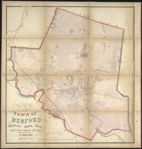
Map of the town of Medford, Middlesex County, Mass : surveyed by order of the town
42.
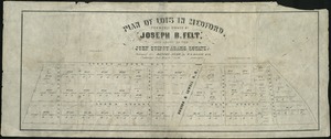
Plan of lots in Medford, formerly owned by Joseph B. Felt, and known as the John Quincy Adams Estate
43.
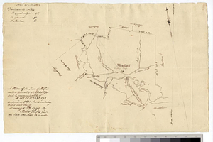
A plan of the town of Medford in the county of Middlesex and commonwealth of Massachusetts containing 5631 acres including...
44.
Saml Wath to Abel Richardson : Wm Foster to James Foster exec ditto
45.
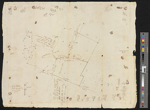
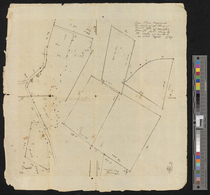
These plans represent the land of Capt Ebenezer Brook, late of Medford
46.
Historical map of Watertown, 1630-1930
47.
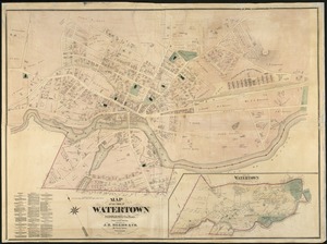
Map of the town of Watertown : Middlesex Co., Mass., from actual surveys
48.
Map of Middlesex County, Mass : copied from a map belonging to the state, with various additions and alterations, by order of...
49.
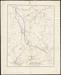
Map of parts of Middlesex & Essex counties, showing the rail road routes between Salem, Lowell, Boston & Methuen
50.
Map of the water region of the county of Middlesex exhibiting the mode of supplying Boston & Charlestown with soft water from...
51.
The North Shore and part of Middlesex County, Mass
52.
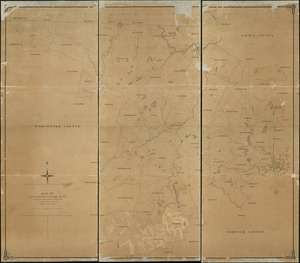
Plan of Middlesex County, Massachusetts
53.
Atlas of the city of Somerville, Massachusetts : from actual surveys and official plans
54.
Atlas of the city of Somerville, Massachusetts : from actual surveys and official records
55.
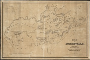
Map of Somerville, Mass
56.
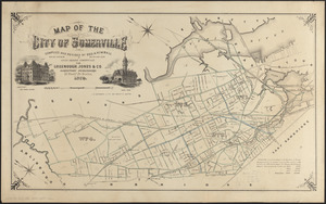
Map of the City of Somerville
57.
Map of the city of Somerville
58.
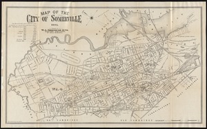
Map of the city of Somerville 1895
59.
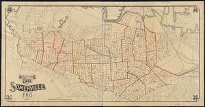
Map of the city of Somerville, 1907
60.
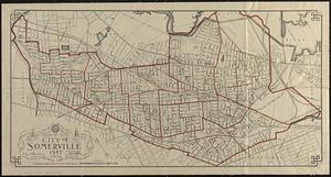
Map of the city of Somerville 1927
‹ Prev
Next ›
1
2
3
4
5
6
7
…
12
13