Toggle navigation
LMEC Home
Exhibitions
Georeferencing
Tools for Teachers
Collections
My Favorites
Sign Up / Log In
Search
Search the map portal
Map Collection
Map Collection
Map Sets
Search
Search
Search for
Search In
All Fields
Creator
Title
Subject
Place
Search All Digital Collections
Advanced Search
419 Results
My Search
Start Over
More Like
commonwealth:z603vp98m
Remove constraint More Like: commonwealth:z603vp98m
Filter your Search
Place
North and Central America
329
North America
237
United States
147
Canada
80
New France
14
Northeastern United States
14
New England
13
Great Lakes Region
9
more
Place
»
Topic
North America--Maps--Early works to 1800
240
United States--Maps--Early works to 1800
103
Canada--Maps--Early works to 1800
79
Great Britain--Colonies--America--Maps--Early works to 1800
22
Northeastern States--Maps--Early works to 1800
14
New England--Maps--Early works to 1800
12
British--America--Maps--Early works to 1800
10
Great Lakes Region (North America)--Maps--Early works to 1800
10
more
Topic
»
Date
Date range begin
–
Date range end
Current results range from
1528
to
1899
View distribution
Creator
Bellin, Jacques Nicolas, 1703-1772
21
Mitchell, John, 1711-1768
20
Jefferys, Thomas, -1771
18
Anville, Jean Baptiste Bourguignon d', 1697-1782
17
Gibson, J. (John), active 1750-1792
17
Sayer, Robert, 1725-1794
16
Kitchin, Thomas, 1719-1784
14
Bowen, Emanuel, 1693 or 1694-1767
11
more
Creator
»
Format
Maps/Atlases
419
Manuscripts
4
Georeferenced
Yes
12
No
407
Collection
American Revolutionary War-Era Maps
342
Norman B. Leventhal Map & Education Center Collection
147
MacLean Collection Map Library
126
New York Public Library Collection
83
Richard H. Brown Revolutionary War Map Collection at Mount Vernon
28
Mapping Boston Collection
12
Sidney R. Knafel Map Collection at Phillips Academy
9
Library and Archives Canada Collection
8
more
Collection
»
Available to use
No known restrictions
141
Creative Commons license
130
Search Constraints
Sort by relevance
relevance
title
date (asc)
date (desc)
Number of results to display per page
20 per page
10
per page
20
per page
50
per page
100
per page
View results as:
grid view
map view
Search Results
381.
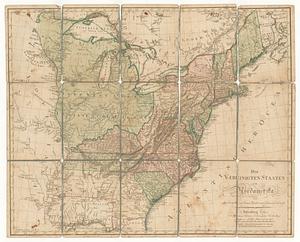
Die vereinigten staaten von Nordamerika
382.
7th map to accompany Willards History of the United States
383.
Amerique septentrionale divisée en ses principales parties
384.
Canada, Louisiane et terres angloises
385.
Canada, Louisiane et terres angloises
386.
Canada, Louisiane et terres angloises
387.
Carta della Nuova Inghilterra, Nuova Yorc, e Pensilvania
388.
Carte des etats-unis : provinces méridionales
389.
Carte des Etats-unis : provinces septentrionales
390.
An exact map of New England, New York, Pensylvania & New Jersey, from the latest surveys
391.
An exact map of New Jersey, Pensylvania [sic], New York, Maryland & Virginia, from the latest surveys
392.
A map of Philadelphia and parts adjacent
393.
[Map of Spanish Louisiana and the American colonies]
394.
[Map of Spanish Louisiana and the American colonies]
395.
A map of the country in which the army under Lt. General Burgoyne acted in the campaign of 1777 : shewing the marches of the...
396.
Map of the middle states of America : drawn from the latest and best authorities
397.
A map of the most inhabited part of Virginia containing the whole province of Maryland : with part of Pensilvania, New Jersey...
398.
Map of the northern parts of the United States of America
399.
Map of the northern provinces of the United States
400.
A map of the seat of war in the southern part of Virginia, North Carolina, and the northern part of South Carolina
‹ Prev
Next ›
1
2
…
16
17
18
19
20
21


![An exact map of New Jersey, Pensylvania [sic], New York, Maryland & Virginia, from the latest surveys](https://bpldcassets.blob.core.windows.net/derivatives/images/commonwealth:z603vp67m/image_thumbnail_300.jpg)

![[Map of Spanish Louisiana and the American colonies]](https://bpldcassets.blob.core.windows.net/derivatives/images/commonwealth:z603vq85r/image_thumbnail_300.jpg)
![[Map of Spanish Louisiana and the American colonies]](https://bpldcassets.blob.core.windows.net/derivatives/images/commonwealth:z603vp210/image_thumbnail_300.jpg)