Toggle navigation
LMEC Home
Exhibitions
Georeferencing
Tools for Teachers
Collections
My Favorites
Sign Up / Log In
Search
Search the map portal
Map Collection
Map Collection
Map Sets
Search
Search
Search for
Search In
All Fields
Creator
Title
Subject
Place
Search All Digital Collections
Advanced Search
143 Results
My Search
Start Over
More Like
commonwealth:z603vp90d
Remove constraint More Like: commonwealth:z603vp90d
Filter your Search
Place
United States
108
North and Central America
103
North America
37
Canada
30
Mississippi River
8
Louisiana
6
Northeastern United States
5
Ohio River
4
more
Place
»
Topic
United States--Maps--Early works to 1800
103
North America--Maps--Early works to 1800
33
Canada--Maps--Early works to 1800
28
Great Britain--Colonies--America--Maps--Early works to 1800
22
Mississippi River Valley--Maps--Early works to 1800
8
France--Colonies--America--Maps--Early works to 1800
7
Northeastern States--Maps--Early works to 1800
6
Louisiana--Maps--Early works to 1800
5
more
Topic
»
Date
Date range begin
–
Date range end
Current results range from
1707
to
1830
View distribution
Creator
Faden, William, 1749-1836
6
Robert Sayer and John Bennett (Firm)
6
Anville, Jean Baptiste Bourguignon d', 1697-1782
5
Hinton, John, -1781
5
Kitchin, Thomas, 1719-1784
5
Bellin, Jacques Nicolas, 1703-1772
4
Conder, Thomas, 1746 or 1747-1831
4
Evans, Lewis, 1700?-1756
4
more
Creator
»
Format
Maps/Atlases
143
Georeferenced
Yes
6
No
137
Collection
American Revolutionary War-Era Maps
131
MacLean Collection Map Library
47
New York Public Library Collection
40
Norman B. Leventhal Map & Education Center Collection
36
Richard H. Brown Revolutionary War Map Collection at Mount Vernon
12
New-York Historical Society Collection
4
Mapping Boston Collection
2
Boston Athenaeum, Cartographic Collection
1
more
Collection
»
Available to use
Creative Commons license
56
No known restrictions
38
Search Constraints
Sort by relevance
relevance
title
date (asc)
date (desc)
Number of results to display per page
20 per page
10
per page
20
per page
50
per page
100
per page
View results as:
grid view
map view
Search Results
141.
The state of New York, compiled from the most authentic information, 1796
142.
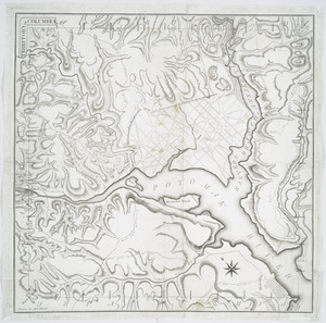
Territory of Columbia
143.
Various plans and draughts of cities, towns, harbours &c
‹ Prev
Next ›
1
2
…
4
5
6
7
8