Toggle navigation
LMEC Home
Exhibitions
Georeferencing
Tools for Teachers
Collections
My Favorites
Sign Up / Log In
Search
Search the map portal
Map Collection
Map Collection
Map Sets
Search
Search
Search for
Search In
All Fields
Creator
Title
Subject
Place
Search All Digital Collections
Advanced Search
5 Results
My Search
Start Over
More Like
commonwealth:z603vn25w
Remove constraint More Like: commonwealth:z603vn25w
Filter your Search
Place
North and Central America
5
Canada
3
Vermont
2
Cape Breton Island
1
Chambly
1
Emmet (county)
1
Kingston
1
Louisbourg
1
more
Place
»
Topic
Manuscript maps--Early works to 1800
3
Burgoyne's Invasion, 1777--Maps--Early works to 1800
2
Vermont--Maps--Early works to 1800
2
Canada--Maps--Early works to 1800
1
Cape Breton Island (N.S.)--Maps--Early works to 1800
1
Chambly (Québec)--Maps--Early works to 1800
1
Coasts--Canada--Maps--Early works to 1800
1
Coasts--New France--Maps--Early works to 1800
1
more
Topic
»
Date
Date range begin
–
Date range end
Current results range from
1717
to
1780
View distribution
Creator
Faden, William, 1749-1836
2
Medcalfe, Mr
2
Olivier, Abel, 1683?-1768
1
Format
Maps/Atlases
5
Manuscripts
3
Georeferenced
No
5
Collection
American Revolutionary War-Era Maps
5
Newberry Library Collection
3
Harvard Map Collection
1
New York Public Library Collection
1
Available to use
Creative Commons license
2
Search Constraints
Sort by relevance
relevance
title
date (asc)
date (desc)
Number of results to display per page
20 per page
10
per page
20
per page
50
per page
100
per page
View results as:
grid view
map view
Search Results
1.
A map of the country in which the army under Lt. General Burgoyne acted in the campaign of 1777 : shewing the marches of the...
2.
A map of the country in which the army under Lt. General Burgoyne acted in the campaign of 1777 : shewing the marches of the...
3.
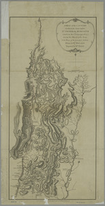
Carte de la rivire du Cannada, la Terre Nevf, Cape Britton et la cotte de Lacadie
4.
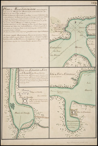
Plan de Missilimakinak avec la description de la route du Missisipi ; Idée de la situation du fort de Chambly, et des ses...
5.
Plan du port et de la ville de Louisbourg : avec ses batteries et sa perspective, où est réprésenté les batteries faites...