Toggle navigation
LMEC Home
Exhibitions
Georeferencing
Tools for Teachers
Collections
My Favorites
Sign Up / Log In
Search
Search the map portal
Map Collection
Map Collection
Map Sets
Search
Search
Search for
Search In
All Fields
Creator
Title
Subject
Place
Search All Digital Collections
Advanced Search
144 Results
My Search
Start Over
More Like
commonwealth:z603vj63p
Remove constraint More Like: commonwealth:z603vj63p
Filter your Search
Place
North and Central America
105
Canada
61
United States
61
Suffolk (county)
40
Boston
39
Nova Scotia
21
Bunker Hill
9
Minas Basin
9
more
Place
»
Topic
Coasts--Nova Scotia--Maps
62
Boston (Mass.)--Buildings, structures, etc--Maps, Manuscript--Early works to 1800
16
Fortification--Massachusetts--Boston--Maps, Manuscript--Early works to 1800
12
Coasts--Nova Scotia--Pictorial works
10
Boston (Mass.)--Maps, Manuscript--Early works to 1800
9
Atlantic Coast (N.S.)--Maps
8
Chignecto Bay (N.B. and N.S.)--Maps
8
Fortification--Massachusetts--Boston--Maps--Early works to 1800
8
more
Topic
»
Date
Date range begin
–
Date range end
Current results range from
1694
to
1879
View distribution
Creator
Des Barres, Joseph F. W. (Joseph Frederick Wallet), 1722-1824
95
Montrésor, John, 1736-1799
6
Page, Thomas Hyde, Sir, 1746-1821
3
Browne, William, Captain
2
De Berniere, Henry
2
Holland, Samuel, 1728-1801
2
Southack, Cyprian, 1662-1745
2
Aitken, Robert, 1735-1802
1
more
Creator
»
Format
Maps/Atlases
143
Manuscripts
38
Prints
1
Georeferenced
Yes
2
No
142
Collection
American Revolutionary War-Era Maps
140
Library of Congress Collection
136
Boston and New England Maps
5
British Library Collection
5
Norman B. Leventhal Map & Education Center Collection
3
Urban Maps
3
Available to use
Creative Commons license
141
No known restrictions
3
Search Constraints
Sort by relevance
relevance
title
date (asc)
date (desc)
Number of results to display per page
20 per page
10
per page
20
per page
50
per page
100
per page
View results as:
grid view
map view
Search Results
41.
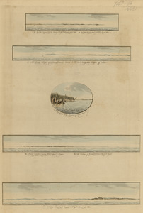
Cape Prospect ... Cape Sambro ... ; The high lands of Haspotagoen ... ; The Ovens at the entrance of Lunenburg Bay ; Cape Sable...
42.
Cape Prospect ... Cape Sambro ... ; The high lands of Haspotagoen ... ; The Ovens at the entrance of Lunenburg Bay ; Cape Sable...
43.
Cape St. Mary n.e. one mile ; South entrance of Grand Passage ; St. Marys Bay
44.
Charlotte Bay
45.
A chart of Nova Scotia
46.
A chart of Nova Scotia
47.
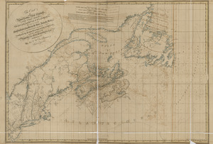
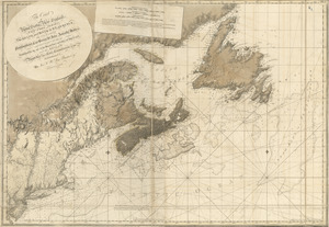
[Chignecto Bay and vicinity]
48.
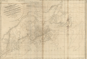
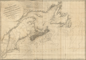
[Chignecto Bay and vicinity]
49.
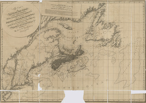
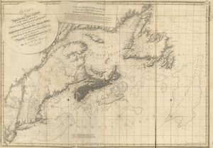
[Chignecto Bay and vicinity]
50.
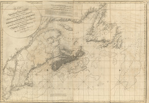
[Chignecto Bay and vicinity]
51.
The coast of Nova Scotia, New England, New-York, Jersey, the Gulph and River of St. Lawrence : the islands of Newfoundland,...
52.
The coast of Nova Scotia, New England, New-York, Jersey, the Gulph and River of St. Lawrence : the islands of Newfoundland,...
53.
The coast of Nova Scotia, New England, New-York, Jersey, the Gulph and River of St. Lawrence : the islands of Newfoundland,...
54.
The coast of Nova Scotia, New England, New-York, Jersey, the Gulph and River of St. Lawrence : the islands of Newfoundland,...
55.
The coast of Nova Scotia, New England, New-York, Jersey, the Gulph and River of St. Lawrence : the islands of Newfoundland,...
56.
The coast of Nova Scotia, New England, New-York, Jersey, the Gulph and River of St. Lawrence : the islands of Newfoundland,...
57.
The coast of Nova Scotia, New England, New-York, Jersey, the Gulph and River of St. Lawrence : the islands of Newfoundland,...
58.
A correct view of the late battle at Charlestown : June 17th, 1775
59.
Crow Harbor, on the south shore of Chedabuctou Bay
60.
Egmont Harbor
‹ Prev
Next ›
1
2
3
4
5
6
7
8


![[Chignecto Bay and vicinity]](https://bpldcassets.blob.core.windows.net/derivatives/images/commonwealth:z603vj91v/image_thumbnail_300.jpg)
![[Chignecto Bay and vicinity]](https://bpldcassets.blob.core.windows.net/derivatives/images/commonwealth:z603vj878/image_thumbnail_300.jpg)
![[Chignecto Bay and vicinity]](https://bpldcassets.blob.core.windows.net/derivatives/images/commonwealth:z603vj89t/image_thumbnail_300.jpg)
![[Chignecto Bay and vicinity]](https://bpldcassets.blob.core.windows.net/derivatives/images/commonwealth:z603vj85q/image_thumbnail_300.jpg)