Toggle navigation
LMEC Home
Exhibitions
Georeferencing
Tools for Teachers
Collections
My Favorites
Sign Up / Log In
Search
Search the map portal
Map Collection
Map Collection
Map Sets
Search
Search
Search for
Search In
All Fields
Creator
Title
Subject
Place
Search All Digital Collections
Advanced Search
300 Results
My Search
Start Over
More Like
commonwealth:z603vj614
Remove constraint More Like: commonwealth:z603vj614
Date facet yearly ssim
1698
to
1699
Remove constraint Date facet yearly ssim: <span class='from'>1698</span> to <span class='to'>1699</span>
Filter your Search
Place
North and Central America
237
United States
146
Canada
75
Suffolk (county)
61
Boston
60
Nova Scotia
24
Boston Harbor
16
Minas Basin
9
more
Place
»
Topic
Manuscript maps--Early works to 1800
138
Coasts--Nova Scotia--Maps
62
Fortification--Massachusetts--Boston--Maps--Early works to 1800
30
Boston (Mass.)--History--Revolution, 1775-1783--Maps--Early works to 1800
26
Boston (Mass.)--Buildings, structures, etc--Maps, Manuscript--Early works to 1800
17
Boston (Mass.)--History--Siege, 1775-1776--Maps--Early works to 1800
11
Fortification--Massachusetts--Boston--Maps, Manuscript--Early works to 1800
11
Coasts--Nova Scotia--Pictorial works
10
more
Topic
»
Date
Date range begin
–
Date range end
Current results range from
1700
to
1899
View distribution
Creator
Des Barres, Joseph F. W. (Joseph Frederick Wallet), 1722-1824
95
Dumont de Montigny
14
Adlum, John, 1759-1836
9
Bingham, William, 1752-1804
9
Page, Thomas Hyde, Sir, 1746-1821
9
Aitken, Robert, 1735-1802
7
Montrésor, John, 1736-1799
7
Beaurain, Jean de, 1696-1771
5
more
Creator
»
Format
Maps/Atlases
297
Manuscripts
172
Drawings/Illustrations
2
Prints
1
Georeferenced
Yes
9
No
291
Collection
American Revolutionary War-Era Maps
294
Library of Congress Collection
228
Newberry Library Collection
39
Boston and New England Maps
20
Norman B. Leventhal Map Center Collection
20
Maritime Charts and Atlases
18
Urban Maps
14
Mapping Boston Collection
10
more
Collection
»
Available to use
Creative Commons license
250
No known restrictions
11
Search Constraints
Sort by date (desc)
relevance
title
date (asc)
date (desc)
Number of results to display per page
20 per page
10
per page
20
per page
50
per page
100
per page
View results as:
grid view
map view
Search Results
41.
Annapolis Royal
42.
Annapolis Royal ; St. Mary's Bay
43.
Barrington Bay
44.
Cape Prospect ... Cape Sambro ... ; The high lands of Haspotagoen ... ; The Ovens at the entrance of Lunenburg Bay ; Cape Sable...
45.
Cape St. Mary n.e. one mile ; South entrance of Grand Passage ; St. Marys Bay
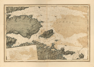
46.
Charlotte Bay
47.
[Chignecto Bay and vicinity]
48.
Combat naval à la hauteur de la Baye de Chézapeake [sic] le 5 7bre. 1781
49.
The environs of Fort Cumberland in the Bay of Fundy
50.
Halifax Harbour ... Catch Harbour ...
51.
Leith Harbour ; Prospect Harbour ; Bristol Bay ; Sambro Harbour
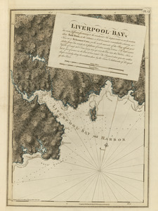
52.
Liverpool Bay
53.
Plan of the peninsula of Chesopeak [sic] Bay
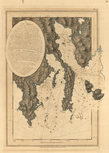
54.
Port Amherst ; Port Haldimand
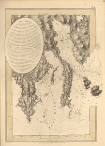
55.
Port Amherst ; Port Haldimand
56.
Port Campbell
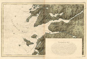
57.
Sandwich Bay
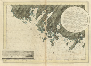
58.
[Torbay]
59.
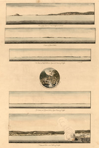
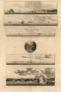
View of Cape Egmont and Winter Rock from the eastward ; Entrance of Egmont Harbor ; The entrance of Keppel Harbor ... ; Falls...
60.
View of Cape Egmont and Winter Rock from the eastward ; Entrance of Egmont Harbor ; The entrance of Keppel Harbor ... ; Falls...
‹ Prev
Next ›
1
2
3
4
5
6
7
…
14
15


![[Chignecto Bay and vicinity]](https://bpldcassets.blob.core.windows.net/derivatives/images/commonwealth:z603vj91v/image_thumbnail_300.jpg)
![Combat naval à la hauteur de la Baye de Chézapeake [sic] le 5 7bre. 1781](https://bpldcassets.blob.core.windows.net/derivatives/images/commonwealth:z603vn12t/image_thumbnail_300.jpg)

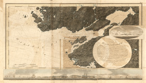
![Plan of the peninsula of Chesopeak [sic] Bay](https://bpldcassets.blob.core.windows.net/derivatives/images/commonwealth:z603vn14c/image_thumbnail_300.jpg)
![[Torbay]](https://bpldcassets.blob.core.windows.net/derivatives/images/commonwealth:z603vj992/image_thumbnail_300.jpg)