Toggle navigation
LMEC Home
Exhibitions
Georeferencing
Tools for Teachers
Collections
My Favorites
Sign Up / Log In
Search
Search the map portal
Map Collection
Map Collection
Map Sets
Search
Search
Search for
Search In
All Fields
Creator
Title
Subject
Place
Search All Digital Collections
Advanced Search
320 Results
My Search
Start Over
More Like
commonwealth:z603vg69x
Remove constraint More Like: commonwealth:z603vg69x
Filter your Search
Place
North and Central America
307
United States
275
New York
151
New Jersey
43
Canada
30
Hudson River
29
New England
25
Massachusetts
22
more
Place
»
Topic
New York (State)--Maps
85
New York (N.Y.)--Maps
48
United States--History--Revolution, 1775-1783--Maps
47
New Jersey--Maps
40
Hudson River (N.Y. and N.J.)--Maps
29
New England--Maps
27
United States--Maps
21
Railroads--New York (State)--Maps
20
more
Topic
»
Date
Date range begin
–
Date range end
Current results range from
1700
to
1976
View distribution
Creator
Kitchin, Thomas, 1719-1784
11
Reid, John, 1764?-1828
11
Bellin, Jacques Nicolas, 1703-1772
9
Farwell, John Whittemore, 1843-1929
9
Carey, Mathew, 1760-1839
6
Carleton, Osgood, 1742-1816
6
Tanner, Benjamin, 1775-1848
6
United States. Post Office Dept
6
more
Creator
»
Format
Maps/Atlases
320
Manuscripts
14
Drawings/Illustrations
1
Georeferenced
Yes
36
No
284
Collection
American Revolutionary War-Era Maps
220
Maps from AAS
138
Norman B. Leventhal Map & Education Center Collection
101
William L. Clements Library Collection
68
Urban Maps
21
Boston and New England Maps
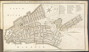
15
MacLean Collection Map Library
7
New-York Historical Society Collection
3
more
Collection
»
Available to use
No known restrictions
104
Creative Commons license
4
Search Constraints
Sort by relevance
relevance
title
date (asc)
date (desc)
Number of results to display per page
20 per page
10
per page
20
per page
50
per page
100
per page
View results as:
grid view
map view
Search Results
121.
Plan of the city of New York : showing the made and swamp land
122.
Plan of the city of New York in North America : surveyed in the years 1766 & 1767
123.
Plan of the city of New-York
124.
A plan of the city of New-York, reduced from an actual survey
125.
Rand McNally & Co.'s map of New York City, Brooklyn, Jersey City and vicinity
126.
Sketch of the country illustrating the late engagement in Long Island
127.
The strangers mercantile guide map of the cities of New York, Brooklyn, Jersey City, Hoboken, etc
128.
This plan of the City of New York (within the palisades which were erected in the year 1743) was made for the purpose of...
129.
Topographical map of the City and County of New-York, and the adjacent country : with views in the border of the principal...
130.
Ville de Manathe ou Nouvelle-Yorc
131.
15 lots of 440a each in Great Lot no. 4 of Macomb purchase : 6600 acres within 2 miles of the St. Lawrence Turnpike & 1/2 mile...
132.
An accurate map of New York in North America from a late survey
133.
A chorographical map of the northern department of North-America : drawn from the latest and most accurate observations
134.
Connecticut with portions of New York & Rhode Island
135.
E.P. Dutton & Co.'s railroad, steam boat & stage route map of New England, New-York and Canada
136.
Four wood lots in no 3
137.
Fragment of map showing two small fortifications
138.
French draught of Lake Champlain & Lake George with remarks of an English prisoner who return'd from Quebec to Fort Edward by...
139.
Hale's map of the central & western parts of Massachusetts, with a part of New-York
140.
The Johnans. Turner farm
‹ Prev
Next ›
1
2
3
4
5
6
7
8
9
10
11
…
15
16