Toggle navigation
LMEC Home
Exhibitions
Georeferencing
Tools for Teachers
Collections
My Favorites
Sign Up / Log In
Search
Search the map portal
Map Collection
Map Collection
Map Sets
Search
Search
Search for
Search In
All Fields
Creator
Title
Subject
Place
Search All Digital Collections
Advanced Search
500 Results
My Search
Start Over
More Like
commonwealth:z603vg175
Remove constraint More Like: commonwealth:z603vg175
Filter your Search
Place
North and Central America
462
United States
407
Canada
36
Louisiana
36
North America
29
Florida
24
West Indies
24
New York
12
more
Place
»
Topic
United States--Maps
330
Elections--United States--Maps
36
Louisiana--Maps
36
Railroads--United States--Maps
34
North America--Maps
28
Canada--Maps
25
Florida--Maps
25
West Indies--Maps
25
more
Topic
»
Date
Date range begin
–
Date range end
Current results range from
1749
to
2023
View distribution
Creator
Paullin, Charles Oscar, 1868 or 1869-1944
70
Wright, John Kirtland, 1891-1969
70
Geological Survey (U.S.)
26
Reid, John, 1764?-1828
11
Farwell, John Whittemore, 1843-1929
9
United States. Post Office Dept
9
Carleton, Osgood, 1742-1816
8
Kitchin, Thomas, 1719-1784
8
more
Creator
»
Format
Maps/Atlases
498
Manuscripts
13
Prints
2
Books
1
Objects/Artifacts
1
Posters
1
Georeferenced
Yes
89
No
411
Collection
Norman B. Leventhal Map & Education Center Collection
331
American Revolutionary War-Era Maps
168
American Antiquarian Society Collection
138
William L. Clements Library Collection
20
MacLean Collection Map Library
10
David Judkins Weaver Papers
2
Mapping Boston Collection
2
Applied Geographics, Inc. Records
1
more
Collection
»
Available to use
No known restrictions
255
Creative Commons license
7
Search Constraints
Sort by relevance
relevance
title
date (asc)
date (desc)
Number of results to display per page
20 per page
10
per page
20
per page
50
per page
100
per page
View results as:
grid view
map view
Search Results
281.
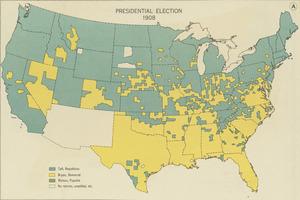
Presidential election 1908
282.
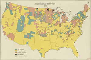
Presidential election 1912
283.
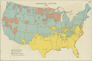
Presidential election 1924
284.
Property qualifications for suffrage, 1775
285.
Property qualifications for suffrage, 1800
286.
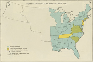
Property qualifications for suffrage, 1830
287.
Property qualifications for suffrage, 1860
288.
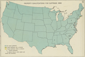
Property qualifications for suffrage, 1890
289.
Property qualifications for suffrage, 1920
290.
Public lands of the United States, 1850
291.
Public lands of the United States, 1870
292.
Public lands of the United States, 1890
293.
Public lands of the United States, 1910
294.
P.W.A. and industry : how benefits are spread
295.
P.W.A. in action
296.
PWA rebuilds the nation
297.
Radio map of the United States
298.
Radio reference map of the United States
299.
Rail road map of the southern states shewing the southern & southwestern railway connections with Philadelphia
300.
Railroad distance map of the United States, Mexico & Canada
‹ Prev
Next ›
1
2
…
11
12
13
14
15
16
17
18
19
…
24
25