Toggle navigation
LMEC Home
Exhibitions
Georeferencing
Tools for Teachers
Collections
My Favorites
Sign Up / Log In
Search
Search the map portal
Map Collection
Map Collection
Map Sets
Search
Search
Search for
Search In
All Fields
Creator
Title
Subject
Place
Search All Digital Collections
Advanced Search
9025 Results
My Search
Start Over
More Like
commonwealth:xw42t945r
Remove constraint More Like: commonwealth:xw42t945r
Filter your Search
Place
North and Central America
6,256
United States
5,172
Massachusetts
2,201
Europe
1,396
Suffolk (county)
1,355
Boston
1,328
Canada
449
Asia
438
more
Place
»
Topic
Boston (Mass.)--Maps
752
United States--Maps
282
City planning--Massachusetts--Boston--Maps
269
Real property--Massachusetts--Boston--Maps
231
Massachusetts--Maps
170
Landowners--Massachusetts--Boston--Maps
169
Urban renewal--Massachusetts--Boston--Maps
167
Buildings--Massachusetts--Boston--Maps
125
more
Topic
»
Date
Date range begin
–
Date range end
Current results range from
1482
to
2023
View distribution
Creator
United States. Hydrographic Office
595
Boston Redevelopment Authority
268
O.H. Bailey & Co
148
Des Barres, Joseph F. W. (Joseph Frederick Wallet), 1722-1824
124
United States. Post Office Dept
120
Ptolemy, 2nd cent
100
Walling, Henry Francis, 1825-1888
94
Geological Survey (U.S.)
87
more
Creator
»
Format
Maps/Atlases
8,964
Manuscripts
215
Prints
56
Books
36
Objects/Artifacts
10
Drawings/Illustrations
9
Posters
6
Georeferenced
Yes
885
No
8,140
Collection
Norman B. Leventhal Map & Education Center Collection
8,737
Boston and New England Maps
2,486
Urban Maps
2,255
Maritime Charts and Atlases
1,087
American Revolutionary War-Era Maps
648
Boston Redevelopment Authority Collection
306
Massachusetts Real Estate Atlases
38
Mapping Boston Collection
28
more
Collection
»
Available to use
No known restrictions
8,785
Creative Commons license
78
Search Constraints
Sort by relevance
relevance
title
date (asc)
date (desc)
Number of results to display per page
20 per page
10
per page
20
per page
50
per page
100
per page
View results as:
grid view
map view
Search Results
121.
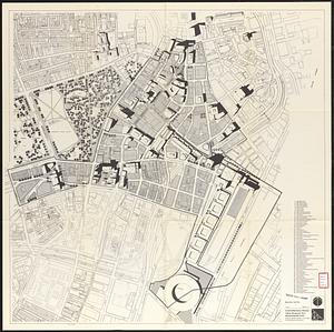
Central business district urban renewal area, Massachusetts r-82 : illustrative site plan
122.
Central business district urban renewal area, Massachusetts r-82 : illustrative site plan
123.
Central business district urban renewal area Massachusetts r-82 : illustrative site plan
124.
Central business district urban renewal area r-82 : parcel acquisition map
125.
Central business district urban renewal area r-82 : existing land use
126.
Central business district urban renewal area r-82 : building deficiencies
127.
Downtown existing buildings conditions
128.
Downtown waterfront-Faneuil Hall project urban renewal area Massachusetts R-77 : illustrative site plan
129.
Downtown waterfront-Faneuil Hall project urban renewal area Massachusetts R-77 : illustrative site plan
130.
Downtown Waterfront-Faneuil Hall renewal area : building conditions
131.
Park Plaza : illustrative site plan
132.
Park Plaza : illustrative site plan showing alternate apartment building configuration
133.
Park Plaza urban renewal area : map no. 4 building deficiencies map
134.
Waterfront land inventory South Boston : CRP port study
135.
Automobile map of Massachusetts : central section
136.
Cyclists' road map of Massachusetts
137.
Hammond's new road map of eastern Massachusetts and southern New Hampshire
138.
Hammond's new road map of Rhode Island and southeastern Massachusetts
139.
Hammond's new road map of western Massachusetts
140.
Map of Massachusetts showing state highways laid out & petitioned for
‹ Prev
Next ›
1
2
3
4
5
6
7
8
9
10
11
…
451
452