Toggle navigation
LMEC Home
Exhibitions
Georeferencing
Tools for Teachers
Collections
My Favorites
Sign Up / Log In
Search
Search the map portal
Map Collection
Map Collection
Map Sets
Search
Search
Search for
Search In
All Fields
Creator
Title
Subject
Place
Search All Digital Collections
Advanced Search
120 Results
My Search
Start Over
More Like
commonwealth:xw42qw91v
Remove constraint More Like: commonwealth:xw42qw91v
Filter your Search
Place
North and Central America
120
United States
120
Massachusetts
92
Middlesex (county)
41
Essex (county)
24
Bristol (county)
20
Hampden (county)
13
Lawrence
13
more
Place
»
Topic
Lawrence (Mass.)--Maps
14
Lowell (Mass.)--Maps
12
Holyoke (Mass.)--Maps
10
Dedham (Mass.)--Maps
9
Real property--Massachusetts--Lawrence--Maps
9
Taunton (Mass.)--Maps
9
Haverhill (Mass.)--Maps
8
New Bedford (Mass.)--Maps
8
more
Topic
»
Date
Date range begin
–
Date range end
Current results range from
1770
to
2022
View distribution
Creator
Geo. H. Walker & Co.
16
Applied Geographics, Inc.
8
Walling, Henry Francis, 1825-1888
7
L.J. Richards & Co.
6
Hopkins, Griffith Morgan, Jr.
5
D.L. Miller & Co.
4
Home Owners' Loan Corporation
4
Richards Map Company
4
more
Creator
»
Format
Maps/Atlases
120
Books
7
Manuscripts
2
Georeferenced
Yes
14
No
106
Collection
Norman B. Leventhal Map & Education Center Collection
85
Boston and New England Maps
78
Urban Maps
70
Massachusetts Real Estate Atlases
25
Applied Geographics, Inc. Records
9
American Revolutionary War-Era Maps
6
William L. Clements Library Collection
6
Mapping Inequality Collection
4
Available to use
No known restrictions
84
Creative Commons license
5
Search Constraints
Sort by relevance
relevance
title
date (asc)
date (desc)
Number of results to display per page
20 per page
10
per page
20
per page
50
per page
100
per page
View results as:
grid view
map view
Search Results
61.
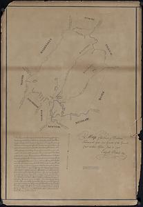
Map of the town of Dedham taken in the year 1795 by order of the General Court at their session June 18 1794
62.
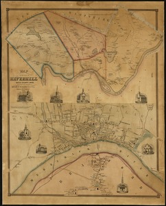
Map of the town of Haverhill, Essex County, Mass
63.
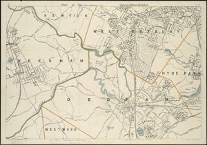
Part of the metropolitan district
64.
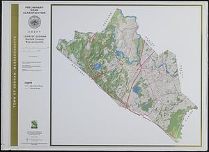
Preliminary road classification town of Dedham, Norfolk County, Massachusetts
65.
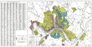
Residential security map of Haverhill, Mass.
66.
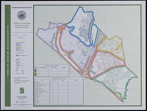
Sanding routes map : town of Dedham, Norfolk County, Massachusetts
67.
Town of Dedham Massachusetts
68.
The town of Dedham, Massachusetts : a pictorial map
69.
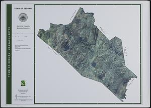
Town of Dedham, Norfolk County, Massachusetts
70.
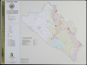
Zoning map : town of Dedham, Norfolk County, Massachusetts
71.
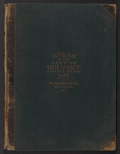
Atlas of Holyoke City, Massachusetts
72.
Atlas of Holyoke City, Massachusetts
73.
Bird's eye view of the city of Holyoke, and village of South Hadley Falls, Mass. looking north
74.
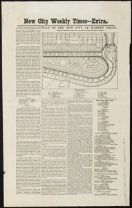
Plan of the new city at Hadley Falls
75.
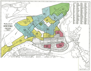
Residential security map of Holyoke and part of the city of Chicopee, Mass.
76.
Richards standard atlas of the city of Holyoke, Massachusetts : containing ten double page maps in colors, covering the entire...
77.
Richards standard atlas of the city of Holyoke, Massachusetts : containing ten double page maps in colors, covering the entire...
78.
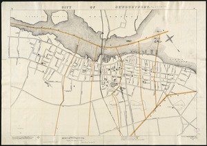
City of Newburyport
79.
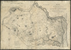
Map of the original town of Newbury, now divided into Newbury, Newburyport and West Newbury
80.
Plan of Newburyport Mass. from an actual survey
‹ Prev
Next ›
1
2
3
4
5
6