Toggle navigation
LMEC Home
Exhibitions
Georeferencing
Tools for Teachers
Collections
My Favorites
Sign Up / Log In
Search
Search the map portal
Map Collection
Map Collection
Map Sets
Search
Search
Search for
Search In
All Fields
Creator
Title
Subject
Place
Search All Digital Collections
Advanced Search
917 Results
My Search
Start Over
More Like
commonwealth:xp68p355p
Remove constraint More Like: commonwealth:xp68p355p
Filter your Search
Place
North and Central America
916
United States
913
Suffolk (county)
802
Boston
800
Massachusetts
650
Middlesex (county)
39
Downtown Boston
36
Essex (county)
28
more
Place
»
Topic
Boston (Mass.)--Maps
752
City planning--Massachusetts--Boston--Maps
135
Real property--Massachusetts--Boston--Maps
128
Landowners--Massachusetts--Boston--Maps
100
Urban renewal--Massachusetts--Boston--Maps
88
Buildings--Massachusetts--Boston--Maps
59
Local transit--Massachusetts--Boston--Maps
56
Massachusetts--Maps
47
more
Topic
»
Date
Date range begin
–
Date range end
Current results range from
1743
to
2023
View distribution
Creator
Boston Redevelopment Authority
146
Bromley, George Washington
48
Bromley, Walter Scott
47
G.W. Bromley & Co.
42
Geo. H. Walker & Co.
29
Geo. H. Walker & Co
27
Boynton, George W., d. 1884
21
Hopkins, Griffith Morgan, Jr.
21
more
Creator
»
Format
Maps/Atlases
917
Manuscripts
9
Georeferenced
Yes
96
No
821
Collection
Norman B. Leventhal Map & Education Center Collection
615
Boston and New England Maps
612
Urban Maps
523
Boston Redevelopment Authority Collection
153
Massachusetts Real Estate Atlases
143
American Revolutionary War-Era Maps
25
Mapping Boston Collection
20
William L. Clements Library Collection
10
more
Collection
»
Available to use
No known restrictions
719
Creative Commons license
34
Search Constraints
Sort by relevance
relevance
title
date (asc)
date (desc)
Number of results to display per page
20 per page
10
per page
20
per page
50
per page
100
per page
View results as:
grid view
map view
Search Results
41.
Proposed land use plan and circulation system
42.
Roxbury - N. Dorchester G.N.R.P. : preliminary land use plan
43.
Roxbury - N. Dorchester G.N.R.P. : preliminary circulation plan
44.
Roxbury-N. Dorchester G.N.R.P. r-50 : existing circulation
45.
Roxbury-N. Dorchester G.N.R.P. r-50 : proposed circulation
46.
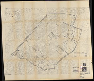
Shawmut Avenue
47.
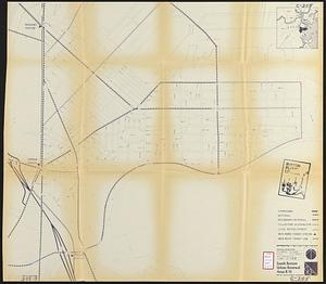
South Boston urban renewal area r-51 : proposed circulation
48.
South Boston urban renewal area r-51 : existing circulation
49.
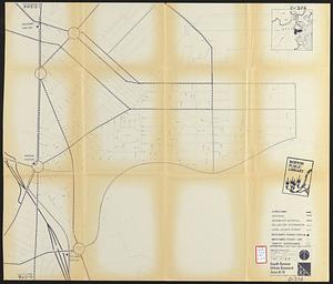
South Boston urban renewal area r-51 : proposed circulation
50.
South Boston urban renewal area r-51 : existing circulation
51.
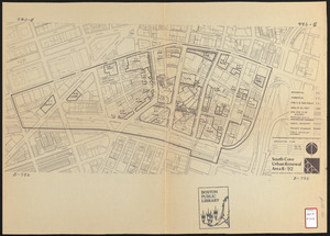
South Cove urban renewal area R-92 : disposition plan
52.
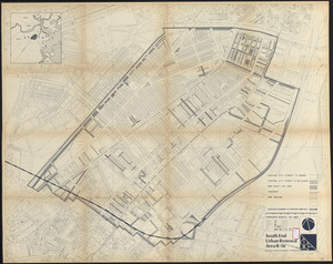
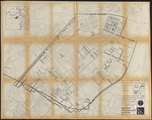
South End urban renewal area R-56 : proposed rights-of-way
53.
South End urban renewal area R-56 : proposed rights-of-way
54.
South End urban renewal area R-56 : proposed rights-of-way
55.
Washington Park urban renewal area : report on feasibility of placing utility services underground
56.
Washington Park urban renewal area Massachusetts r-24 : property map acquisitions
57.
Washington Park urban renewal area Massachusetts r-24 : property map acquisitions
58.
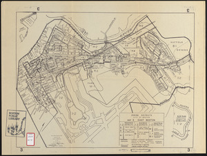
Zoning districts city of Boston map 3 East Boston
59.
Atlas, city of Everett, Middlesex County, Massachusetts
60.
Atlas of Attleboro town, Massachusetts
‹ Prev
Next ›
1
2
3
4
5
6
7
…
45
46