Toggle navigation
LMEC Home
Exhibitions
Georeferencing
Tools for Teachers
Collections
My Favorites
Sign Up / Log In
Search
Search the map portal
Map Collection
Map Collection
Map Sets
Search
Search
Search for
Search In
All Fields
Creator
Title
Subject
Place
Search All Digital Collections
Advanced Search
8945 Results
My Search
Start Over
More Like
commonwealth:wd3768095
Remove constraint More Like: commonwealth:wd3768095
Filter your Search
Place
North and Central America
6,176
United States
5,080
Massachusetts
2,216
Europe
1,396
Suffolk (county)
1,210
Boston
1,183
Canada
450
Asia
438
more
Place
»
Topic
Boston (Mass.)--Maps
752
United States--Maps
282
Massachusetts--Maps
235
Real property--Massachusetts--Boston--Maps
195
City planning--Massachusetts--Boston--Maps
158
Landowners--Massachusetts--Boston--Maps
142
New England--Maps
106
North America--Maps--Early works to 1800
103
more
Topic
»
Date
Date range begin
–
Date range end
Current results range from
1482
to
2023
View distribution
Creator
United States. Hydrographic Office
595
Boston Redevelopment Authority
162
O.H. Bailey & Co
148
Des Barres, Joseph F. W. (Joseph Frederick Wallet), 1722-1824
124
United States. Post Office Dept
120
Ptolemy, 2nd cent
100
Walling, Henry Francis, 1825-1888
95
Geological Survey (U.S.)
92
more
Creator
»
Format
Maps/Atlases
8,884
Manuscripts
217
Prints
56
Books
36
Objects/Artifacts
10
Drawings/Illustrations
8
Posters
6
Ephemera
1
Georeferenced
Yes
894
No
8,051
Collection
Norman B. Leventhal Map & Education Center Collection
8,772
Boston and New England Maps
2,411
Urban Maps
2,143
Maritime Charts and Atlases
1,087
American Revolutionary War-Era Maps
662
Boston Redevelopment Authority Collection
195
Mapping Boston Collection
29
William L. Clements Library Collection
23
more
Collection
»
Available to use
No known restrictions
8,708
Creative Commons license
80
Search Constraints
Sort by relevance
relevance
title
date (asc)
date (desc)
Number of results to display per page
20 per page
10
per page
20
per page
50
per page
100
per page
View results as:
grid view
map view
Search Results
7261.
Public lands of the United States, 1850
7262.
Public lands of the United States, 1870
7263.
Public lands of the United States, 1890
7264.
Public lands of the United States, 1910
7265.
The public libraries of Massachusetts
7266.
Puget Sound, Washington Territory
7267.
Puno - Rio Beni : South America 1:1,000,000
7268.
Putnam Co., West Virginia
7269.
Pvgna navalis in ipsis faucibus freti Öresund Svecos inter et Belgas Foederatos commissa d 29 Octob an: 1658
7270.
P.W.A. and industry : how benefits are spread
7271.
P.W.A. in action
7272.
PWA rebuilds the nation
7273.
Quakertown : Pennsylvania
7274.
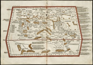
Quarta Africae tabula
7275.
Quarta Asiae tabula
7276.
Quarta Asiae taubla continet Cyprum & Syrium & Iudea & vtraq. Arabia petream & deserta ac Mesopotamia & Babilonia
7277.
Quarta et Ultima Affrice tabula continet interiorem Libyã Ethyopiam q̄ sub Egypto ẽ & q̃ est interius cũ insulis ei...
7278.
Quarta Europae tabula
7279.
Quarta Europe tabula continet Germaniam
7280.
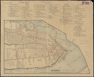
Quebec
‹ Prev
Next ›
1
2
…
360
361
362
363
364
365
366
367
368
…
447
448