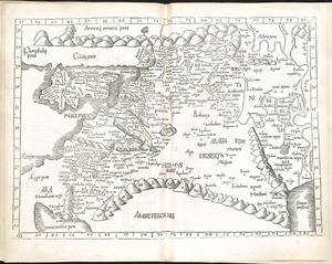
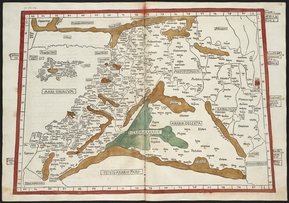
Quarta Asiae taubla continet Cyprum & Syrium & Iudea & vtraq. Arabia petream & deserta ac Mesopotamia & Babilonia
Item Information
- Title:
- Quarta Asiae taubla continet Cyprum & Syrium & Iudea & vtraq. Arabia petream & deserta ac Mesopotamia & Babilonia
- Creator:
- Ptolemy, 2nd cent
- Printer:
- Hol, Lienhart
- Date:
-
[1482]
- Format:
-
Maps/Atlases
- Location:
-
Boston Public Library
Norman B. Leventhal Map & Education Center - Collection (local):
-
Norman B. Leventhal Map & Education Center Collection
- Subjects:
-
Middle East--Maps--Early works to 1800
Lebanon--Maps--Early works to 1800
Iraq--Maps--Early works to 1800
Syria--Maps--Early works to 1800
Israel--Maps--Early works to 1800
Jordan--Maps--Early works to 1800
Kuwait--Maps--Early works to 1800
Cyprus--Maps--Early works to 1800
- Places:
-
Middle East (area)
Israel
Lebanon
Jordan
Iraq
Kuwait
Cyprus
Syria
- Extent:
- 1 map : hand col. ; 35 x 50 cm.
- Terms of Use:
-
No known copyright restrictions.
No known restrictions on use.
- Publisher:
-
Ulm :
Leonardus Holle
- Scale:
-
Scale [ca. 1:3,800,000]
- Language:
-
Latin
- Notes:
-
Title from verso.
Map of Palestine, Mesopotamia and Babylonia in present day Middle East.
Relief shown by brown coloring.
Engraved on wood with place names in moveable type.
Includes names of places and natural features.
In margin: notes on latitude.
Descriptive text within ornamental borders on verso.
Appears in the author's Geographia. Ulm : Lienhart Hol, 16 July 1482.
Cataloging, conservation, and digitization made possible in part by The National Endowment for the Humanities: Exploring the human endeavor.
Atlas scanned by Internet Archive http://www.archive.org/details/cosmographia00ptol
- Notes (date):
-
This date is inferred.
- Identifier:
-
06_01_000856
- Call #:
-
G1005 .P7 1482
- Barcode:
-
30000003825246