Toggle navigation
LMEC Home
Exhibitions
Georeferencing
Tools for Teachers
Collections
My Favorites
Sign Up / Log In
Search
Search the map portal
Map Collection
Map Collection
Map Sets
Search
Search
Search for
Search In
All Fields
Creator
Title
Subject
Place
Search All Digital Collections
Advanced Search
8885 Results
My Search
Start Over
More Like
commonwealth:wd376722h
Remove constraint More Like: commonwealth:wd376722h
Filter your Search
Place
North and Central America
6,116
United States
5,032
Massachusetts
2,129
Europe
1,396
Suffolk (county)
1,207
Boston
1,180
Canada
456
Asia
438
more
Place
»
Topic
Boston (Mass.)--Maps
752
United States--Maps
282
Real property--Massachusetts--Boston--Maps
195
Massachusetts--Maps
168
City planning--Massachusetts--Boston--Maps
157
Landowners--Massachusetts--Boston--Maps
142
New England--Maps
127
North America--Maps--Early works to 1800
103
more
Topic
»
Date
Date range begin
–
Date range end
Current results range from
1482
to
2023
View distribution
Creator
United States. Hydrographic Office
595
Boston Redevelopment Authority
162
O.H. Bailey & Co
148
Des Barres, Joseph F. W. (Joseph Frederick Wallet), 1722-1824
124
United States. Post Office Dept
120
Ptolemy, 2nd cent
100
Walling, Henry Francis, 1825-1888
94
Geological Survey (U.S.)
87
more
Creator
»
Format
Maps/Atlases
8,825
Manuscripts
215
Prints
56
Books
36
Objects/Artifacts
10
Drawings/Illustrations
8
Posters
5
Georeferenced
Yes
885
No
8,000
Collection
Norman B. Leventhal Map & Education Center Collection
8,727
Boston and New England Maps
2,363
Urban Maps
2,142
Maritime Charts and Atlases
1,083
American Revolutionary War-Era Maps
653
Boston Redevelopment Authority Collection
191
Mapping Boston Collection
20
American Antiquarian Society Collection
16
more
Collection
»
Available to use
No known restrictions
8,668
Creative Commons license
73
Search Constraints
Sort by relevance
relevance
title
date (asc)
date (desc)
Number of results to display per page
20 per page
10
per page
20
per page
50
per page
100
per page
View results as:
grid view
map view
Search Results
6141.
Panorama from the Pinnacle ("Acorn Hill," 1371'), Lyme, N.H.
6142.
Panorama orografico e pittoresco della città e contorni di Milano preso dalla somità della cattedrale
6143.
Panoramic view from Bunker Hill Monument
6144.
Panoramic view from Strawberry Hill, one of the St. Andrews Mountains, Jamaica
6145.
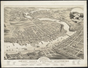
Panoramic view of the city of Calais, St. Stephen and Milltown : Washington Co. Maine, Charlotte Co. New Brunswick : mills,...
6146.
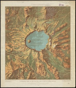
Panoramic view of the Crater Lake National Park, Oregon
6147.
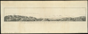
[Panoramic view of the Gettysburg battlefield]
6148.
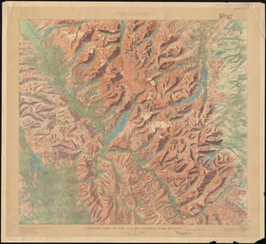
Panoramic view of the Glacier National Park, Montana
6149.
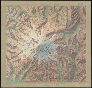
Panoramic view of the Mount Rainier National Park, Washington
6150.
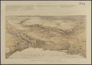
Panoramic view of the seat of war in Europe
6151.
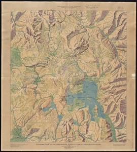
Panoramic view of the Yellowstone National Park, Wyoming-Montana-Idaho
6152.
Panoramic view of the Yosemite National Park, California
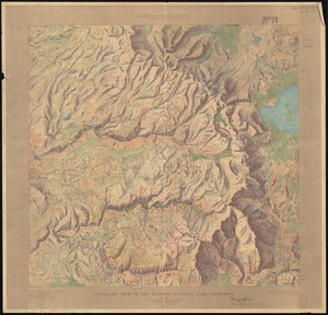
6153.
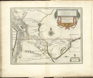
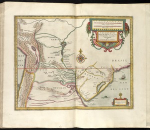
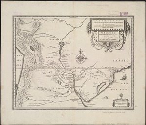
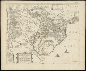
Paraguay, ó, prov. de Rio de la Plata cum regionibus adiacentibus Tucuman et Sta. Cruz de la Sierra
6154.
Paraguay, ó prov. de Rio de la Plata cum regionibus adiacentibus Tucuman et Sta. Cruz de la Sierra
6155.
Paraguay, ó prov. de Rio de la Plata cum regionibus adiacentibus Tucuman et Sta. Cruz de la Sierra
6156.
Le Paraguayr, Le Chili, La Terre, et les Isles Magellanicques : tirées de diverses rélations
6157.
Paraquaria vulgo Paraguay : cum adjacentibus
6158.
Parcel 13 rehabilitation
6159.
Parcel 22
6160.
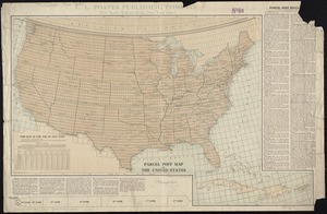
Parcel post map of the United States
‹ Prev
Next ›
1
2
…
304
305
306
307
308
309
310
311
312
…
444
445


![[Panoramic view of the Gettysburg battlefield]](https://bpldcassets.blob.core.windows.net/derivatives/images/commonwealth:xg94j2023/image_thumbnail_300.jpg)