Toggle navigation
LMEC Home
Exhibitions
Georeferencing
Tools for Teachers
Collections
My Favorites
Sign Up / Log In
Search
Search the map portal
Map Collection
Map Collection
Map Sets
Search
Search
Search for
Search In
All Fields
Creator
Title
Subject
Place
Search All Digital Collections
Advanced Search
8591 Results
My Search
Start Over
More Like
commonwealth:wd376211z
Remove constraint More Like: commonwealth:wd376211z
Filter your Search
Place
North and Central America
5,877
United States
4,806
Massachusetts
2,052
Europe
1,359
Suffolk (county)
1,034
Boston
1,007
Canada
462
Asia
422
more
Place
»
Topic
Boston (Mass.)--Maps
577
United States--Maps
314
Real property--Massachusetts--Boston--Maps
174
Massachusetts--Maps
160
Landowners--Massachusetts--Boston--Maps
132
North America--Maps--Early works to 1800
103
New England--Maps
99
Europe--Maps
78
more
Topic
»
Date
Date range begin
–
Date range end
Current results range from
1482
to
2023
View distribution
Creator
United States. Hydrographic Office
594
O.H. Bailey & Co
148
Des Barres, Joseph F. W. (Joseph Frederick Wallet), 1722-1824
123
United States. Post Office Dept
120
Ptolemy, 2nd cent
100
Walling, Henry Francis, 1825-1888
94
Geological Survey (U.S.)
87
Jefferys, Thomas, -1771
85
more
Creator
»
Format
Maps/Atlases
8,532
Manuscripts
215
Prints
56
Books
36
Objects/Artifacts
10
Drawings/Illustrations
8
Posters
4
Georeferenced
Yes
871
No
7,720
Collection
Norman B. Leventhal Map & Education Center Collection
8,554
Boston and New England Maps
2,204
Urban Maps
1,936
Maritime Charts and Atlases
1,081
American Revolutionary War-Era Maps
651
Boston Redevelopment Authority Collection
87
American Antiquarian Society Collection
20
William L. Clements Library Collection
13
more
Collection
»
Available to use
No known restrictions
8,411
Creative Commons license
49
Search Constraints
Sort by date (asc)
relevance
title
date (asc)
date (desc)
Number of results to display per page
20 per page
10
per page
20
per page
50
per page
100
per page
View results as:
grid view
map view
Search Results
161.
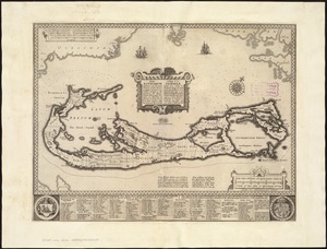
Mappa æstivarum insularum alias Bermudas dictarum ad ostia Mexicani ... accurate descr = A Mapp of the Sommer Islands once...
162.
Carte du pais d'Aunis ville & gounernement de la Rochelle
163.
Eboracum, Lincolnia, Derbia, Staffordia, Notinghamia, Lecestria, Rutlandia, et Norfolcia
164.
Gerardus Mercator natus Rupelmundæ III non. Martii anno MDXII, vixit ann. LXXXII. M. VIII. D. XXVI, denatus IV non. Decembris...
165.
Hispaniae novae nova descriptio
166.
Irlandiæ regnum
167.
Irlandiae regnum
168.
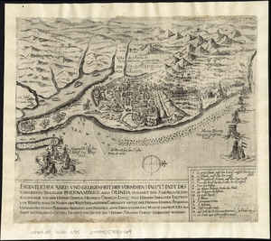
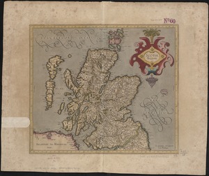
Scotia Regnum
169.
Scotiae regnum
170.
[Scotiae regnum]
171.
Vdrone Irlandiæ in Catherlagh Baronia
172.
Vltoniae orientalis : pars
173.
Warwicum, Northamtonia, Huntingdonia, Cantabrigia, Suffolcia, Oxonium, Buckinghamia, Bedfordia, Hartfordia, Essexia, Berceria,...
174.
Zeilan Insula
175.
Daniae regni typum potentissimo Invictissimoque D. Christiano, Daniae, Norvegiae, Gotthorum Vandalorum Regi lubens offert
176.
Africae nova descriptio
177.
Austria archiducatus
178.
Beschryvinghe der eylanden van Cuba, Hispaniola, Iamaica, S. Ioannis ende Margarita
179.
Chili
180.
Eygentlicher abris und gelegenheit der vornemen hauptstadt des Königreichs Brasilien Phernambuco auch Olinda genandt inn...
‹ Prev
Next ›
1
2
…
5
6
7
8
9
10
11
12
13
…
429
430


![[Scotiae regnum]](https://bpldcassets.blob.core.windows.net/derivatives/images/commonwealth:cj82m2666/image_thumbnail_300.jpg)


![Warwicum, Northamtonia, Huntingdonia, Cantabrigia, Suffolcia, Oxonium, Buckinghamia, Bedfordia, Hartfordia, Essexia, Berceria, Middelsexia, Southa[m]tonia, Surria, Cantiu[m] & Southsexia](https://bpldcassets.blob.core.windows.net/derivatives/images/commonwealth:6w924q64s/image_thumbnail_300.jpg)