Toggle navigation
LMEC Home
Exhibitions
Georeferencing
Tools for Teachers
Collections
My Favorites
Sign Up / Log In
Search
Search the map portal
Map Collection
Map Collection
Map Sets
Search
Search
Search for
Search In
All Fields
Creator
Title
Subject
Place
Search All Digital Collections
Advanced Search
8903 Results
My Search
Start Over
More Like
commonwealth:tt44pw386
Remove constraint More Like: commonwealth:tt44pw386
Filter your Search
Place
North and Central America
6,143
United States
5,060
Massachusetts
2,125
Europe
1,392
Suffolk (county)
1,292
Boston
1,265
Canada
449
Asia
437
more
Place
»
Topic
Boston (Mass.)--Maps
747
United States--Maps
279
Real property--Massachusetts--Boston--Maps
253
City planning--Massachusetts--Boston--Maps
216
Landowners--Massachusetts--Boston--Maps
170
Massachusetts--Maps
165
Urban renewal--Massachusetts--Boston--Maps
124
New England--Maps
103
more
Topic
»
Date
Date range begin
–
Date range end
Current results range from
1482
to
2023
View distribution
Creator
United States. Hydrographic Office
595
Boston Redevelopment Authority
222
O.H. Bailey & Co
148
Des Barres, Joseph F. W. (Joseph Frederick Wallet), 1722-1824
124
United States. Post Office Dept
120
Ptolemy, 2nd cent
100
Walling, Henry Francis, 1825-1888
94
Geological Survey (U.S.)
87
more
Creator
»
Format
Maps/Atlases
8,844
Manuscripts
215
Prints
56
Books
36
Objects/Artifacts
10
Drawings/Illustrations
8
Posters
4
Georeferenced
Yes
885
No
8,018
Collection
Norman B. Leventhal Map & Education Center Collection
8,675
Boston and New England Maps
2,410
Urban Maps
2,175
Maritime Charts and Atlases
1,083
American Revolutionary War-Era Maps
637
Boston Redevelopment Authority Collection
255
Massachusetts Real Estate Atlases
38
Mapping Boston Collection
20
more
Collection
»
Available to use
No known restrictions
8,680
Creative Commons license
70
Search Constraints
Sort by relevance
relevance
title
date (asc)
date (desc)
Number of results to display per page
20 per page
10
per page
20
per page
50
per page
100
per page
View results as:
grid view
map view
Search Results
8621.
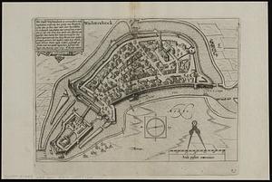
Wachtendonck
8622.
Wage map no. 1 - Polk Street to Twelfth, Halsted Street to Jefferson, Chicago ; Wage map no. 2 - Polk Street to Twelfth,...
8623.
Wage map no. 3 - Polk Street to Twelfth, Beach Street to Pacific Avenue, Chicago ; Wage map no. 4 - Polk Street to Twelfth,...
8624.
Wahre Bildtnüé der vesten Statt Montavban und wie dieselbe von Königl. Maÿ. in Franckreich belägert worden Anno 1621
8625.
Wakefield and Peace Dale, Rhode Island : 1888
8626.
Wakes Island ; Vatoa or Turtle Island and Vuata Vatoa ; Taloo Harbour, Island of Eimeo
8627.
Die Walachei
8628.
Waldoboro, Lincoln County, Maine, 1896
8629.
Wales
8630.
Walling and Gray's map of the United States and territories
8631.
Wallis's plan of the cities of London & Westminster
8632.
Wallis's tour through the United Kingdom of England, Scotland and Ireland, a new geographical game, comprehending all the...
8633.
Wallowa National Forest, Oregon
8634.
Walpole, Massachusetts : 1882
8635.
Waltham, 1911
8636.
Walworth County, Wis.
8637.
War chart of the Southern States showing the towns, rivers, rail-roads and common roads
8638.
War map no. 2 : northern Italy
8639.
War map of Central Europe from Paris to Vienna
8640.
War map of the Rhine frontiers
‹ Prev
Next ›
1
2
…
428
429
430
431
432
433
434
435
436
…
445
446