Toggle navigation
LMEC Home
Exhibitions
Georeferencing
Tools for Teachers
Collections
My Favorites
Sign Up / Log In
Search
Search the map portal
Map Collection
Map Collection
Map Sets
Search
Search
Search for
Search In
All Fields
Creator
Title
Subject
Place
Search All Digital Collections
Advanced Search
8698 Results
My Search
Start Over
More Like
commonwealth:tt44pw13b
Remove constraint More Like: commonwealth:tt44pw13b
Filter your Search
Place
North and Central America
5,929
United States
4,847
Massachusetts
2,078
Europe
1,396
Suffolk (county)
1,046
Boston
1,019
Canada
449
Asia
438
more
Place
»
Topic
Boston (Mass.)--Maps
586
United States--Maps
282
Real property--Massachusetts--Boston--Maps
175
Massachusetts--Maps
162
Landowners--Massachusetts--Boston--Maps
133
North America--Maps--Early works to 1800
103
New England--Maps
102
Europe--Maps
79
more
Topic
»
Date
Date range begin
–
Date range end
Current results range from
1482
to
2023
View distribution
Creator
United States. Hydrographic Office
595
O.H. Bailey & Co
148
Des Barres, Joseph F. W. (Joseph Frederick Wallet), 1722-1824
123
United States. Post Office Dept
120
Ptolemy, 2nd cent
100
Walling, Henry Francis, 1825-1888
94
Geological Survey (U.S.)
86
Jefferys, Thomas, -1771
85
more
Creator
»
Format
Maps/Atlases
8,638
Manuscripts
215
Prints
56
Books
36
Objects/Artifacts
10
Drawings/Illustrations
8
Posters
5
Georeferenced
Yes
869
No
7,829
Collection
Norman B. Leventhal Map & Education Center Collection
8,694
Boston and New England Maps
2,232
Urban Maps
2,022
Maritime Charts and Atlases
1,083
American Revolutionary War-Era Maps
616
Boston Redevelopment Authority Collection
87
Massachusetts Real Estate Atlases
4
Available to use
No known restrictions
8,552
Creative Commons license
47
Search Constraints
Sort by relevance
relevance
title
date (asc)
date (desc)
Number of results to display per page
20 per page
10
per page
20
per page
50
per page
100
per page
View results as:
grid view
map view
Search Results
1621.
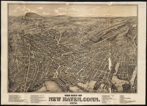
The city of New Haven, Conn : 1879
1622.
The city of New York as laid out by the Commissioners with the surrounding country
1623.
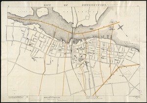
City of Newburyport
1624.
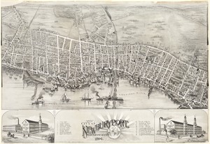
The city of Newburyport, Massachusetts
1625.
City of New-York
1626.
[City of Niagara Falls]
1627.
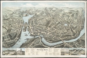
City of Norwich, Conn : 1876
1628.
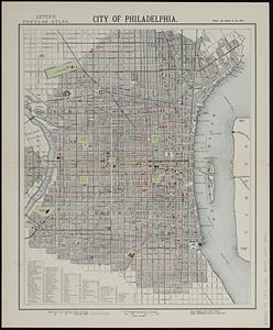
City of Philadelphia
1629.
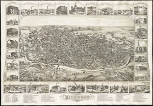
The city of Richmond, Indiana : 1884
1630.
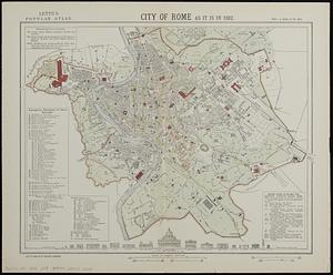
City of Rome as it is in 1882
1631.
City of Salem
1632.
City of San Francisco and its vicinity, California
1633.
City of Somerville : ward 3 : voting precincts
1634.
City of Spokane, 1910, Washington : from official records
1635.
The city of St. John : New Brunswick
1636.
City of Taunton
1637.
City of Taunton, Mass : 1875
1638.
City of Toronto : compiled from surveys made to the present date
1639.
City of Toronto, reduced by permission from Wadsworth & Unwin's large map
1640.
A city of unequal risks
‹ Prev
Next ›
1
2
…
78
79
80
81
82
83
84
85
86
…
434
435


![[City of Niagara Falls]](https://bpldcassets.blob.core.windows.net/derivatives/images/commonwealth:4m90f177c/image_thumbnail_300.jpg)