Toggle navigation
LMEC Home
Exhibitions
Georeferencing
Tools for Teachers
Collections
My Favorites
Sign Up / Log In
Search
Search the map portal
Map Collection
Map Collection
Map Sets
Search
Search
Search for
Search In
All Fields
Creator
Title
Subject
Place
Search All Digital Collections
Advanced Search
528 Results
My Search
Start Over
More Like
commonwealth:t722ks862
Remove constraint More Like: commonwealth:t722ks862
Filter your Search
Place
North and Central America
525
United States
519
Suffolk (county)
515
Boston
514
Massachusetts
83
South End
56
Roxbury
52
Back Bay
43
more
Place
»
Topic
City planning--Massachusetts--Boston--Maps
417
Urban renewal--Massachusetts--Boston--Maps
253
Boston (Mass.)--Maps
135
Buildings--Massachusetts--Boston--Maps
122
Land use--Massachusetts--Boston--Maps
100
Real property--Massachusetts--Boston--Maps
88
Roxbury (Boston, Mass.)--Maps
49
South End (Boston, Mass.)--Maps
49
more
Topic
»
Date
Date range begin
–
Date range end
Current results range from
1835
to
2017
View distribution
Creator
Boston Redevelopment Authority
376
Bromley, George Washington
24
Bromley, Walter Scott
24
G.W. Bromley & Co.
24
Downtown Waterfront Corporation
10
Victor Gruen Associates
10
Boston (Mass.). Parks and Recreation Department
8
Hopkins, Griffith Morgan, Jr.
7
more
Creator
»
Format
Maps/Atlases
527
Drawings/Illustrations
3
Manuscripts
1
Prints
1
Georeferenced
Yes
3
No
525
Collection
Boston and New England Maps
486
Urban Maps
472
Boston Redevelopment Authority Collection
446
Norman B. Leventhal Map Center Collection
108
Massachusetts Real Estate Atlases
34
Available to use
No known restrictions
492
Creative Commons license
1
Search Constraints
Sort by relevance
relevance
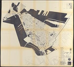
title
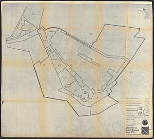
date (asc)
date (desc)
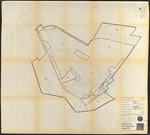
Number of results to display per page
20 per page
10
per page
20
per page
50
per page
100
per page
View results as:
grid view
map view
Search Results
121.
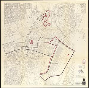
Central business district urban renewal area Massachusetts r-82 A,B,C : zoning
122.
Charlestown project no. Mass r-42 (GN) : existing circulation
123.
Charlestown project no. Mass r-42 (GN) : proposed treatment areas and project boundaries
124.
Charlestown project no. Mass r-42 (GN) : population distribution
125.
Charlestown project no. Mass r-42 (GN) : existing zoning
126.
Charlestown renewal area : existing land use
127.
Charlestown renewal area : locality map
128.
Charlestown renewal area : location map
129.
Charlestown renewal area : blighted areas
130.
Charlestown urban renewal area r-42 : GNRP map no. 2
131.
Charlestown urban renewal area r-42 : GNRP map no. 1
132.
Charlestown urban renewal area r-55 : proposed land use
133.
Charlestown urban renewal area r-55 : existing land use
134.
Charlestown urban renewal area r-55 : property map and perimeter boundaries
135.
Charlestown urban renewal area r-55 : right of way adjustments
136.
Charlestown urban renewal area r-55 : existing zoning
137.
Charlestown urban renewal area r-55 : proposed zoning
138.
Charlestown urban renewal area r-55 : existing land use
139.
Conceptual plan
140.
Conceptual plan
‹ Prev
Next ›
1
2
3
4
5
6
7
8
9
10
11
…
26
27