Toggle navigation
LMEC Home
Exhibitions
Georeferencing
Tools for Teachers
Collections
My Favorites
Sign Up / Log In
Search
Search the map portal
Map Collection
Map Collection
Map Sets
Search
Search
Search for
Search In
All Fields
Creator
Title
Subject
Place
Search All Digital Collections
Advanced Search
153 Results
My Search
Start Over
More Like
commonwealth:sx61h892c
Remove constraint More Like: commonwealth:sx61h892c
Filter your Search
Place
North and Central America
153
United States
150
Suffolk (county)
38
Essex (county)
37
Boston
36
Middlesex (county)
26
Norfolk (county)
13
Lawrence
12
more
Place
»
Topic
Landowners--Massachusetts--Boston--Maps
35
Real property--Massachusetts--Boston--Maps
35
Buildings--Massachusetts--Boston--Maps
34
Lawrence (Mass.)--Maps
14
Boston (Mass.)--Maps
12
Buildings--Massachusetts--Brookline--Maps
9
Dorchester (Boston, Mass.)--Maps
8
Real property--Massachusetts--Lawrence--Maps
8
more
Topic
»
Date
Date range begin
–
Date range end
Current results range from
1830
to
2022
View distribution
Creator
Bromley, George Washington
37
Bromley, Walter Scott
36
G.W. Bromley & Co.
36
Geo. H. Walker & Co.
24
Hopkins, Griffith Morgan, Jr.
19
L.J. Richards & Co.
15
Richards Map Company
8
Walker Lith. & Pub. Co.
7
more
Creator
»
Format
Maps/Atlases
153
Books
1
Georeferenced
Yes
5
No
148
Collection
Massachusetts Real Estate Atlases
143
Boston and New England Maps
10
Norman B. Leventhal Map Center Collection
10
Urban Maps
8
Available to use
No known restrictions
9
Creative Commons license
1
Search Constraints
Sort by relevance
relevance
title
date (asc)
date (desc)
Number of results to display per page
20 per page
10
per page
20
per page
50
per page
100
per page
View results as:
grid view
map view
Search Results
1.
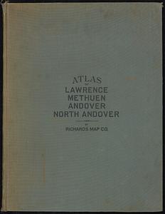
Atlas of the city of Lawrence and the towns of Methuen, Andover and North Andover, Massachusetts
2.
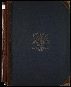
Atlas of the city of Lawrence, Massachusetts : including also the town of Methuen
3.
City atlas of Lawrence, Massachusetts : from official records, private plans and actual surveys, based upon plans deposited in...
4.
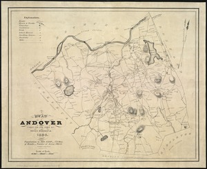
A plan of Andover taken for the town
5.
Atlas of the city of Lawrence and the towns of Methuen, Andover and North Andover, Massachusetts
6.
Atlas of the city of Lawrence and the towns of Methuen, Andover and North Andover, Massachusetts
7.
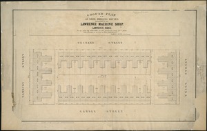
Ground plan of 50 brick dwelling houses, belonging to the Lawrence Machine Shop, Lawrence, Mass : to be sold by auction on the...
8.
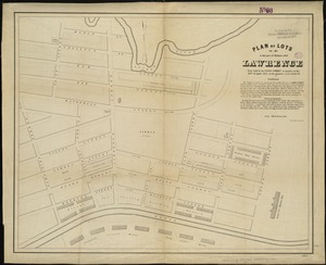
Plan of lots in that part of Methuen called Lawrence : to be sold by the Essex Company at auction on the 28th of April, 1847,...
9.
Atlas of Massachusetts
10.
Atlas of Essex County, Massachusetts
11.
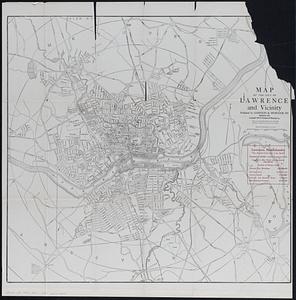
Map of the city of Lawrence and vicinity
12.
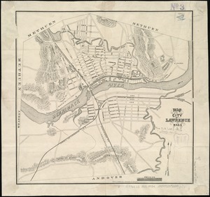
Map of the city of Lawrence Mass
13.
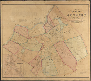
Map of the town of Andover, Essex County, Massachusetts
14.
A people's map of Lawrence, Massachusetts
15.
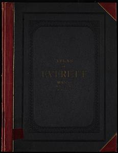
Atlas, city of Everett, Middlesex County, Massachusetts
16.
Atlas of Attleboro town, Massachusetts
17.
Atlas of Barnstable County, Massachusetts : towns of Bourne, Mashpee, Falmouth, Sandwich, Barnstable, Yarmouth, Dennis,...
18.
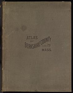
Atlas of Berkshire County, Massachusetts
19.
Atlas of Brookfield, West Brookfield and North Brookfield towns, Massachusetts
20.
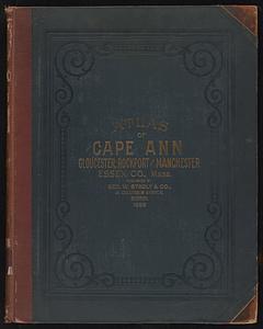
Atlas of Cape Ann, Gloucester, Rockport and Manchester, Essex County, Mass
‹ Prev
Next ›
1
2
3
4
5
…
7
8