Toggle navigation
LMEC Home
Exhibitions
Georeferencing
Tools for Teachers
Collections
My Favorites
Sign Up / Log In
Search
Search the map portal
Map Collection
Map Collection
Map Sets
Search
Search
Search for
Search In
All Fields
Creator
Title
Subject
Place
Search All Digital Collections
Advanced Search
8736 Results
My Search
Start Over
More Like
commonwealth:st74cw92q
Remove constraint More Like: commonwealth:st74cw92q
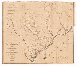
Filter your Search
Place
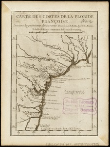
North and Central America
5,967
United States
4,865
Massachusetts
2,078
Europe
1,396
Suffolk (county)
1,045
Boston
1,018
Canada
450
Asia
438
more
Place
»
Topic
Boston (Mass.)--Maps
586
United States--Maps
282
Real property--Massachusetts--Boston--Maps
175
Massachusetts--Maps
162
Landowners--Massachusetts--Boston--Maps
133
North America--Maps--Early works to 1800
105
New England--Maps
102
Europe--Maps
79
more
Topic
»
Date
Date range begin
–
Date range end
Current results range from
1482
to
2023
View distribution
Creator
United States. Hydrographic Office
595
O.H. Bailey & Co
148
Des Barres, Joseph F. W. (Joseph Frederick Wallet), 1722-1824
126
United States. Post Office Dept
120
Ptolemy, 2nd cent
100
Walling, Henry Francis, 1825-1888
94
Jefferys, Thomas, -1771
90
Geological Survey (U.S.)
86
more
Creator
»
Format
Maps/Atlases
8,676
Manuscripts
220
Prints
56
Books
36
Objects/Artifacts
10
Drawings/Illustrations
8
Posters
5
Georeferenced
Yes
871
No
7,865
Collection
Norman B. Leventhal Map & Education Center Collection
8,694
Boston and New England Maps
2,232
Urban Maps
2,023
Maritime Charts and Atlases
1,088
American Revolutionary War-Era Maps
656
Boston Redevelopment Authority Collection
87
MacLean Collection Map Library
17
Richard H. Brown Revolutionary War Map Collection at Mount Vernon
9
more
Collection
»
Available to use
No known restrictions
8,553
Creative Commons license
70
Search Constraints
Sort by relevance
relevance
title
date (asc)
date (desc)
Number of results to display per page
20 per page
10
per page
20
per page
50
per page
100
per page
View results as:
grid view
map view
Search Results
21.
A new mapp of Carolina
22.
Americæ pars, nunc Virginia dicta, primum ab Anglis inuenta, sumtibus Dn. Walteri Raleigh, equestris ordinis Viri, Anno Dn̄i....
23.
Virginia Marylandia et Carolina in America septentrionali Brittannorum industria excultæ
24.
Virginiae item et Floridae Americae provincarum, nova descriptio
25.
Caroline méridionale et partie de la Georgie
26.
A map of South Carolina and a part of Georgia : Containing the whole sea-coast; all the islands, inlets, rivers, creeks,...
27.
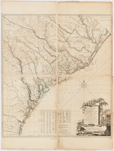
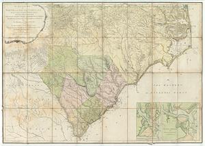
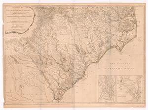
An accurate map of North and South Carolina with their Indian frontiers : shewing in a distinct manner all the mountains,...
28.
An accurate map of North and South Carolina with their Indian frontiers, shewing in a distinct manner all the mountains,...
29.
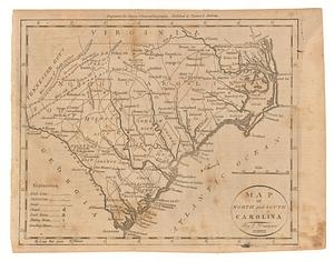
Map of North and South Carolina
30.
South-Carolina and parts adjacent : shewing the movements of the American and British armies
31.
Carta particolare della costa di Florida è di Virginia
32.
Carte des costes de la Floride Françoise : suivant les premieres découvertes
33.
The coast of West Florida and Louisiana
34.
La Florida
35.
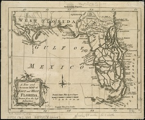
A New and accurate map of East and West Florida, drawn from the best authorities
36.
Païs cedés, sheet IId, containing the Peninsula & Gulf of Florida, with the Bahama Islands
37.
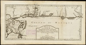
Partie de la coste de la Louisiane et de la Floride : depuis le Mississipi jusqua St. Marc d'Apalache
38.
Georgia, from the latest authorities
39.
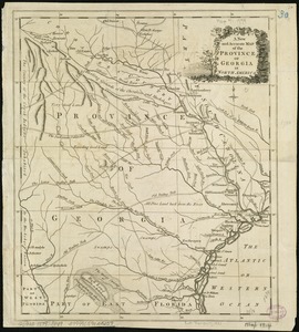
A New and accurate map of the province of Georgia in North America
40.
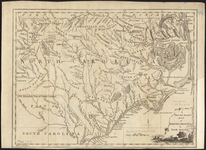
A new and accurate map of North Carolina in North America
‹ Prev
Next ›
1
2
3
4
5
6
…
436
437