Toggle navigation
LMEC Home
Exhibitions
Georeferencing
Tools for Teachers
Collections
My Favorites
Sign Up / Log In
Search
Search the map portal
Map Collection
Map Collection
Map Sets
Search
Search
Search for
Search In
All Fields
Creator
Title
Subject
Place
Search All Digital Collections
Advanced Search
493 Results
My Search
Start Over
More Like
commonwealth:q524ng14b
Remove constraint More Like: commonwealth:q524ng14b
Filter your Search
Place
North and Central America
432
United States
301
New York
40
Florida
19
Canada
17
Alabama
15
Chatham (county)
15
Chesapeake Bay
13
more
Place
»
Topic
Manuscript maps--Early works to 1800
93
Manuscript maps
21
Gulf Coast (U.S.)--Maps, Manuscript--Early works to 1800
12
Fortification--New York (State)--New York--Maps--Early works to 1800
11
Nautical charts--Chesapeake Bay (Md. and Va.)--Early works to 1800
9
New York (N.Y.)--Buildings, structures, etc--Maps, Manuscript--Early works to 1800
9
Nautical charts--Delaware Bay (Del. and N.J.)--Early works to 1800
8
New York (N.Y.)--Maps, Manuscript--Early works to 1800
8
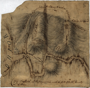
more
Topic
»
Date
Date range begin
–
Date range end
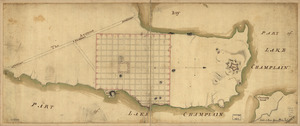
Current results range from
1700
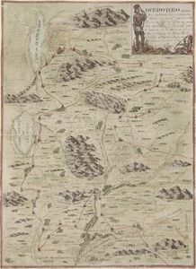
to
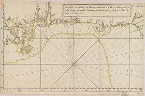
1899
View distribution
Creator
Hills, John, (Surveyor)
18
Montrésor, John, 1736-1799
16
Bingham, William, 1752-1804
12
Adlum, John, 1759-1836
10
Washington, George, 1732-1799
9
Faden, William, 1749-1836
7
Morgan, Benjamin, (Draftsman)
7
Wangenheim, Friedrich Adam Julius von
7
more
Creator
»
Format
Maps/Atlases
491
Manuscripts
476
Objects/Artifacts
2
Georeferenced
Yes
5
No
488
Collection
American Revolutionary War-Era Maps
490
Library of Congress Collection
480
Maritime Charts and Atlases
37
Urban Maps
15
Norman B. Leventhal Map & Education Center Collection
7
British Library Collection
4
Newberry Library Collection
1
Richard H. Brown Revolutionary War Map Collection at Mount Vernon
1
Available to use
Creative Commons license
485
No known restrictions
7
Search Constraints
Sort by relevance
relevance
title
date (asc)
date (desc)
Number of results to display per page
20 per page
10
per page
20
per page
50
per page
100
per page
View results as:
grid view
map view
Search Results
61.
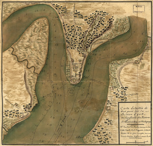
Carte detaillée de West Point sur la rivière d'York au confluent des Rivières de Pamunkey et Matapony
62.
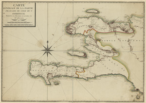
Carte générale de la partie française de l'isle de St. Domingue
63.
Cawanesque
64.
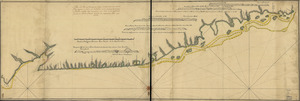
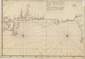
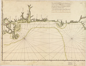
Chart of the sea coast from latitude 27⁰00ʹ00ʺ to 27⁰20ʹ00ʺ, with Little Inlet & River into Hillsborough River ; Chart of the...
65.
Chart of the sea coast from lattde. 26⁰20ʹ00ʺ to 26⁰ & 40ʹ00ʺ with the head of Sharkshead River ; Chart of New Inlet ; Chart of...
66.
The coast of Florida from the Dry Tortugas to the old Cape
67.
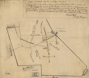
Colchester, May the: 6:th: Day: A.D.: 1765
68.
Copy of a sketch of the Monongahela, with the field of battle
69.
Copy of a survey return'd by Mr. Sam Lewis, surveyor of Botetourt Coun[t]y : Surveyed for George Washington 2950 acres of land...
70.
Costa de Cuba desde Cabo de San Antonio a la bahía de Cardenas
71.
Costa desde la Mobila asta la Bahía de Sn. Josef
72.
Côte de York-town à Boston: Marches de l'armée
73.
Country between North River and Croton River
74.
The course of Delaware River from Philadelphia to Chester, exhibiting the several works erected by the rebels to defend its...
75.
Crown Point & part of Lake Champlain
76.
Cuba, ciudad capittal de la ysla del mismo nombre y su famoso puerto sittuado en la costa del sur de gra. ysla, los 20 grados y...
77.
Derrotero hecho por Antonia Vélez y Escalante, misionero para mejor conocimiento de las misiones, pueblos de indios y...
78.
Descripción de la costa de la Luciana y entrada en el Río de Micisipi con sus sondas y bajos, nuebamente correjido y...
79.
Descripción de la costa de la Luciana y entrada en el Río de Micisipi con sus sondas y bajos nuebamte. corregido y enmendado...
80.
Descripción de la costa de la Luciana y entrada en el Río de Micisipi con sus sondas y bajos, nuebamte. correjido y enmendado...
‹ Prev
Next ›
1
2
3
4
5
6
7
8
…
24
25

![Chart of the sea coast from latitude 27⁰00ʹ00ʺ to 27⁰20ʹ00ʺ, with Little Inlet & River into Hillsborough River ; Chart of the sea coast from latitude 26⁰40ʹ00ʺ to [27⁰]00ʹ00ʺ, the Leech Shoal & Hillsborough River](https://bpldcassets.blob.core.windows.net/derivatives/images/commonwealth:q524nd97p/image_thumbnail_300.jpg)


![Copy of a survey return'd by Mr. Sam Lewis, surveyor of Botetourt Coun[t]y](https://bpldcassets.blob.core.windows.net/derivatives/images/commonwealth:q524nf40r/image_thumbnail_300.jpg)