Toggle navigation
LMEC Home
Exhibitions
Georeferencing
Tools for Teachers
Collections
My Favorites
Sign Up / Log In
Search
Search the map portal
Map Collection
Map Collection
Map Sets
Search
Search
Search for
Search In
All Fields
Creator
Title
Subject
Place
Search All Digital Collections
Advanced Search
588 Results
My Search
Start Over
More Like
commonwealth:q524nd88q
Remove constraint More Like: commonwealth:q524nd88q
Filter your Search
Place
North and Central America
523
United States
384
Suffolk (county)
63
Boston
62
Massachusetts
51
New York
42
Canada
27
Boston Harbor
26
more
Place
»
Topic
Manuscript maps--Early works to 1800
138
Boston (Mass.)--Maps--Early works to 1800
46
Manuscript maps
21
Boston (Mass.)--History--Revolution, 1775-1783--Maps--Early works to 1800
18
Boston Harbor (Mass.)--Maps--Early works to 1800
18
Bunker Hill, Battle of, Boston, Mass., 1775--Maps--Early works to 1800
18
Gulf Coast (U.S.)--Maps, Manuscript--Early works to 1800
12
Fortification--New York (State)--New York--Maps--Early works to 1800
11
more
Topic
»
Date
Date range begin
–
Date range end
Current results range from
1694
to
1899
View distribution
Creator
Hills, John, (Surveyor)
18
Montrésor, John, 1736-1799
18
Dumont de Montigny
14
Bingham, William, 1752-1804
12
Adlum, John, 1759-1836
10
Faden, William, 1749-1836
10
Washington, George, 1732-1799
9
Page, Thomas Hyde, Sir, 1746-1821
8
more
Creator
»
Format
Maps/Atlases
586
Manuscripts
524
Objects/Artifacts
2
Georeferenced
Yes
13
No
575
Collection
American Revolutionary War-Era Maps
574
Library of Congress Collection
488
Boston and New England Maps
52
Norman B. Leventhal Map & Education Center Collection
52
Urban Maps
42
Newberry Library Collection
39
Maritime Charts and Atlases
36
Mapping Boston Collection
13
more
Collection
»
Available to use
Creative Commons license
507
No known restrictions
42
Search Constraints
Sort by relevance
relevance
title
date (asc)
date (desc)
Number of results to display per page
20 per page
10
per page
20
per page
50
per page
100
per page
View results as:
grid view
map view
Search Results
581.
A tracing relating to Fort Washington or Knyphausen
582.
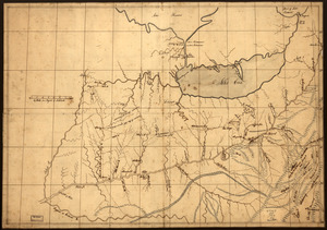
A trader's map of the Ohio country before 1753
583.
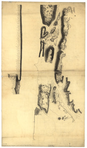
Unfinished draught for a topographical map of the northern part of New York Island
584.
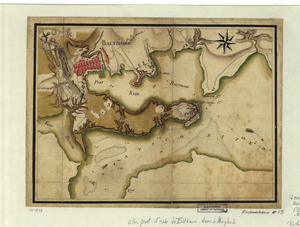
Ville, port, et rade de Baltimore dans le Maryland
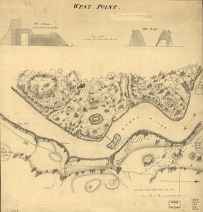
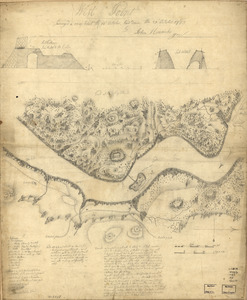
585.
West Point
586.
West Point : surveyed a coup d'oeil the 24th October, laid down the 27th October 1783
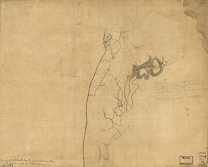
587.
Westchester County coast, New Rochelle to Horseneck River: unfinished
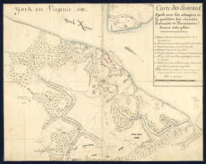
588.
York en Virginie, 1781 : Carte des environs d'York avec les attaques à la position des Armées francaise et americaine devant...
‹ Prev
Next ›
1
2
…
26
27
28
29
30