Toggle navigation
LMEC Home
Exhibitions
Georeferencing
Tools for Teachers
Collections
My Favorites
Sign Up / Log In
Search
Search the map portal
Map Collection
Map Collection
Map Sets
Search
Search
Search for
Search In
All Fields
Creator
Title
Subject
Place
Search All Digital Collections
Advanced Search
452 Results
My Search
Start Over
More Like
commonwealth:q524mv399
Remove constraint More Like: commonwealth:q524mv399
Filter your Search
Place
North and Central America
386
United States
247
Canada
119
New York
78
Quebec
72
Suffolk (county)
31
Boston
29
North America
27
more
Place
»
Topic
United States--History--French and Indian War, 1754-1763--Maps
161
Saint Lawrence River--Maps
24
North America--Maps--Early works to 1800
18
Boston (Mass.)--History--Revolution, 1775-1783--Maps--Early works to 1800
16
Braddock's Campaign, 1755--Maps
14
Louisbourg (N.S.)--Maps
11
Québec (Québec)--Maps
11
Québec Campaign, Québec, 1759--Maps
11
more
Topic
»
Date
Date range begin
–
Date range end
Current results range from
1740
to
1900
View distribution
Creator
Jefferys, Thomas, -1771
38
Faden, William, 1749-1836
33
Rocque, Mary Ann
24
Le Rouge, Georges-Louis
23
Des Barres, Joseph F. W. (Joseph Frederick Wallet), 1722-1824
21
Sayer, Robert, 1725-1794
21
Orme, Robert, -1781
16
Korn, Christoph Heinrich, 1726-1783
11
more
Creator
»
Format
Maps/Atlases
408
Prints
33
Manuscripts
23
Drawings/Illustrations
9
Books
2
Georeferenced
Yes
12
No
440
Collection
American Revolutionary War-Era Maps
450
Richard H. Brown Revolutionary War Map Collection at Mount Vernon
293
William L. Clements Library Collection
149
Norman B. Leventhal Map & Education Center Collection
6
Boston and New England Maps
4
American Antiquarian Society Collection
3
Maritime Charts and Atlases
2
Urban Maps
2
more
Collection
»
Available to use
Creative Commons license
293
No known restrictions
7
Search Constraints
Sort by relevance
relevance
title
date (asc)
date (desc)
Number of results to display per page
20 per page
10
per page
20
per page
50
per page
100
per page
View results as:
grid view
map view
Search Results
81.
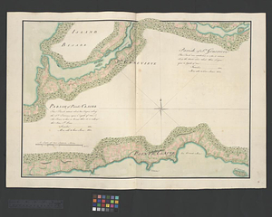
Parish of St. Charles
82.
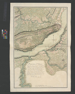
Parish of St. Foix
83.
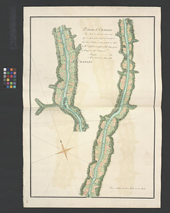
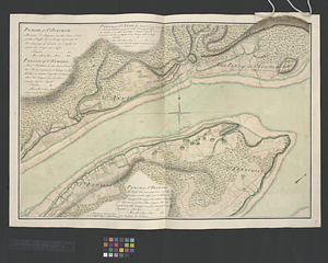
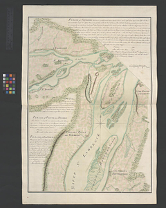
Parish of St. Genevieve. Parish of Pointe Claire
84.
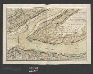
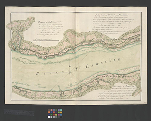
Parish of St. Joachim. Parish of St. Famille. Parish of St. Anne. Parish of St. François
85.
Parish of St. Joseph [of Masquinonge]. Parish of the River du Loup
86.
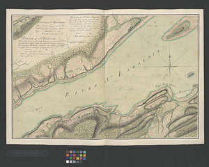
Parish of St. Lawrence. Parish of Beaumont. Parish of St. Peter
87.
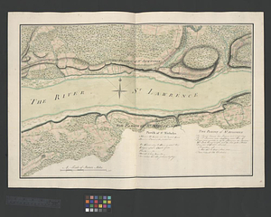
Parish of St. Michelle. Parish of St. John Baptist. Parish of St. Vertier
88.
Parish of St. Nicholas. The Parish of St. Augustin
89.
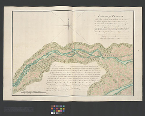
Parish of Terbone
90.
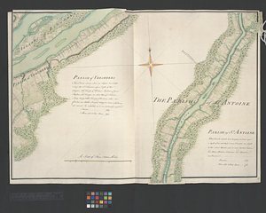
Parish of the Ecureuils. Parish of Point aux Trembles. Parish of St. Antoine. Parish of St. Croix
91.
Parish of Varrenes. Parish of Pointe aux Trembles. Parish of La Chenais
92.
Parish of Vercheres. Parish of St. Antoine
93.
Part of the Richelieu River showing Fort de St. Ieant
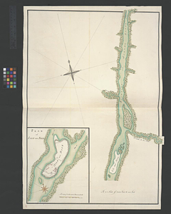
94.
Part of the Richelieu River showing Isle aux Noix
95.
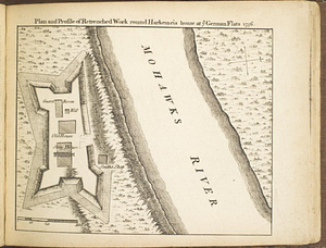
Plan and profile of retrenched work round Harkemeis house at ye German Flats 1756
96.
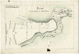
Plan de la pointe à Rochefort
97.
Plan du fort de Carillon et de ses environs avec l'attaque des retranchments faite par une armee Angloise de 25000 homes aux...
98.
Plan du port et de la ville de Louisbourg en l'Isle Royale et des attaques faites par les Anglois pandent le siege depuis le 8...
99.
Plan du port et de la ville de Louisbourg en l'Isle Royale, et des Attaques faites par les Anglois pendant le Siége depuis le 8...
100.
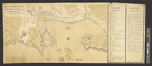
Plan of Fort [Brewerton] at the west end of Onnide Lake
‹ Prev
Next ›
1
2
3
4
5
6
7
8
9
…
22
23
![Parish of St. Joseph [of Masquinonge]. Parish of the River du Loup](https://bpldcassets.blob.core.windows.net/derivatives/metadata/commonwealth-oai:8336n077h/image_thumbnail_300.jpg)

![Plan of Fort [Brewerton] at the west end of Onnide Lake](https://bpldcassets.blob.core.windows.net/derivatives/metadata/commonwealth-oai:639615613/image_thumbnail_300.jpg)