Toggle navigation
LMEC Home
Exhibitions
Georeferencing
Tools for Teachers
Collections
My Favorites
Sign Up / Log In
Search
Search the map portal
Map Collection
Map Collection
Map Sets
Search
Search
Search for
Search In
All Fields
Creator
Title
Subject
Place
Search All Digital Collections
Advanced Search
8955 Results
My Search
Start Over
More Like
commonwealth:m900r8868
Remove constraint More Like: commonwealth:m900r8868
Filter your Search
Place
North and Central America
6,186
United States
5,102
Massachusetts
2,146
Europe
1,396
Suffolk (county)
1,301
Boston
1,274
Canada
449
Asia
438
more
Place
»
Topic
Boston (Mass.)--Maps
753
United States--Maps
282
Real property--Massachusetts--Boston--Maps
254
City planning--Massachusetts--Boston--Maps
218
Landowners--Massachusetts--Boston--Maps
170
Massachusetts--Maps
166
Urban renewal--Massachusetts--Boston--Maps
124
New England--Maps
104
more
Topic
»
Date
Date range begin
–
Date range end
Current results range from
1482
to
2023
View distribution
Creator
United States. Hydrographic Office
595
Boston Redevelopment Authority
222
O.H. Bailey & Co
148
Des Barres, Joseph F. W. (Joseph Frederick Wallet), 1722-1824
124
United States. Post Office Dept
120
Ptolemy, 2nd cent
100
Walling, Henry Francis, 1825-1888
94
Geological Survey (U.S.)
87
more
Creator
»
Format
Maps/Atlases
8,895
Manuscripts
215
Prints
56
Books
36
Objects/Artifacts
10
Drawings/Illustrations
8
Posters
5
Georeferenced
Yes
885
No
8,070
Collection
Norman B. Leventhal Map & Education Center Collection
8,726
Boston and New England Maps
2,425
Urban Maps
2,208
Maritime Charts and Atlases
1,083
American Revolutionary War-Era Maps
638
Boston Redevelopment Authority Collection
256
Massachusetts Real Estate Atlases
38
Mapping Boston Collection
20
more
Collection
»
Available to use
No known restrictions
8,732
Creative Commons license
70
Search Constraints
Sort by relevance
relevance
title
date (asc)
date (desc)
Number of results to display per page
20 per page
10
per page
20
per page
50
per page
100
per page
View results as:
grid view
map view
Search Results
3361.
The Gut of Canso : which divides ... cables distance
3362.
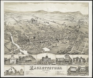
Hackettstown : New Jersey
3363.
Der Hafen von Hamburg
3364.
Der Hafen von Hamburg
3365.
Hagstrom's map of Brooklyn (New York City) : house-number and subway guide
3366.
Haiti
3367.
Hale's map of the central & western parts of Massachusetts, with a part of New-York
3368.
Halifax Harbour ... Catch Harbour ... small vessels only
3369.
Halifax Harbour ... Catch Harbour ... small vessels only
3370.
Hall and Elvans' subdivision of Meridian Hill, Washington County, D.C : Sept. 1867
3371.
[Hamadaradz Asharhatsuyts] = [Extensive world map]
3372.
Hammond's complete map of Jersey City, Bayonne and Hoboken
3373.
Hammond's complete map of New York City
3374.
Hammond's complete map of the Bronx
3375.
Hammond's comprehensive map of the United States with portions of Canada and Mexico
3376.
Hammond's comprehensive map of the United States with portions of Canada and Mexico
3377.
Hammond's enlarged map of Europe of to-day showing boundaries of the new states as determined by the peace conference
3378.
Hammond's five mile maps of western front
3379.
Hammond's large scale war map of the Italian Front
3380.
Hammond's new road map of eastern Massachusetts and southern New Hampshire
‹ Prev
Next ›
1
2
…
165
166
167
168
169
170
171
172
173
…
447
448


![[Hamadaradz Asharhatsuyts]](https://bpldcassets.blob.core.windows.net/derivatives/images/commonwealth:x633f982n/image_thumbnail_300.jpg)


