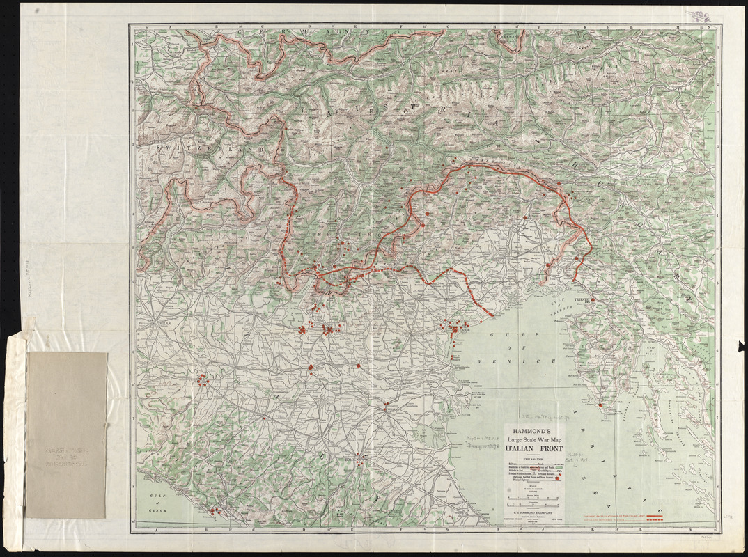
Hammond's large scale war map of the Italian Front
Item Information
- Title:
- Hammond's large scale war map of the Italian Front
- Description:
-
Published for an American audience, this war map depicts the Italian front during World War I. The Italian front lines depicted on this map represent the northern and eastern positions of the Italian army as of September 23, 1918. Only a month later, the Italian army pushed over the Piave River to take the contested town of Vittorio Veneto. The army continued to push eastward with a momentum that quickly led to the collapse of the Austro-Hungarian army. The cease-fire was called on the second of November, effectively bringing World War I to an end.
- Creator:
- C.S. Hammond & Company
- Name on Item:
-
C.S. Hammond & Company
- Date:
-
1918
- Format:
-
Maps/Atlases
- Location:
-
Boston Public Library
Norman B. Leventhal Map & Education Center - Collection (local):
-
Norman B. Leventhal Map & Education Center Collection
- Subjects:
-
World War, 1914-1918--Campaigns--Italy--Maps
World War, 1914-1918--Europe--Maps
Italy--Maps
- Places:
-
Italy
- Extent:
- 1 map : col. ; 77 x 77 cm.
- Terms of Use:
-
No known copyright restrictions.
No known restrictions on use.
- Publisher:
-
New York :
C.S. Hammond
- Scale:
-
Scale 1:633,600
- Language:
-
English
- Notes:
-
Relief shown by hachures and spot heights.
Exhibited in “Faces and Places,” at the Boston Public Library, Boston, MA, October 2003 - September 2004.
- Identifier:
-
05_04_000028
- Call #:
-
G6711.S65 1918 .C3
- Barcode:
-
39999052507058