Toggle navigation
LMEC Home
Exhibitions
Georeferencing
Tools for Teachers
Collections
My Favorites
Sign Up / Log In
Search
Search the map portal
Map Collection
Map Collection
Map Sets
Search
Search
Search for
Search In
All Fields
Creator
Title
Subject
Place
Search All Digital Collections
Advanced Search
8932 Results
My Search
Start Over
More Like
commonwealth:m900r8273
Remove constraint More Like: commonwealth:m900r8273
Filter your Search
Place
North and Central America
6,163
United States
5,079
Massachusetts
2,138
Europe
1,396
Suffolk (county)
1,278
Boston
1,251
Canada
449
Asia
438
more
Place
»
Topic
Boston (Mass.)--Maps
753
United States--Maps
282
Real property--Massachusetts--Boston--Maps
254
City planning--Massachusetts--Boston--Maps
197
Landowners--Massachusetts--Boston--Maps
170
Massachusetts--Maps
166
Urban renewal--Massachusetts--Boston--Maps
107
New England--Maps
104
more
Topic
»
Date
Date range begin
–
Date range end
Current results range from
1482
to
2023
View distribution
Creator
United States. Hydrographic Office
595
Boston Redevelopment Authority
202
O.H. Bailey & Co
148
Des Barres, Joseph F. W. (Joseph Frederick Wallet), 1722-1824
124
United States. Post Office Dept
120
Ptolemy, 2nd cent
100
Walling, Henry Francis, 1825-1888
94
Geological Survey (U.S.)
87
more
Creator
»
Format
Maps/Atlases
8,872
Manuscripts
215
Prints
56
Books
36
Objects/Artifacts
10
Drawings/Illustrations
8
Posters
5
Georeferenced
Yes
885
No
8,047
Collection
Norman B. Leventhal Map & Education Center Collection
8,725
Boston and New England Maps
2,402
Urban Maps
2,186
Maritime Charts and Atlases
1,083
American Revolutionary War-Era Maps
638
Boston Redevelopment Authority Collection
234
Massachusetts Real Estate Atlases
38
Mapping Boston Collection
20
more
Collection
»
Available to use
No known restrictions
8,709
Creative Commons license
70
Search Constraints
Sort by relevance
relevance
title
date (asc)
date (desc)
Number of results to display per page
20 per page
10
per page
20
per page
50
per page
100
per page
View results as:
grid view
map view
Search Results
7261.
Racine & Kenosha Counties, Wis.
7262.
Racing routes of the Yankee clippers
7263.
Radio map of the United States
7264.
Radio reference map of the United States
7265.
Radiotelegraph and radiotelephone communication systems of France : radiotelegraph communication system of the French Ministry...
7266.
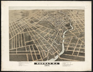
Rahway, N.J : 1874
7267.
Rail road map of New England & eastern New York
7268.
Rail road map of New England & eastern New York
7269.
Rail road map of Pennsylvania
7270.
Rail road map of Pennsylvania
7271.
Rail road map of the southern states shewing the southern & southwestern railway connections with Philadelphia
7272.
Railroad and county map of Mississippi
7273.
Railroad Commissioners' map of the State of Vermont
7274.
Railroad distance map of the United States, Mexico & Canada
7275.
Railroad map of Illinois
7276.
Railroad map of New England & eastern New York complied from the most authentic sources
7277.
Railroad map of New England, with adjacent portions of New York & Canada
7278.
Railroads of Lithuania, 1939
7279.
Railway and highway map of the famous Berkshire Hills region, showing also villages and points of interest : from official...
7280.
Railway and highway map of the famous Berkshire Hills region, showing also villages and points of interest : from official...
‹ Prev
Next ›
1
2
…
360
361
362
363
364
365
366
367
368
…
446
447