Toggle navigation
LMEC Home
Exhibitions
Georeferencing
Tools for Teachers
Collections
My Favorites
Sign Up / Log In
Search
Search the map portal
Map Collection
Map Collection
Map Sets
Search
Search
Search for
Search In
All Fields
Creator
Title
Subject
Place
Search All Digital Collections
Advanced Search
502 Results
My Search
Start Over
More Like
commonwealth:kp78jz54n
Remove constraint More Like: commonwealth:kp78jz54n
Filter your Search
Place
North and Central America
499
United States
496
Suffolk (county)
489
Boston
488
Massachusetts
188
Charlestown
64
Roxbury
53
South End
49
more
Place
»
Topic
City planning--Massachusetts--Boston--Maps
418
Urban renewal--Massachusetts--Boston--Maps
253
Boston (Mass.)--Maps
128
Land use--Massachusetts--Boston--Maps
101
Buildings--Massachusetts--Boston--Maps
85
Charlestown (Boston, Mass.)--Maps
67
Real property--Massachusetts--Boston--Maps
61
Roxbury (Boston, Mass.)--Maps
50
more
Topic
»
Date
Date range begin
–
Date range end
Current results range from
1775
to
2003
View distribution
Creator
Boston Redevelopment Authority
373
Downtown Waterfront Corporation
10
Victor Gruen Associates
10
Boston (Mass.). Parks and Recreation Department
8
Sasaki Associates
6
Boston (Mass.). Department of Parks
5
Charles A. Maguire and Associates
5
I.M. Pei & Associates
5
more
Creator
»
Format
Maps/Atlases
500
Drawings/Illustrations
4
Manuscripts
1
Prints
1
Georeferenced
Yes
6
No
496
Collection
Boston and New England Maps
491
Urban Maps
475
Boston Redevelopment Authority Collection
442
Norman B. Leventhal Map & Education Center Collection
112
American Revolutionary War-Era Maps
4
William L. Clements Library Collection
3
Mapping Boston Collection
2
Massachusetts Real Estate Atlases
1
Available to use
No known restrictions
495
Creative Commons license
2
Search Constraints
Sort by relevance
relevance
title
date (asc)
date (desc)
Number of results to display per page
20 per page
10
per page
20
per page
50
per page
100
per page
View results as:
grid view
map view
Search Results
341.
Ruggles Center : site area diagram
342.
Shawmut Avenue
343.
South Boston urban renewal area R-51
344.
South Cove property ownership 1950
345.
South Cove property ownership 1962
346.
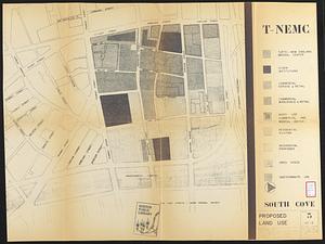
South Cove proposed land use
347.
South Cove urban renewal area Massachusetts R-92 : illustrative site plan
348.
South Cove urban renewal area R-92 : zoning plan
349.
South Cove urban renewal area R-92 : disposition plan
350.
South End renewal area : locality map
351.
South End renewal area : existing conditions & proposed treatment areas
352.
South End renewal area : existing land use
353.
South End urban renewal area R-56 : property map
354.
South End urban renewal area R-56 : property map
355.
South End urban renewal area R-56 : property map
356.
South End urban renewal area R-56 : proposed rights-of-way
357.
South End urban renewal area R-56 : re-use parcels
358.
South End urban renewal area R-56 : re-use parcels
359.
South End urban renewal area R-56 : proposed land use
360.
South End urban renewal area R-56 : zone district changes
‹ Prev
Next ›
1
2
…
14
15
16
17
18
19
20
21
22
…
25
26