Toggle navigation
LMEC Home
Exhibitions
Georeferencing
Tools for Teachers
Collections
My Favorites
Sign Up / Log In
Search
Search the map portal
Map Collection
Map Collection
Map Sets
Search
Search
Search for
Search In
All Fields
Creator
Title
Subject
Place
Search All Digital Collections
Advanced Search
8698 Results
My Search
Start Over
More Like
commonwealth:kk91fq84f
Remove constraint More Like: commonwealth:kk91fq84f
Filter your Search
Place
North and Central America
5,928
United States
4,844
Massachusetts
2,079
Europe
1,395
Suffolk (county)
1,046
Boston
1,019
Canada
449
Asia
438
more
Place
»
Topic
Boston (Mass.)--Maps
586
United States--Maps
282
Real property--Massachusetts--Boston--Maps
175
Massachusetts--Maps
162
Landowners--Massachusetts--Boston--Maps
133
North America--Maps--Early works to 1800
103
New England--Maps
102
Europe--Maps
79
more
Topic
»
Date
Date range begin
–
Date range end
Current results range from
1482
to
2023
View distribution
Creator
United States. Hydrographic Office
595
O.H. Bailey & Co
148
Des Barres, Joseph F. W. (Joseph Frederick Wallet), 1722-1824
123
United States. Post Office Dept
120
Ptolemy, 2nd cent
100
Walling, Henry Francis, 1825-1888
94
Geological Survey (U.S.)
86
Jefferys, Thomas, -1771
86
more
Creator
»
Format
Maps/Atlases
8,638
Manuscripts
215
Prints
56
Books
36
Objects/Artifacts
10
Drawings/Illustrations
8
Posters
5
Georeferenced
Yes
869
No
7,829
Collection
Norman B. Leventhal Map & Education Center Collection
8,694
Boston and New England Maps
2,233
Urban Maps
2,023
Maritime Charts and Atlases
1,083
American Revolutionary War-Era Maps
620
Boston Redevelopment Authority Collection
87
Richard H. Brown Revolutionary War Map Collection at Mount Vernon
2
Boston Athenaeum, Cartographic Collection
1
more
Collection
»
Available to use
No known restrictions
8,552
Creative Commons license
50
Search Constraints
Sort by relevance
relevance
title
date (asc)
date (desc)
Number of results to display per page
20 per page
10
per page
20
per page
50
per page
100
per page
View results as:
grid view
map view
Search Results
41.
De cust van Barbaria, Gualata, Arguyn en Geneheo van Capo S Vincente tot Capo Verde
42.
Grundriss der stadt und der forts von St. Jago od. Jacob
43.
Grundriss von der bay der insel St. Vincent einer von den Eylanden des grünen Vorgebirges
44.
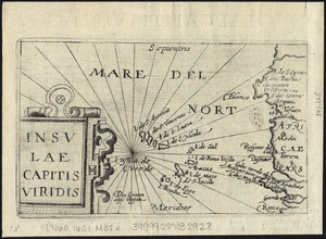
Insulae Capitis Viridis
45.
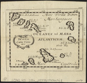
Insulae Capo Viridis
46.
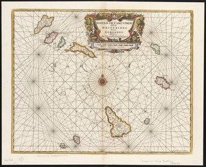
Insulae de Cabo Verde, Olim Hesperides, sive Gorgades : Belgice de zoute eylanden
47.
Insulae Promontorii Viridis, Hispanis, Issas Cabo Verde, Belgis, De Soute Eylanden
48.
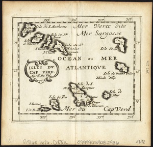
Isles du Cap Verd
49.
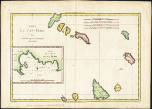
Isles du Cap-Verd
50.
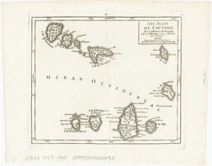
Les Isles du Cap-Verd
51.
Isles Du Cap-Verd = Die Inseln von Capo Verde
52.
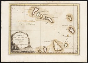
Le Isole di Capo Verde : delineate sulle ultime osservvazioni
53.
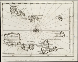
Karte von den Eylanden des Grünen Vorgebürges, nach den Tagebüchern und Anmerkungen der geschicktesten Seefahrer
54.
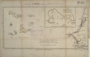
A map of the Cape de Verd Islands with the adjacent coast of Africa, the settlements of Senegal, Gambia and Goree, also a plan...
55.
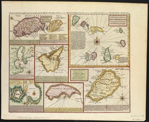
Particular draughts of some of the chief African Islands in the Mediterranean : as also in the Atlantic and Ethiopic Oceans
56.
Pascaarte vande zee custen van Guinea, en Brasilia : van Cabo de Verde, tot C. de bona Esperanc̨a : van R. de Amazones tot Rio...
57.
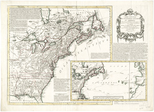
Carte nouvelle des posséssions angloises en Amérique : dressée pour l'intelligence de la guerre présente et divisée...
58.
Chart comprizing Greenland with the countries and islands about Baffin's and Hudson's Bays
59.
A chart of the Atlantic Ocean : its islands and the adjacent continents: In which the British Dominions in Europe and America,...
60.
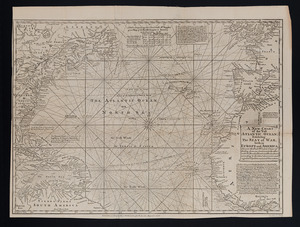
A new chart of the vast Atlantic Ocean
‹ Prev
Next ›
1
2
3
4
5
6
7
…
434
435