Toggle navigation
LMEC Home
Exhibitions
Georeferencing
Tools for Teachers
Collections
My Favorites
Sign Up / Log In
Search
Search the map portal
Map Collection
Map Collection
Map Sets
Search
Search
Search for
Search In
All Fields
Creator
Title
Subject
Place
Search All Digital Collections
Advanced Search
8862 Results
My Search
Start Over
More Like
commonwealth:js956j76f
Remove constraint More Like: commonwealth:js956j76f
Filter your Search
Place
North and Central America
6,093
United States
5,009
Massachusetts
2,128
Europe
1,396
Suffolk (county)
1,208
Boston
1,181
Canada
449
Asia
438
more
Place
»
Topic
Boston (Mass.)--Maps
752
United States--Maps
282
Real property--Massachusetts--Boston--Maps
195
Massachusetts--Maps
166
City planning--Massachusetts--Boston--Maps
158
Landowners--Massachusetts--Boston--Maps
142
New England--Maps
104
North America--Maps--Early works to 1800
103
more
Topic
»
Date
Date range begin
–
Date range end
Current results range from
1482
to
2023
View distribution
Creator
United States. Hydrographic Office
595
Boston Redevelopment Authority
162
O.H. Bailey & Co
148
Des Barres, Joseph F. W. (Joseph Frederick Wallet), 1722-1824
124
United States. Post Office Dept
120
Ptolemy, 2nd cent
100
Walling, Henry Francis, 1825-1888
94
Geological Survey (U.S.)
87
more
Creator
»
Format
Maps/Atlases
8,802
Manuscripts
214
Prints
56
Books
36
Objects/Artifacts
10
Drawings/Illustrations
8
Posters
5
Georeferenced
Yes
885
No
7,977
Collection
Norman B. Leventhal Map & Education Center Collection
8,723
Boston and New England Maps
2,359
Urban Maps
2,143
Maritime Charts and Atlases
1,083
American Revolutionary War-Era Maps
638
Boston Redevelopment Authority Collection
192
Mapping Boston Collection
20
Massachusetts Real Estate Atlases
12
more
Collection
»
Available to use
No known restrictions
8,665
Creative Commons license
70
Search Constraints
Sort by relevance
relevance
title
date (asc)
date (desc)
Number of results to display per page
20 per page
10
per page
20
per page
50
per page
100
per page
View results as:
grid view
map view
Search Results
2581.
A description of the towne of Mannados or New Amsterdam : as it was in September, 1661, lying in lattitude 40 de. and 40 m.,...
2582.
A description of the towne of Mannados or New Amsterdam : as it was in September, 1661, lying in lattitude 40 de. and 40 m.,...
2583.
A descriptive map of the region within one hundred miles of the capital of the United States : portraying the principal events...
2584.
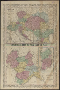
Desilver's maps of the seat of war
2585.
Detail map of the Atlantic & Pacific Rail Road from the Mississippi River to the Pacific Ocean
2586.
Detailed map of the seat of war from Chateau Salins to Mannheim & Worms to Strasbourg
2587.
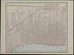
Detroit
2588.
Detroit 1820
2589.
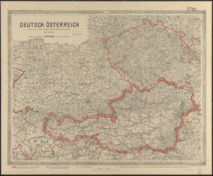
Deutsch Österreich nach den forderungen des friedensentwurfes der entente
2590.
Das Deutsche Reich : in 4 Blättern
2591.
Deutschland
2592.
Deutschland in seiner neugestaltung
2593.
Deutschland, königr. der Niederlande, kgr. Belgien und die Schweiz, nebst theilen der angränzenden länder nach Adolf...
2594.
Deutschland nebst den königreichen Holland, Belgien und der republik Schweiz
2595.
Deutschland und der gröste theil der umliegenden staaten oder Mittel-Europa in 35 blättern : nach astronomischen...
2596.
Deutschland und der gröste theil der umliegenden staaten, oder Mittel-Europa in 35 blättern : nach astronomischen...
2597.
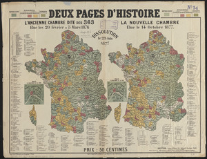
Deux pages d'histoire : l'ancienne Chambre dite des 363, elue les 20 Février et 5 Mars 1876, dissolution le 23 Juin 1877, la...
2598.
Devoniae descriptio : the description of Devonshire
2599.
Diagram of rail roads diverging from Boston : showing the depots and distances
2600.
Diagram of the Battle of Ball's Bluff
‹ Prev
Next ›
1
2
…
126
127
128
129
130
131
132
133
134
…
443
444