Toggle navigation
LMEC Home
Exhibitions
Georeferencing
Tools for Teachers
Collections
My Favorites
Sign Up / Log In
Search
Search the map portal
Map Collection
Map Collection
Map Sets
Search
Search
Search for
Search In
All Fields
Creator
Title
Subject
Place
Search All Digital Collections
Advanced Search
8820 Results
My Search
Start Over
More Like
commonwealth:jd477893m
Remove constraint More Like: commonwealth:jd477893m
Filter your Search
Place
North and Central America
6,051
United States
4,969
Massachusetts
2,097
Europe
1,396
Suffolk (county)
1,171
Boston
1,144
Canada
449
Asia
438
more
Place
»
Topic
Boston (Mass.)--Maps
612
United States--Maps
282
Real property--Massachusetts--Boston--Maps
220
Landowners--Massachusetts--Boston--Maps
168
Massachusetts--Maps
162
City planning--Massachusetts--Boston--Maps
156
Buildings--Massachusetts--Boston--Maps
125
North America--Maps--Early works to 1800
103
more
Topic
»
Date
Date range begin
–
Date range end
Current results range from
1482
to
2023
View distribution
Creator
United States. Hydrographic Office
595
Boston Redevelopment Authority
151
O.H. Bailey & Co
148
Des Barres, Joseph F. W. (Joseph Frederick Wallet), 1722-1824
123
United States. Post Office Dept
120
Ptolemy, 2nd cent
100
Walling, Henry Francis, 1825-1888
94
Geological Survey (U.S.)
86
more
Creator
»
Format
Maps/Atlases
8,760
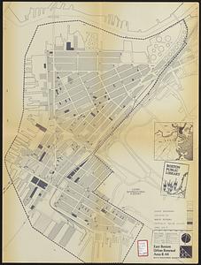
Manuscripts
215
Prints
56
Books
36
Objects/Artifacts
10
Drawings/Illustrations
8
Posters
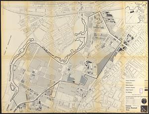
5
Georeferenced
Yes
869
No
7,951
Collection
Norman B. Leventhal Map & Education Center Collection
8,695
Boston and New England Maps
2,324
Urban Maps
2,114
Maritime Charts and Atlases
1,083
American Revolutionary War-Era Maps
616
Boston Redevelopment Authority Collection
177
Massachusetts Real Estate Atlases
34
Applied Geographics, Inc. Records
1
Available to use
No known restrictions
8,644
Creative Commons license
47
Search Constraints
Sort by relevance
relevance
title
date (asc)
date (desc)
Number of results to display per page
20 per page
10
per page
20
per page
50
per page
100
per page
View results as:
grid view
map view
Search Results
101.
Downtown waterfront-Faneuil Hall project urban renewal area Massachusetts R-77 : illustrative site plan
102.
Downtown Waterfront-Faneuil Hall renewal area : building conditions
103.
East Boston urban renewal area r-44 : building conditions
104.
Fenway urban renewal area : building conditions
105.
General plan : Government Center - Boston - 1959
106.
Government Center project Mass. r-35 : parcel 7 & subway structure topographic map
107.
Government Center project no. Mass. r-35 : building deficiencies map
108.
Government Center project no. Mass. r-35 : disposition parcel map
109.
Government Center urban renewal area r-35 parcel-7 : site section 1
110.
Government Center urban renewal area r-35 parcel-7 : site section 2
111.
Illustrative site plan : Government Center
112.
Illustrative site plan : South End urban renewal area, Massachusetts r-56
113.
Jamaica Plain urban renewal area r-49 : building conditions
114.
Longwood Medical Area
115.
Mattapan project : building deficiencies
116.
Park Plaza : illustrative site plan
117.
Park Plaza : illustrative site plan showing alternate apartment building configuration
118.
Park Plaza urban renewal area : environmental deficiencies and blighting influences map
119.
Park Plaza urban renewal area : map no. 4 building deficiencies map
120.
Park Plaza urban renewal area : environmental deficiencies and blighting influences map
‹ Prev
Next ›
1
2
3
4
5
6
7
8
9
10
…
440
441