Toggle navigation
LMEC Home
Exhibitions
Georeferencing
Tools for Teachers
Collections
My Favorites
Sign Up / Log In
Search
Search the map portal
Map Collection
Map Collection
Map Sets
Search
Search
Search for
Search In
All Fields
Creator
Title
Subject
Place
Search All Digital Collections
Advanced Search
483 Results
My Search
Start Over
More Like
commonwealth:j6733j19n
Remove constraint More Like: commonwealth:j6733j19n
Filter your Search
Place
North and Central America
480
United States
477
Suffolk (county)
470
Boston
469
Massachusetts
170
Roxbury
54
Fens
51
South End
49
more
Place
»
Topic
City planning--Massachusetts--Boston--Maps
418
Urban renewal--Massachusetts--Boston--Maps
253
Boston (Mass.)--Maps
123
Land use--Massachusetts--Boston--Maps
101
Buildings--Massachusetts--Boston--Maps
81
Fenway (Boston, Mass.)--Maps
55
Real property--Massachusetts--Boston--Maps
55
Roxbury (Boston, Mass.)--Maps
50
more
Topic
»
Date
Date range begin
–
Date range end
Current results range from
1835
to
2009
View distribution
Creator
Boston Redevelopment Authority
369
Downtown Waterfront Corporation
10
Victor Gruen Associates
10
Boston (Mass.). Parks and Recreation Department
8
Sasaki Associates
6
Boston (Mass.). Department of Parks
5
Boston (Mass.). Water and Sewer Commission
5
Charles A. Maguire and Associates
5
more
Creator
»
Format
Maps/Atlases
482
Drawings/Illustrations
3
Manuscripts
1
Prints
1
Georeferenced
Yes
2
No
481
Collection
Boston and New England Maps
474
Urban Maps
459
Boston Redevelopment Authority Collection
441
Norman B. Leventhal Map & Education Center Collection
97
Available to use
No known restrictions
482
Search Constraints
Sort by relevance
relevance
title
date (asc)
date (desc)
Number of results to display per page
20 per page
10
per page
20
per page
50
per page
100
per page
View results as:
grid view
map view
Search Results
81.
Charlestown project no. Mass r-42 (GN) : existing zoning
82.
Charlestown project no. Mass r-42 (GN) : generalized building conditions
83.
Charlestown project no. Mass r-42 (GN) : proposed treatment areas and project boundaries
84.
Charlestown project no. Mass r-42 (GN) : population distribution
85.
Charlestown project no. Mass r-42 (GN) : existing building coverage
86.
Charlestown renewal area : location map
87.
Charlestown renewal area : blighted areas
88.
Charlestown renewal area : existing conditions & proposed treatment areas
89.
Charlestown renewal area : locality map
90.
Charlestown renewal area : existing land use
91.
Charlestown urban renewal area r-42 : GNRP map no. 2
92.
Charlestown urban renewal area r-42 : GNRP map no. 1
93.
Charlestown urban renewal area r-55 : property map and perimeter boundaries
94.
Charlestown urban renewal area r-55 : proposed land use
95.
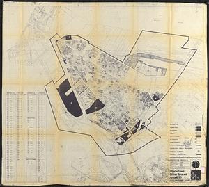
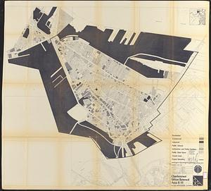
Charlestown urban renewal area r-55 : existing land use
96.
Charlestown urban renewal area r-55 : disposition parcels
97.
Charlestown urban renewal area r-55 : right of way adjustments
98.
Charlestown urban renewal area r-55 : building deficiencies
99.
Charlestown urban renewal area r-55 : treatment areas
100.
Charlestown urban renewal area r-55 : existing land use
‹ Prev
Next ›
1
2
3
4
5
6
7
8
9
…
24
25