Toggle navigation
LMEC Home
Exhibitions
Georeferencing
Tools for Teachers
Collections
My Favorites
Sign Up / Log In
Search
Search the map portal
Map Collection
Map Collection
Map Sets
Search
Search
Search for
Search In
All Fields
Creator
Title
Subject
Place
Search All Digital Collections
Advanced Search
8689 Results
My Search
Start Over
More Like
commonwealth:ht250064m
Remove constraint More Like: commonwealth:ht250064m
Filter your Search
Place
North and Central America
5,928
United States
4,847
Massachusetts
2,102
Europe
1,392
Suffolk (county)
1,073
Boston
1,046
Canada
449
Asia
437
more
Place
»
Topic
Boston (Mass.)--Maps
583
United States--Maps
279
Real property--Massachusetts--Boston--Maps
177
Massachusetts--Maps
161
Landowners--Massachusetts--Boston--Maps
134
North America--Maps--Early works to 1800
103
New England--Maps
101
City planning--Massachusetts--Boston--Maps
92
more
Topic
»
Date
Date range begin
–
Date range end
Current results range from
1482
to
2023
View distribution
Creator
United States. Hydrographic Office
595
O.H. Bailey & Co
148
Des Barres, Joseph F. W. (Joseph Frederick Wallet), 1722-1824
123
United States. Post Office Dept
120
Ptolemy, 2nd cent
100
Boston Redevelopment Authority
95
Walling, Henry Francis, 1825-1888
94
Geological Survey (U.S.)
86
more
Creator
»
Format
Maps/Atlases
8,628
Manuscripts
215
Prints
56
Books
36
Objects/Artifacts
10
Drawings/Illustrations
9
Posters
5
Georeferenced
Yes
870
No
7,819
Collection
Norman B. Leventhal Map & Education Center Collection
8,652
Boston and New England Maps
2,251
Urban Maps
2,021
Maritime Charts and Atlases
1,083
American Revolutionary War-Era Maps
619
Boston Redevelopment Authority Collection
113
Massachusetts Real Estate Atlases
8
William L. Clements Library Collection
3
more
Collection
»
Available to use
No known restrictions
8,534
Creative Commons license
49
Search Constraints
Sort by relevance
relevance
title
date (asc)
date (desc)
Number of results to display per page
20 per page
10
per page
20
per page
50
per page
100
per page
View results as:
grid view
map view
Search Results
7601.
Springfield, Vt
7602.
Springvale, Maine : looking west
7603.
Spry Harbour : Port Pallisser ; Port North ; Port Parker ; Beaver Harbour ; Fleming River
7604.
S.R.I. Bavariae : circulus atque electoratus tam cum adjacentibus quam insertis regionibus accuratissime in suasquasque...
7605.
S.R.I. Sueviae Circulus atq[ue] Ducatus una cum insertis et adjacentibus Regionibus, accuratissime in earundem particulares...
7606.
S.R.I. Westphaliae circulus, in omnes ejusdem subjacentes provincias exactissime distinctus
7607.
St. Christophers
7608.
St. Christophers or St. Kitts
7609.
St. Croix County, Wis.
7610.
St. Helena : this island belongs to ye English east India Company whose ships usually touch here for a recruit of fresh water...
7611.
St. Joe National Forest, Idaho
7612.
St. Johnsbury, county seat of Caledonia County, Vt : 1884
7613.
St. Lawrence Bay showing Lutke's Harbor
7614.
St. Lawrence Bay showing Lutke's Harbor
7615.
St. Mihiel - B
7616.
St. Pablo, Paumotu Group ; Nukutipipi or Margaret Island, Paumotu Group ; Heretua or Archangel of Quiros, Paumotu Group ; Teku...
7617.
[St. Peter's Bay, on the south shore of Cape Breton Island]
7618.
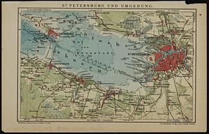
St. Petersburg und umgebung
7619.
St. Stephen, New Brunswick and Calais, Maine : 1889
7620.
St. Thomas, Province, Ontario Canada, 1875
‹ Prev
Next ›
1
2
…
377
378
379
380
381
382
383
384
385
…
434
435


![S.R.I. Sueviae Circulus atq[ue] Ducatus una cum insertis et adjacentibus Regionibus, accuratissime in earundem particulares provincias divisum](https://bpldcassets.blob.core.windows.net/derivatives/images/commonwealth:cj82kw70k/image_thumbnail_300.jpg)


![[St. Peter's Bay, on the south shore of Cape Breton Island]](https://bpldcassets.blob.core.windows.net/derivatives/images/commonwealth:ws859h094/image_thumbnail_300.jpg)