Toggle navigation
LMEC Home
Exhibitions
Georeferencing
Tools for Teachers
Collections
My Favorites
Sign Up / Log In
Search
Search the map portal
Map Collection
Map Collection
Map Sets
Search
Search
Search for
Search In
All Fields
Creator
Title
Subject
Place
Search All Digital Collections
Advanced Search
570 Results
My Search
Start Over
More Like
commonwealth:gh93ph79k
Remove constraint More Like: commonwealth:gh93ph79k
Filter your Search
Place
North and Central America
467
United States
241
North America
236
Canada
75
New York
26
Asia
19
Pennsylvania
18
Great Lakes Region
15
more
Place
»
Topic
North America--Maps--Early works to 1800
240
United States--Maps--Early works to 1800
55
Canada--Maps--Early works to 1800
49
Great Britain--Colonies--America--Maps--Early works to 1800
18
Central America--Maps--Early works to 1800
14
Great Lakes Region (North America)--Maps--Early works to 1800
14
West Indies--Maps--Early works to 1800
14
New England--Maps--Early works to 1800
11
more
Topic
»
Date
Date range begin
–
Date range end
Current results range from
1528
to
1999
View distribution
Creator
Jefferys, Thomas, -1771
30
Mitchell, John, 1711-1768
22
Sayer, Robert, 1725-1794
21
Gibson, J. (John), active 1750-1792
19
Bellin, Jacques Nicolas, 1703-1772
17
Anville, Jean Baptiste Bourguignon d', 1697-1782
16
Robert Sayer and John Bennett (Firm)
16
Faden, William, 1749-1836
14
more
Creator
»
Format
Maps/Atlases
568
Manuscripts
5
Paintings
3
Ephemera
1
Objects/Artifacts
1
Prints
1
Georeferenced
Yes
5
No
565
Collection
American Revolutionary War-Era Maps
448
MacLean Collection Map Library
379
Norman B. Leventhal Map & Education Center Collection
122
New York Public Library Collection
32
Richard H. Brown Revolutionary War Map Collection at Mount Vernon
18
Mapping Boston Collection
10
Sidney R. Knafel Map Collection at Phillips Academy
8
British Library Collection
3
more
Collection
»
Available to use
No known restrictions
116
Creative Commons license
64
Search Constraints
Sort by relevance
relevance
title
date (asc)
date (desc)
Number of results to display per page
20 per page
10
per page
20
per page
50
per page
100
per page
View results as:
grid view
map view
Search Results
21.
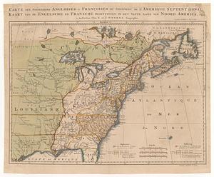
Carte des possessions angloises & françoises du continent de l'Amerique Septentrionale = Kaart van de engelsche en fransche...
22.
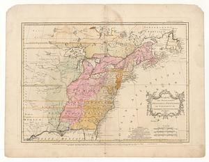
Carte des possessions angloises & françoises du continent de l'Amérique Septentrionale
23.
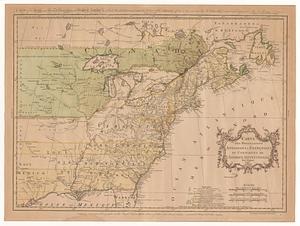
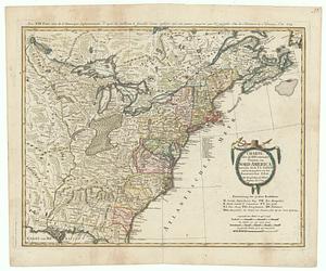
Carte des possessions angloises & françoises du continent de l'Amérique Septentrionale = A map of the British and French...
24.
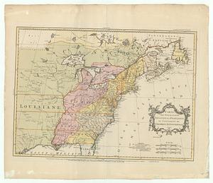
Carte des possessions angloises & françoises du continent de l'Amérique Septentrionale
25.
Carte des possessions angloises & françoises du continent de l'Amérique Septentrionale
26.
Carte detaillé des possessions angloises dans l'Amerique Septentrionale : construite d'après les derniéres relations et les...
27.
Carte du théatre de la guerre actuel entre les anglais et les Treize Colonies Unies de l'Amerique Septentrionale
28.
Carte générale de l'Amérique séptentrionale avec les posséssions angloises dans cette partie du nouveau monde
29.
Charte über die XIII Vereinigte Staaten von Nord-America = XIII Etats Unis de I'Amerique Septentrionale, d'apres les meilleures...
30.
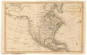
An exact map of North America from the best authorities
31.
A general map of North America; in which is express'd the several new roads, forts, engagements, &c. taken from actual surveys...
32.
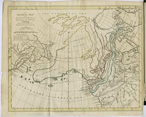
A general map of the discoveries of Admiral de Fonte, exhibiting the great probability of a north-west passage
33.
Generalkarte von Nordamerika samt den Westindischen Inseln
34.
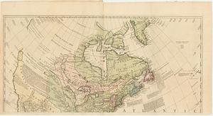
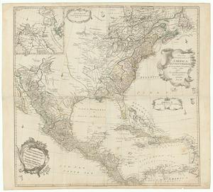
A map exhibiting all the new discoveries, in the interior parts of North America : inscribed by permission to the honorable...
35.
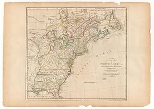
A map of North America
36.
Map of Sullivan's expedition from Wyoming on the Susquehanna River, in Pennsylvania, to the Seneca Village on the Genesee River...
37.
A map of the Britisch Empire in America with the French Spanish and the Dutch settlements adjacent thereto
38.
A map of the British and French dominions in North America : with the roads, distances, limits, and extent of the settlements,...
39.
Mappa geographica Americæ Septentrionalis ad emendatiora exemplaria
40.
A new and accurate map of North America, drawn from the famous M.r d'Anville with improvements from the best English maps
‹ Prev
Next ›
1
2
3
4
5
6
…
28
29