Toggle navigation
LMEC Home
Exhibitions
Georeferencing
Tools for Teachers
Collections
My Favorites
Sign Up / Log In
Search
Search the map portal
Map Collection
Map Collection
Map Sets
Search
Search
Search for
Search In
All Fields
Creator
Title
Subject
Place
Search All Digital Collections
Advanced Search
1121 Results
My Search
Start Over
More Like
commonwealth:ft84cd47r
Remove constraint More Like: commonwealth:ft84cd47r
Filter your Search
Place
North and Central America
1,120
United States
1,105
Massachusetts
869
Suffolk (county)
766
Boston
763
Middlesex (county)
53
Downtown Boston
35
Essex (county)
32
more
Place
»
Topic
Boston (Mass.)--Maps
747
Massachusetts--Maps
233
Real property--Massachusetts--Boston--Maps
125
City planning--Massachusetts--Boston--Maps
103
Landowners--Massachusetts--Boston--Maps
100
Urban renewal--Massachusetts--Boston--Maps
63
Buildings--Massachusetts--Boston--Maps
57
Local transit--Massachusetts--Boston--Maps
47
more
Topic
»
Date
Date range begin
–
Date range end
Current results range from
1743
to
2023
View distribution
Creator
Boston Redevelopment Authority
114
Bromley, George Washington
48
Bromley, Walter Scott
47
G.W. Bromley & Co.
42
Geo. H. Walker & Co
36
Geo. H. Walker & Co.
36
MassGIS (Office : Mass.)
24
Boynton, George W., d. 1884
22
more
Creator
»
Format
Maps/Atlases
1,119
Manuscripts
15
Books
8
Ephemera
1
Prints
1
Georeferenced
Yes
152
No
969
Collection
Norman B. Leventhal Map & Education Center Collection
822
Boston and New England Maps
756
Urban Maps
520
Massachusetts Real Estate Atlases
143
Boston Redevelopment Authority Collection
123
American Revolutionary War-Era Maps
47
Applied Geographics, Inc. Records
23
Mapping Boston Collection
22
more
Collection
»
Available to use
No known restrictions
886
Creative Commons license
45
Search Constraints
Sort by relevance
relevance
title
date (asc)
date (desc)
Number of results to display per page
20 per page
10
per page
20
per page
50
per page
100
per page
View results as:
grid view
map view
Search Results
1041.
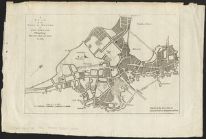
A Plan of the town of Boston, in New-England, : distinguishing that part which was burnt in 1760
1042.
A plan of the town of Boston, in New-England, distinguishing that part which was burnt in 1760
1043.
A plan of those parts of Boston, and the towns in its vicinity, with the waters and flats adjacent, which are immediately or...
1044.
Plan of two lots of valuable land in Washington Village, South Boston : to be sold at Public Auction, on Wednesday April 22d...
1045.
Plan of wards 6, 7, 8, 9, 10 and 12, Boston : showing sewers and contours :Jan., 1878
1046.
Plan of Washington Street showing proposed lines of widening from Asylum to Warren : Oct. 2nd 1860
1047.
Plan of Washington Street showing proposed lines of widening from Dover to Asylum : Oct. 3rd 1860
1048.
Plan of Washington Street showing proposed lines of widening from Warren to Kneeland : Oct. 1st 1860
1049.
Plan showing approximate location of Eastern Avenue : Sept. 18th 1861
1050.
Plan showing proposed route of Subway, February 1895
1051.
Plan showing the locality of the formation and the route of the procession of Knights Templar, August 27, 1895 : issued for the...
1052.
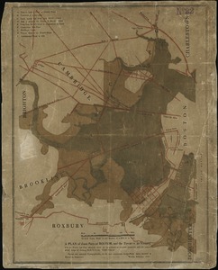
Plan showing the principal portion of Boston : from the oldest authorities
1053.
Plan showing the principal portion of Boston : from the latest authorities
1054.
Plano de la bahia y puerto de Boston
1055.
Plenty of free wi-fi is keeping Boston connected!
1056.
Port facilities at Boston, MA
1057.
A practical map of Boston : ... with a reproduction of Bonner's famous old map of Boston, dated 1722
1058.
Proportion of units where rent costs over 30% of resident's income
1059.
Proposed Charles River Park
1060.
Proposed Charles River Park
‹ Prev
Next ›
1
2
…
49
50
51
52
53
54
55
56
57