Toggle navigation
LMEC Home
Exhibitions
Georeferencing
Tools for Teachers
Collections
My Favorites
Sign Up / Log In
Search
Search the map portal
Map Collection
Map Collection
Map Sets
Search
Search
Search for
Search In
All Fields
Creator
Title
Subject
Place
Search All Digital Collections
Advanced Search
494 Results
My Search
Start Over
More Like
commonwealth:cr56qj54g
Remove constraint More Like: commonwealth:cr56qj54g
Filter your Search
Place
North and Central America
491
United States
488
Suffolk (county)
481
Boston
479
Massachusetts
181
Roxbury
56
South End
50
Fens
47
more
Place
»
Topic
City planning--Massachusetts--Boston--Maps
418
Urban renewal--Massachusetts--Boston--Maps
253
Boston (Mass.)--Maps
122
Land use--Massachusetts--Boston--Maps
101
Buildings--Massachusetts--Boston--Maps
81
Real property--Massachusetts--Boston--Maps
64
Roxbury (Boston, Mass.)--Maps
52
Fenway (Boston, Mass.)--Maps
47
more
Topic
»
Date
Date range begin
–
Date range end
Current results range from
1835
to
2020
View distribution
Creator
Boston Redevelopment Authority
369
Bromley, George Washington
10
Bromley, Walter Scott
10
Downtown Waterfront Corporation
10
Victor Gruen Associates
10
Boston (Mass.). Parks and Recreation Department
8
G.W. Bromley & Co.
6
Sasaki Associates
6
more
Creator
»
Format
Maps/Atlases
493
Drawings/Illustrations
3
Manuscripts
1
Prints
1
Georeferenced
Yes
5
No
489
Collection
Boston and New England Maps
484
Urban Maps
468
Boston Redevelopment Authority Collection
439
Norman B. Leventhal Map & Education Center Collection
108
Available to use
No known restrictions
492
Creative Commons license
1
Search Constraints
Sort by relevance
relevance
title
date (asc)
date (desc)
Number of results to display per page
20 per page
10
per page
20
per page
50
per page
100
per page
View results as:
grid view
map view
Search Results
141.
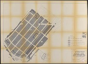
Mattapan project : proposed zoning under proposed code
142.
Mattapan project : right-of-way adjustment plan
143.
Mattapan project : land use and disposition plan
144.
Mattapan project : existing zoning under proposed code
145.
Mattapan project : existing land use
146.
Mattapan project : proposed zoning
147.
Midtown improvement area
148.
North Harvard project area : location map
149.
North Harvard project area : land use of project area
150.
North Harvard project area : conditions in project area
151.
North Harvard project area : locality map
152.
Parcel 10 : Sears Crescent, Government Center
153.
Park Plaza : illustrative site plan
154.
Park Plaza : illustrative site plan showing alternate apartment building configuration
155.
Park Plaza building study stage environmental impact analysis : environmental base : sanitary sewerage and storm drainage
156.
Park Plaza urban renewal area : map no. 4 building deficiencies map
157.
Park Plaza urban renewal area : map no. 5 ownership data map
158.
Park Plaza urban renewal area : map no. 2 land use map (existing)
159.
Park Plaza urban renewal area : map no. 1 boundary map
160.
Park Plaza urban renewal area : map no. 6 land disposal map
‹ Prev
Next ›
1
2
…
4
5
6
7
8
9
10
11
12
…
24
25