Toggle navigation
LMEC Home
Exhibitions
Georeferencing
Tools for Teachers
Collections
My Favorites
Sign Up / Log In
Search
Search the map portal
Map Collection
Map Collection
Map Sets
Search
Search
Search for
Search In
All Fields
Creator
Title
Subject
Place
Search All Digital Collections
Advanced Search
8827 Results
My Search
Start Over
More Like
commonwealth:cj82m1058
Remove constraint More Like: commonwealth:cj82m1058
Filter your Search
Place
North and Central America
6,122
United States
5,030
Massachusetts
2,160
Europe
1,359
Suffolk (county)
1,251
Boston
1,224
Canada
448
Asia
422
more
Place
»
Topic
Boston (Mass.)--Maps
740
United States--Maps
273
Real property--Massachusetts--Boston--Maps
251
Massachusetts--Maps
218
City planning--Massachusetts--Boston--Maps
186
Landowners--Massachusetts--Boston--Maps
169
North America--Maps--Early works to 1800
103
New England--Maps
102
more
Topic
»
Date
Date range begin
–
Date range end
Current results range from
1482
to
2023
View distribution
Creator
United States. Hydrographic Office
594
Boston Redevelopment Authority
191
O.H. Bailey & Co
148
Des Barres, Joseph F. W. (Joseph Frederick Wallet), 1722-1824
124
United States. Post Office Dept
120
Ptolemy, 2nd cent
100
Walling, Henry Francis, 1825-1888
95
Geological Survey (U.S.)
92
more
Creator
»
Format
Maps/Atlases
8,767
Manuscripts
217
Prints
56
Books
36
Objects/Artifacts
10
Drawings/Illustrations
8
Posters
4
Ephemera
1
Georeferenced
Yes
894
No
7,933
Collection
Norman B. Leventhal Map & Education Center Collection
8,603
Boston and New England Maps
2,389
Urban Maps
2,088
Maritime Charts and Atlases
1,081
American Revolutionary War-Era Maps
656
Boston Redevelopment Authority Collection
226
Massachusetts Real Estate Atlases
39
Mapping Boston Collection
22
more
Collection
»
Available to use
No known restrictions
8,578
Creative Commons license
72
Search Constraints
Sort by relevance
relevance
title
date (asc)
date (desc)
Number of results to display per page
20 per page
10
per page
20
per page
50
per page
100
per page
View results as:
grid view
map view
Search Results
61.
Insurance map of Boston : volume 2
62.
Insurance map of Boston : volume 2
63.
Insurance map of Boston : volume 1
64.
Map of Boston and its vicinity from actual survey
65.
[Map of Scollay Square and vicinity]
66.
Map of the city of Boston : from the recent surveys of the city and dist. surveyors, and from official records and actual surveys
67.
A map plat or draught of the twelve divisions of land as they were laid out, bounded & measured to ye proprietors in...
68.
Old Boston, compiled from the Book of possessions
69.
Peremptory sale : this valuable property will positively be sold at public auction on Saturday the 29th day of April current at...
70.
A plan of 8 lots of city land known as the Arsenal Lot : and 7 lots fronting on Providence St. to be sold at auction, on...
71.
Plan of a portion of the properties of the Long Wharf or Boston Pier & Central Wharf & Wet Dock Corporatins, showing sixteen...
72.
Plan of an estate belonging to the City of Boston to be sold by public auction on Wednesday, Sept. 14th, 1881 ... : per order...
73.
Plan of building lots on Phillips Place, Tremont & Somerset Streets
74.
Plan of building lots on Phillips Place, Tremont & Somerset Streets
75.
Plan of building lots on Washington, Waltham & Parker Streets and Harrison Avenue, belonging to the Boston Lying-In Hospital...
76.
Plan of Church St. district, showing estates and buildings : as proposed to be taken by the city of Boston under the Act of the...
77.
Plan of city lands to be sold Oct. 30th 1850
78.
Plan of City Wharf in Boston, Mass : shewing 14 lots of land on the side of the south dock of said wharf & Commercial St. : to...
79.
Plan of estate, nos 1043 to 1059 Washington Street, Boston, belonging to the heirs of the late William Brigham : to be sold by...
80.
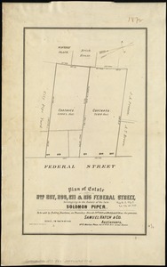
Plan of estate nos 207, 209, 211 & 215 Federal Street, belonging to the estate of the late Solomon Piper : to be sold at public...
‹ Prev
Next ›
1
2
3
4
5
6
7
8
…
441
442


![[Map of Scollay Square and vicinity]](https://bpldcassets.blob.core.windows.net/derivatives/images/commonwealth:x059cc25q/image_thumbnail_300.jpg)