Toggle navigation
LMEC Home
Exhibitions
Georeferencing
Tools for Teachers
Collections
My Favorites
Sign Up / Log In
Search
Search the map portal
Map Collection
Map Collection
Map Sets
Search
Search
Search for
Search In
All Fields
Creator
Title
Subject
Place
Search All Digital Collections
Advanced Search
8740 Results
My Search
Start Over
More Like
commonwealth:cj82kw65q
Remove constraint More Like: commonwealth:cj82kw65q
Filter your Search
Place
North and Central America
5,961
United States
4,844
Massachusetts
2,079
Europe
1,396
Suffolk (county)
1,046
Boston
1,019
Canada
449
Asia
438
more
Place
»
Topic
Boston (Mass.)--Maps
586
United States--Maps
283
Real property--Massachusetts--Boston--Maps
175
Massachusetts--Maps
162
Landowners--Massachusetts--Boston--Maps
133
North America--Maps--Early works to 1800
103
New England--Maps
102
North America--Maps
85
more
Topic
»
Date
Date range begin
–
Date range end
Current results range from
1482
to
2023
View distribution
Creator
United States. Hydrographic Office
595
O.H. Bailey & Co
148
Des Barres, Joseph F. W. (Joseph Frederick Wallet), 1722-1824
123
United States. Post Office Dept
120
Ptolemy, 2nd cent
100
Walling, Henry Francis, 1825-1888
94
Jefferys, Thomas, -1771
87
Geological Survey (U.S.)
86
more
Creator
»
Format
Maps/Atlases
8,680
Manuscripts
215
Prints
56
Books
36
Objects/Artifacts
10
Drawings/Illustrations
8
Posters
5
Georeferenced
Yes
872
No
7,868
Collection
Norman B. Leventhal Map & Education Center Collection
8,695
Boston and New England Maps
2,233
Urban Maps
2,023
Maritime Charts and Atlases
1,083
American Revolutionary War-Era Maps
661
Boston Redevelopment Authority Collection
87
Maps from AAS
17
William L. Clements Library Collection
12
more
Collection
»
Available to use
No known restrictions
8,553
Creative Commons license
58
Search Constraints
Sort by relevance
relevance
title
date (asc)
date (desc)
Number of results to display per page
20 per page
10
per page
20
per page
50
per page
100
per page
View results as:
grid view
map view
Search Results
6421.
Plan of the city and harbour of Toulon
6422.
Plan of the city and suburbs of Carthagena ; Plan of the bay & town of Sta. Martha, on the coast of Tierra Firma
6423.
Plan of the city intended for the permanent seat of the government of t[he] United States : projected agreeable to the...
6424.
Plan of the city intended for the permanent seat of the government of the United States : projected agreeable to the direction...
6425.
Plan of the city of Albany about the year 1770 : from the original survey
6426.
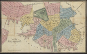
Plan of the city of Boston
6427.
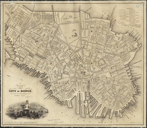
Plan of the city of Boston
6428.
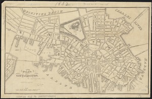
Plan of the city of Boston
6429.
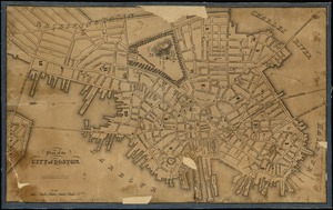
Plan of the city of Boston
6430.
Plan of the city of Boston
6431.
Plan of the city of Boston
6432.
Plan of the city of Boston
6433.
Plan of the city of Boston
6434.
Plan of the city of Boston
6435.
Plan of the city of Boston
6436.
Plan of the city of Boston
6437.
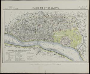
Plan of the city of Calcutta
6438.
Plan of the city of Charlestown
6439.
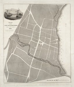
Plan of the city of Hartford from a survey made in 1824
6440.
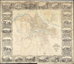
Plan of the city of Lowell, Massachusetts
‹ Prev
Next ›
1
2
…
318
319
320
321
322
323
324
325
326
…
436
437


![Plan of the city intended for the permanent seat of the government of t[he] United States](https://bpldcassets.blob.core.windows.net/derivatives/images/commonwealth:4m90f381c/image_thumbnail_300.jpg)