Toggle navigation
LMEC Home
Exhibitions
Georeferencing
Tools for Teachers
Collections
My Favorites
Sign Up / Log In
Search
Search the map portal
Map Collection
Map Collection
Map Sets
Search
Search
Search for
Search In
All Fields
Creator
Title
Subject
Place
Search All Digital Collections
Advanced Search
8590 Results
My Search
Start Over
More Like
commonwealth:cj82kw65q
Remove constraint More Like: commonwealth:cj82kw65q
Filter your Search
Place
North and Central America
5,859
United States
4,769
Massachusetts
2,052
Europe
1,359
Suffolk (county)
1,034
Boston
1,007
Canada
448
Asia
422
more
Place
»
Topic
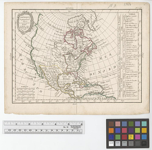
Boston (Mass.)--Maps
577
United States--Maps
274
Real property--Massachusetts--Boston--Maps
174
Massachusetts--Maps
160
Landowners--Massachusetts--Boston--Maps
132
North America--Maps--Early works to 1800
103
New England--Maps
99
North America--Maps
80
more
Topic
»
Date
Date range begin
–
Date range end
Current results range from
1482
to
2023
View distribution
Creator
United States. Hydrographic Office
594
O.H. Bailey & Co
148
Des Barres, Joseph F. W. (Joseph Frederick Wallet), 1722-1824
123
United States. Post Office Dept
120
Ptolemy, 2nd cent
100
Walling, Henry Francis, 1825-1888
94
Geological Survey (U.S.)
86
Jefferys, Thomas, -1771
86
more
Creator
»
Format
Maps/Atlases
8,531
Manuscripts
215
Prints
56
Books
36
Objects/Artifacts
10
Drawings/Illustrations
8
Posters
4
Georeferenced
Yes
872
No
7,718
Collection
Norman B. Leventhal Map & Education Center Collection
8,550
Boston and New England Maps
2,204
Urban Maps
1,936
Maritime Charts and Atlases
1,081
American Revolutionary War-Era Maps
656
Boston Redevelopment Authority Collection
87
American Antiquarian Society Collection
17
William L. Clements Library Collection
12
more
Collection
»
Available to use
No known restrictions
8,409
Creative Commons license
57
Search Constraints
Sort by relevance
relevance
title
date (asc)
date (desc)
Number of results to display per page
20 per page
10
per page
20
per page
50
per page
100
per page
View results as:
grid view
map view
Search Results
41.
Amerique Septentrionale
42.
Amérique Septentrionale
43.
L'Amérique Septentrionale
44.
Amerique septentrionale divisée en ses principales parties
45.
Amérique Septentrionale divisée en ses principaux etats
46.
Amérique Septentrionale publiée sous les auspices de Monseigneur le Duc d'Orleans prémier prince du sang
47.
The British colonies in North America
48.
Canada, Louisiane et terres angloises
49.
Canada, Louisiane et terres angloises
50.
Canada, Louisiane et terres angloises
51.
Carte de l'Amerique Septentrionale depuis le 28 degré de latitude jusqu'au 72
52.
Carte des parties nord et ouest de l'Amérique dressée d'apres les relations les plus authentique par M... en 1764 : nouvelle...
53.
A General map of North America
54.
A general map of North America
55.
A general map of North America drawn from the best surveys 1795
56.
A map of North America and the West Indies
57.
Map of North America from 20 to 80 degrees north latitude : exhibiting the recent discoveries, geographical and nautical; drawn...
58.
A Map of North America from the latest discoveries 1798
59.
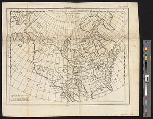
[Map of Spanish Louisiana and the American colonies]
60.
[Map of Spanish Louisiana and the American colonies]
‹ Prev
Next ›
1
2
3
4
5
6
7
…
429
430


![[Map of Spanish Louisiana and the American colonies]](https://bpldcassets.blob.core.windows.net/derivatives/images/commonwealth:z603vq85r/image_thumbnail_300.jpg)
![[Map of Spanish Louisiana and the American colonies]](https://bpldcassets.blob.core.windows.net/derivatives/images/commonwealth:z603vp210/image_thumbnail_300.jpg)