Toggle navigation
LMEC Home
Exhibitions
Georeferencing
Tools for Teachers
Collections
My Favorites
Sign Up / Log In
Search
Search the map portal
Map Collection
Map Collection
Map Sets
Search
Search
Search for
Search In
All Fields
Creator
Title
Subject
Place
Search All Digital Collections
Advanced Search
8862 Results
My Search
Start Over
More Like
commonwealth:9s161j35d
Remove constraint More Like: commonwealth:9s161j35d
Filter your Search
Place
North and Central America
6,093
United States
5,009
Massachusetts
2,134
Europe
1,396
Suffolk (county)
1,208
Boston
1,181
Canada
449
Asia
438
more
Place
»
Topic
Boston (Mass.)--Maps
752
United States--Maps
282
Real property--Massachusetts--Boston--Maps
195
Massachusetts--Maps
166
City planning--Massachusetts--Boston--Maps
158
Landowners--Massachusetts--Boston--Maps
142
New England--Maps
104
North America--Maps--Early works to 1800
103
more
Topic
»
Date
Date range begin
–
Date range end
Current results range from
1482
to
2023
View distribution
Creator
United States. Hydrographic Office
595
Boston Redevelopment Authority
163
O.H. Bailey & Co
148
Des Barres, Joseph F. W. (Joseph Frederick Wallet), 1722-1824
124
United States. Post Office Dept
120
Ptolemy, 2nd cent
100
Walling, Henry Francis, 1825-1888
94
Geological Survey (U.S.)
87
more
Creator
»
Format
Maps/Atlases
8,802
Manuscripts
215
Prints
56
Books
36
Objects/Artifacts
10
Drawings/Illustrations
8
Posters
5
Georeferenced
Yes
885
No
7,977
Collection
Norman B. Leventhal Map & Education Center Collection
8,723
Boston and New England Maps
2,358
Urban Maps
2,142
Maritime Charts and Atlases
1,083
American Revolutionary War-Era Maps
638
Boston Redevelopment Authority Collection
192
Mapping Boston Collection
20
Massachusetts Real Estate Atlases
12
more
Collection
»
Available to use
No known restrictions
8,665
Creative Commons license
70
Search Constraints
Sort by relevance
relevance
title
date (asc)
date (desc)
Number of results to display per page
20 per page
10
per page
20
per page
50
per page
100
per page
View results as:
grid view
map view
Search Results
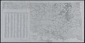
6021.
Oil and gas producing areas in Oklahoma
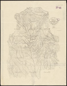
6022.
Oil City oil field, Fresno Co., California
6023.
Oil in America : a pictorial story of the petroleum industry in the United States
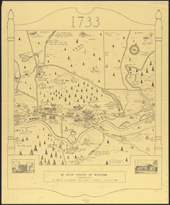
6024.
Ye olde towne of Rumford : (Concord, N.H.)
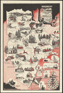
6025.
Olde York County Maine : published in commemoration of the 300th anniversary
6026.
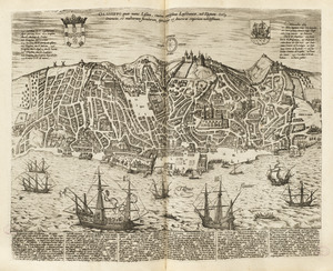
Olissippo quae nunc Lisboa ciuitas amplissima Lusi taniae, ad Tagum, toti Orientis, et multarum insularum Aphricaeque et...
6027.
Olmsted Park master plan
6028.
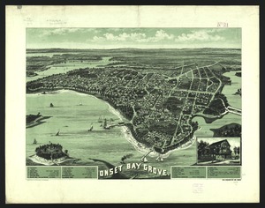
Onset Bay Grove, Wareham, Mass
6029.
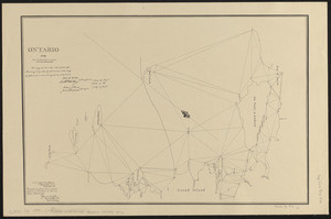
Ontario 1819
6030.
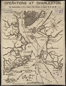
Operations at Charleston : the bombardment of Fort Sumter : the actions of August 18, 19 and 20
6031.
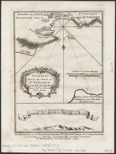
Oppervlakte van de baaije van't eiland St. Vincent, een der Kabo-Verdse Eilanden, op 16 graaden 50 minuuten, noorderbreedte ;...
6032.
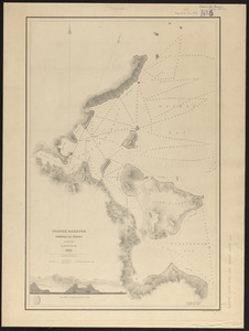
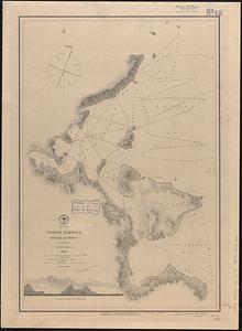
Orange Harbour, Tierra del Fuego
6033.
Orange Harbour, Tierra del Fuego
6034.
Orange, Mass
6035.
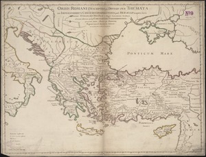
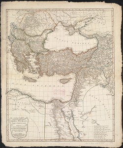
Orbis Romani descriptio : seu divisio per themata sub Imperatoribus Constantinopolitanis post Heraclii tempora facta
6036.
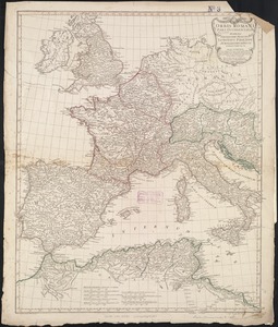
Orbis Romani pars occidentalis
6037.
Orbis Romani pars occidentalis : auspiciis serenissimi principis Ludovici Philippi Aurelianorum ducis publici juris facta
6038.
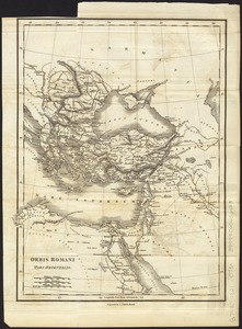
Orbis Romani pars orientalis
6039.
Orbis Romani pars orientalis : auspiciis serenissimi principis Ludovici Philippi Aurelianorum ducis publici juris facta
6040.
Orbis terrarum nova et accuratissima tabula
‹ Prev
Next ›
1
2
…
298
299
300
301
302
303
304
305
306
…
443
444