Toggle navigation
LMEC Home
Exhibitions
Georeferencing
Tools for Teachers
Collections
My Favorites
Sign Up / Log In
Search
Search the map portal
Map Collection
Map Collection
Map Sets
Search
Search
Search for
Search In
All Fields
Creator
Title
Subject
Place
Search All Digital Collections
Advanced Search
8792 Results
My Search
Start Over
More Like
commonwealth:9s161h05g
Remove constraint More Like: commonwealth:9s161h05g
Filter your Search
Place
North and Central America
6,087
United States
5,009
Massachusetts
2,106
Europe
1,359
Suffolk (county)
1,272
Boston
1,245
Canada
448
Asia
422
more
Place
»
Topic
Boston (Mass.)--Maps
740
United States--Maps
273
Real property--Massachusetts--Boston--Maps
251
City planning--Massachusetts--Boston--Maps
206
Landowners--Massachusetts--Boston--Maps
169
Massachusetts--Maps
163
Urban renewal--Massachusetts--Boston--Maps
114
North America--Maps--Early works to 1800
103
more
Topic
»
Date
Date range begin
–
Date range end
Current results range from
1482
to
2023
View distribution
Creator
United States. Hydrographic Office
594
Boston Redevelopment Authority
211
O.H. Bailey & Co
148
Des Barres, Joseph F. W. (Joseph Frederick Wallet), 1722-1824
124
United States. Post Office Dept
120
Ptolemy, 2nd cent
100
Walling, Henry Francis, 1825-1888
94
Geological Survey (U.S.)
87
more
Creator
»
Format
Maps/Atlases
8,733
Manuscripts
215
Prints
56
Books
36
Objects/Artifacts
10
Drawings/Illustrations
8
Posters
4
Georeferenced
Yes
885
No
7,907
Collection
Norman B. Leventhal Map & Education Center Collection
8,575
Boston and New England Maps
2,378
Urban Maps
2,107
Maritime Charts and Atlases
1,081
American Revolutionary War-Era Maps
638
Boston Redevelopment Authority Collection
244
Massachusetts Real Estate Atlases
38
Mapping Boston Collection
20
more
Collection
»
Available to use
No known restrictions
8,570
Creative Commons license
69
Search Constraints
Sort by relevance
relevance
title
date (asc)
date (desc)
Number of results to display per page
20 per page
10
per page
20
per page
50
per page
100
per page
View results as:
grid view
map view
Search Results
1.
Plan of city lands to be sold Oct. 30th 1850
2.
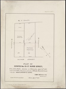
Plan of estates nos. 13-17 Oliver Street, to be sold by public auction on Wednesday April 12th 1871 at 12 o'clock m. on the...
3.
Plan of land & wharves belonging to Mill Pond Wharf Co. near Bartons Point
4.
Plan of Mercantile Wharf property in Boston Mass : showing 5 lots of land thereon to be sold at public auction on Tuesday April...
5.
Insurance map of Boston : volume 2
6.
Insurance map of Boston : volume 2
7.
[Plan of lots in South Boston]
8.
Plan of building lots on Columbus Avenue, and various streets and squares west of said avenue : to be sold by public auction at...
9.
Plan for the occupation of flats owned by the Commonwealth in Boston Harbor
10.
[Plan of channels and flats as they were before the 200 feet outside of the Mill Dam was filled up]
11.
Plan showing approximate location of Eastern Avenue : Sept. 18th 1861
12.
Atlas of the city of Boston : Roxbury, Mass. : volume four : from actual surveys and official records
13.
Atlas of the city of Boston : South & East Boston : volume four
14.
Atlas of the city of Boston : South Boston : from actual surveys and official plans
15.
Atlas of the city of Boston : South Boston : from actual surveys and official plans
16.
Atlas of the city of Boston : South Boston : from actual surveys and official plans
17.
Atlas of the city of Boston, volume eight, South Boston, Mass. : from actual surveys and official plans
18.
Atlas of the county of Suffolk, Massachusetts : vol. 2nd late city of Roxbury, now wards 13-14 and 15, city of Boston
19.
Atlas of the county of Suffolk, Massachusetts : vol. 3rd including Boston and Dorchester : from actual surveys and official...
20.
Atlas of the city of Boston : Boston proper : from actual surveys and official plans
‹ Prev
Next ›
1
2
3
4
5
…
439
440


![[Plan of lots in South Boston]](https://bpldcassets.blob.core.windows.net/derivatives/images/commonwealth:9s161h046/image_thumbnail_300.jpg)


![[Plan of channels and flats as they were before the 200 feet outside of the Mill Dam was filled up]](https://bpldcassets.blob.core.windows.net/derivatives/images/commonwealth:b8516207x/image_thumbnail_300.jpg)


