Toggle navigation
LMEC Home
Exhibitions
Georeferencing
Tools for Teachers
Collections
My Favorites
Sign Up / Log In
Search
Search the map portal
Map Collection
Map Collection
Map Sets
Search
Search
Search for
Search In
All Fields
Creator
Title
Subject
Place
Search All Digital Collections
Advanced Search
684 Results
My Search
Start Over
More Like
commonwealth:8c97p735x
Remove constraint More Like: commonwealth:8c97p735x
Filter your Search
Place
North and Central America
681
United States
678
Suffolk (county)
671
Boston
670
Massachusetts
336
Roxbury
74
South End
55
Fens
47
more
Place
»
Topic
City planning--Massachusetts--Boston--Maps
418
Real property--Massachusetts--Boston--Maps
253
Urban renewal--Massachusetts--Boston--Maps
253
Boston (Mass.)--Maps
218
Landowners--Massachusetts--Boston--Maps
140
Buildings--Massachusetts--Boston--Maps
118
Land use--Massachusetts--Boston--Maps
101
Roxbury (Boston, Mass.)--Maps
71
more
Topic
»
Date
Date range begin
–
Date range end
Current results range from
1798
to
2023
View distribution
Creator
Boston Redevelopment Authority
375
Bromley, George Washington
68
Bromley, Walter Scott
68
G.W. Bromley & Co.
46
Wadsworth, Alexander, 1806-1898
19
Hopkins, Griffith Morgan, Jr.
15
Downtown Waterfront Corporation
10
Victor Gruen Associates
10
more
Creator
»
Format
Maps/Atlases
683
Manuscripts
5
Drawings/Illustrations
3
Prints
1
Georeferenced
Yes
11
No
673
Collection
Boston and New England Maps
636
Urban Maps
619
Boston Redevelopment Authority Collection
441
Norman B. Leventhal Map & Education Center Collection
262
Massachusetts Real Estate Atlases
36
American Revolutionary War-Era Maps
1
Applied Geographics, Inc. Records
1
Available to use
No known restrictions
645
Creative Commons license
2
Search Constraints
Sort by relevance
relevance
title
date (asc)
date (desc)
Number of results to display per page
20 per page
10
per page
20
per page
50
per page
100
per page
View results as:
grid view
map view
Search Results
181.
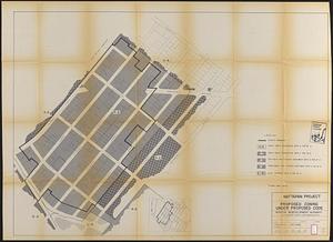
Mattapan project : proposed zoning under proposed code
182.
Mattapan project : right-of-way adjustment plan
183.
Mattapan project : land use and disposition plan
184.
Mattapan project : existing zoning under proposed code
185.
Mattapan project : existing land use
186.
Mattapan project : proposed zoning
187.
Midtown improvement area
188.
North Harvard project area : land use of project area
189.
North Harvard project area : conditions in project area
190.
North Harvard project area : locality map
191.
Parcel 10 : Sears Crescent, Government Center
192.
Park Plaza : illustrative site plan
193.
Park Plaza : illustrative site plan showing alternate apartment building configuration
194.
Park Plaza building study stage environmental impact analysis : environmental base : sanitary sewerage and storm drainage
195.
Park Plaza urban renewal area : map no. 4 building deficiencies map
196.
Park Plaza urban renewal area : map no. 2 land use map (existing)
197.
Park Plaza urban renewal area : map no. 1 boundary map
198.
Park Plaza urban renewal area : 1973 survey building deficiencies map for Park Plaza stage I
199.
Park Plaza urban renewal area : building conditions map
200.
Parker Hill-Fenway urban renewal area r-48 : building conditions
‹ Prev
Next ›
1
2
…
6
7
8
9
10
11
12
13
14
…
34
35