Toggle navigation
LMEC Home
Exhibitions
Georeferencing
Tools for Teachers
Collections
My Favorites
Sign Up / Log In
Search
Search the map portal
Map Collection
Map Collection
Map Sets
Search
Search
Search for
Search In
All Fields
Creator
Title
Subject
Place
Search All Digital Collections
Advanced Search
8778 Results
My Search
Start Over
More Like
commonwealth:8336h366x
Remove constraint More Like: commonwealth:8336h366x
Filter your Search
Place
North and Central America
6,009
United States
4,913
Massachusetts
2,151
Europe
1,396
Suffolk (county)
1,047
Boston
1,020
Canada
450
Asia
438
more
Place
»
Topic
Boston (Mass.)--Maps
590
United States--Maps
282
Massachusetts--Maps
235
Real property--Massachusetts--Boston--Maps
175
Landowners--Massachusetts--Boston--Maps
133
New England--Maps
104
North America--Maps--Early works to 1800
103
Europe--Maps
79
more
Topic
»
Date
Date range begin
–
Date range end
Current results range from
1482
to
2023
View distribution
Creator
United States. Hydrographic Office
595
O.H. Bailey & Co
148
Des Barres, Joseph F. W. (Joseph Frederick Wallet), 1722-1824
123
United States. Post Office Dept
120
Ptolemy, 2nd cent
100
Walling, Henry Francis, 1825-1888
95
Geological Survey (U.S.)
93
Jefferys, Thomas, -1771
85
more
Creator
»
Format
Maps/Atlases
8,717
Manuscripts
217
Prints
56
Books
36
Objects/Artifacts
10
Drawings/Illustrations
8
Posters
5
Ephemera
1
Georeferenced
Yes
879
No
7,899
Collection
Norman B. Leventhal Map & Education Center Collection
8,739
Boston and New England Maps
2,281
Urban Maps
2,024
Maritime Charts and Atlases
1,083
American Revolutionary War-Era Maps
643
Boston Redevelopment Authority Collection
90
Applied Geographics, Inc. Records
20
David Judkins Weaver Papers
20
more
Collection
»
Available to use
No known restrictions
8,597
Creative Commons license
51
Search Constraints
Sort by relevance
relevance
title
date (asc)
date (desc)
Number of results to display per page
20 per page
10
per page
20
per page
50
per page
100
per page
View results as:
grid view
map view
Search Results
941.
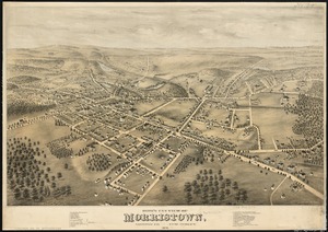
Bird's eye view of Morristown, Morris Co., New Jersey : 1876
942.
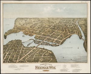
Bird's eye view of Neenah, Wis : 1879
943.
Birds eye view of North and South Carolina and part of Georgia
944.
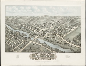
Bird's eye view of Orange, Massachusetts : 1878
945.
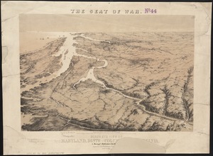
Bird's eye view of part of Maryland, Distr of Columbia and part of Virginia
946.
Bird's eye view of Pawtucket & Central Falls, R.I. 1877
947.
Bird's eye view of Philadelphia
948.
Bird's eye view of Pittsfield, Mass : 1876
949.
Bird's eye view of Plainville, Conn : 1878
950.
Bird's eye view of Plattsburgh, Clinton Co., New York 1877
951.
Bird's eye view of Port Townsend, Puget Sound, Washington Territory : from the north-east, 1878
952.
Bird's eye view of Portsmouth, Rockingham Co., New Hampshire
953.
Bird's eye view of Rochester, Strafford County, New Hampshire, 1877 : from a position, east of town
954.
Birds eye view of Syracuse, New York : 1874
955.
Bird's eye view of the city of Brockton, Plymouth County, Mass : looking southwest, 1882
956.
Bird's eye view of the city of Holyoke, and village of South Hadley Falls, Mass. looking north
957.
Bird's eye view of the city of Olympia, East Olympia and Tumwater, Puget Sound, Washington Territory, 1879
958.
Bird's eye view of the city of Portland, Maine, 1876
959.
Birds eye view of the Mississippi Valley from Cairo to the Gulf of Mexico
960.
Birds eye view of the seat of War in Europe
‹ Prev
Next ›
1
2
…
44
45
46
47
48
49
50
51
52
…
438
439