Toggle navigation
LMEC Home
Exhibitions
Georeferencing
Tools for Teachers
Collections
My Favorites
Sign Up / Log In
Search
Search the map portal
Map Collection
Map Collection
Map Sets
Search
Search
Search for
Search In
All Fields
Creator
Title
Subject
Place
Search All Digital Collections
Advanced Search
8749 Results
My Search
Start Over
More Like
commonwealth:8336h240k
Remove constraint More Like: commonwealth:8336h240k
Filter your Search
Place
North and Central America
5,980
United States
4,897
Massachusetts
2,081
Europe
1,396
Suffolk (county)
1,099
Boston
1,072
Canada
449
Asia
438
more
Place
»
Topic
Boston (Mass.)--Maps
589
United States--Maps
282
Real property--Massachusetts--Boston--Maps
192
Massachusetts--Maps
163
Landowners--Massachusetts--Boston--Maps
143
City planning--Massachusetts--Boston--Maps
107
North America--Maps--Early works to 1800
103
New England--Maps
102
more
Topic
»
Date
Date range begin
–
Date range end
Current results range from
1482
to
2023
View distribution
Creator
United States. Hydrographic Office
595
O.H. Bailey & Co
148
Des Barres, Joseph F. W. (Joseph Frederick Wallet), 1722-1824
123
United States. Post Office Dept
120
Boston Redevelopment Authority
107
Ptolemy, 2nd cent
100
Walling, Henry Francis, 1825-1888
94
Geological Survey (U.S.)
87
more
Creator
»
Format
Maps/Atlases
8,689
Manuscripts
215
Prints
56
Books
36
Objects/Artifacts
10
Drawings/Illustrations
8
Posters
5
Georeferenced
Yes
870
No
7,879
Collection
Norman B. Leventhal Map & Education Center Collection
8,696
Boston and New England Maps
2,276
Urban Maps
2,065
Maritime Charts and Atlases
1,083
American Revolutionary War-Era Maps
616
Boston Redevelopment Authority Collection
129
Massachusetts Real Estate Atlases
11
Applied Geographics, Inc. Records
1
more
Collection
»
Available to use
No known restrictions
8,595
Creative Commons license
48
Search Constraints
Sort by relevance
relevance
title
date (asc)
date (desc)
Number of results to display per page
20 per page
10
per page
20
per page
50
per page
100
per page
View results as:
grid view
map view
Search Results
6101.
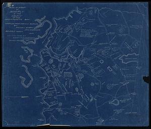
Plan of a part of Beverly in the Colony of the Massachusetts Bay
6102.
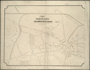
Plan of a part of Cambridge showing the location of the Fayerweather Estate
6103.
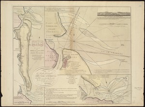
Plan of a part of New Brighton, Staten Island, showing the 500 blocks comprised in a proposed sale of lots
6104.
Plan of a portion of the properties of the Long Wharf or Boston Pier & Central Wharf & Wet Dock Corporatins, showing sixteen...
6105.
A plan of a survey of Noddles Island
6106.
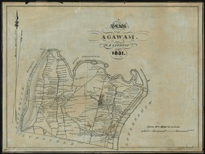
A plan of Agawam
6107.
Plan of Amelia Island in East Florida : A chart of the entrance into St. Mary's River taken by Captn. W. Fuller in November,...
6108.
Plan of an estate belonging to the City of Boston to be sold by public auction on Wednesday, Sept. 14th, 1881 ... : per order...
6109.
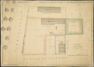
Plan of an estate in Boston belonging to Jos. Head Esqr
6110.
Plan of an estate in High St. to be sold at auction Sat. May 1st 1847 at 12 o'clock on the premises by Whitwell, Seaver & Co....
6111.
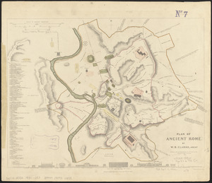
Plan of ancient Rome
6112.
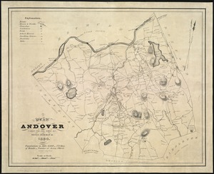
A plan of Andover taken for the town
6113.
Plan of Back Bay and vicinity : prepared from surveys made under the direction of Simon Greenleaf, Joel Giles, Ezra Lincoln,...
6114.
Plan of Back Bay showing improvements on streets and estates
6115.
Plan of Bahía Honda ; Plan of Puerto de Cavañas
6116.
Plan of Bahia Xagua on the south side of Cuba ; Plan of the Colorado Rocks, near the west end of Cuba
6117.
A plan of Becket protracted by a scale of 120 rods to an inch
6118.
Plan of Bishop Parker's estate Bedford Street
6119.
Plan of Boston
6120.
Plan of Boston
‹ Prev
Next ›
1
2
…
302
303
304
305
306
307
308
309
310
…
437
438