Toggle navigation
LMEC Home
Exhibitions
Georeferencing
Tools for Teachers
Collections
My Favorites
Sign Up / Log In
Search
Search the map portal
Map Collection
Map Collection
Map Sets
Search
Search
Search for
Search In
All Fields
Creator
Title
Subject
Place
Search All Digital Collections
Advanced Search
8627 Results
My Search
Start Over
More Like
commonwealth:8049g9430
Remove constraint More Like: commonwealth:8049g9430
Filter your Search
Place
North and Central America
5,865
United States
4,784
Massachusetts
2,052
Europe
1,359
Suffolk (county)
1,034
Boston
1,007
Canada
453
Asia
422
more
Place
»
Topic
Boston (Mass.)--Maps
577
United States--Maps
273
North America--Maps--Early works to 1800
180
Real property--Massachusetts--Boston--Maps
174
Massachusetts--Maps
160
Landowners--Massachusetts--Boston--Maps
132
New England--Maps
99
Europe--Maps
78
more
Topic
»
Date
Date range begin
–
Date range end
Current results range from
1482
to
2023
View distribution
Creator
United States. Hydrographic Office
594
O.H. Bailey & Co
148
Des Barres, Joseph F. W. (Joseph Frederick Wallet), 1722-1824
123
United States. Post Office Dept
120
Ptolemy, 2nd cent
100
Walling, Henry Francis, 1825-1888
94
Jefferys, Thomas, -1771
90
Geological Survey (U.S.)
86
more
Creator
»
Format
Maps/Atlases
8,568
Manuscripts
217
Prints
56
Books
36
Objects/Artifacts
10
Drawings/Illustrations
8
Posters
4
Georeferenced
Yes
872
No
7,755
Collection
Norman B. Leventhal Map & Education Center Collection
8,558
Boston and New England Maps
2,205
Urban Maps
1,936
Maritime Charts and Atlases
1,081
American Revolutionary War-Era Maps
678
Boston Redevelopment Authority Collection
87
New York Public Library Collection
32
Richard H. Brown Revolutionary War Map Collection at Mount Vernon
18
more
Collection
»
Available to use
No known restrictions
8,411
Creative Commons license
110
Search Constraints
Sort by date (desc)
relevance
title
date (asc)
date (desc)
Number of results to display per page
20 per page
10
per page
20
per page
50
per page
100
per page
View results as:
grid view
map view
Search Results
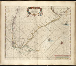
8181.
Paskaarte van't zuÿdelÿckste Deel van America, van Cabo St. Antonio, to Caep de Hoorn, en de inde Zuÿd Zee, tot B. de Tongoÿ
8182.
Paskaert van Brasilia van Pernambuco tot C. de S. Antonio
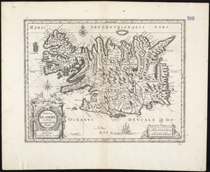
8183.
Tabula Islandiae
8184.
Americae sive Indiae Occidentalis : tabula generalis
8185.
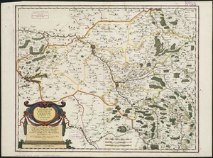
Lugdunensis Prima, cujus metropolis Lugdunum Segusianorum : Province de Lyon ou sont les dioeceses de l'Archevesche de Lyon, et...
8186.
Macedonia, Epirus et Achaia
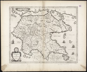
8187.
Morea olim Peloponnesus
8188.
Segusiani : partie du dioecese et archevesche de Lyon : Le Bas Forez et Beaujolois : eslectons de Roanne et de Villefranche
8189.
West-Indische paskaert : waer in de graden der breedde over weder zyden vande middellyn wassende soo vergroten dat die...
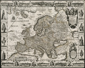
8190.
A new, plaine & exact map of Europe : described by N.I. Visscher and done into English, enlarged & corrected according to I....
8191.
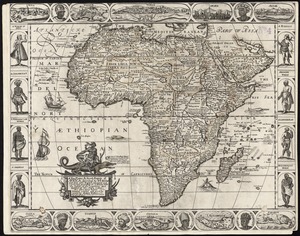
A new, plaine, & exact mapp of Africa : described by N.I. Visscher and done into English, enlarged and corrected, according to...
8192.
A new, plaine, and exact map of America : described by N.I. Visscher, and don into English, enlarged, and corrected, according...
8193.
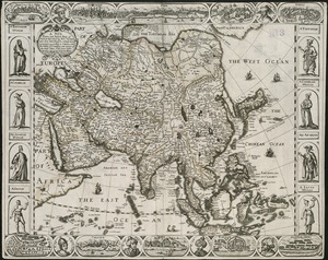
A new, plaine, and exact map of Asia : described by N.I. Visscher, and done into English, enlarged, and corrected, according to...
8194.
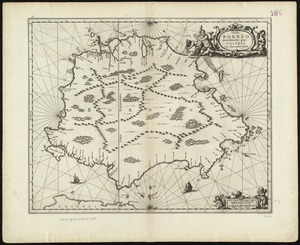
Insula Borneo et occidentalis pars Celebris, cum adjacentibus insulis
8195.
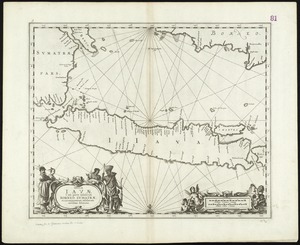
Insulae Iavae, cum parte insularum Borneo Sumatrae, et circumjacentum insularum novissima delineatio
8196.
Atrebates : Evesché d'Arras comté d'Artois subdivisé en toutes ses Iurisdictions scav. gouvernance d'Arras, com.te de St Pol...
8197.
Le Canada, ou Nouvelle France, &c : ce qui est le plus advance vers le Septentrion est tiré de diverses relations des Anglois,...
8198.
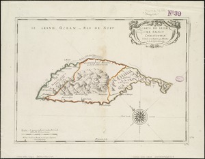
Carte de lisle de Sainct Christophle : scituée a 17 degrez 30 minutes de lat. septentrionale
8199.
Catalauni : evesché de Chalons sur Marne, et en Champagne
8200.
Le Chili
‹ Prev
Next ›
1
2
…
406
407
408
409
410
411
412
413
414
…
431
432