Toggle navigation
LMEC Home
Exhibitions
Georeferencing
Tools for Teachers
Collections
My Favorites
Sign Up / Log In
Search
Search the map portal
Map Collection
Map Collection
Map Sets
Search
Search
Search for
Search In
All Fields
Creator
Title
Subject
Place
Search All Digital Collections
Advanced Search
8956 Results
My Search
Start Over
More Like
commonwealth:7w62hs23k
Remove constraint More Like: commonwealth:7w62hs23k
Filter your Search
Place
North and Central America
6,250
United States
5,174
Massachusetts
2,129
Suffolk (county)
1,428
Boston
1,401
Europe
1,359
Canada
448
Asia
422
more
Place
»
Topic
Boston (Mass.)--Maps
680
City planning--Massachusetts--Boston--Maps
417
United States--Maps
278
Urban renewal--Massachusetts--Boston--Maps
253
Real property--Massachusetts--Boston--Maps
252
Landowners--Massachusetts--Boston--Maps
169
Massachusetts--Maps
160
Buildings--Massachusetts--Boston--Maps
123
more
Topic
»
Date
Date range begin
–
Date range end
Current results range from
1482
to
2023
View distribution
Creator
United States. Hydrographic Office
594
Boston Redevelopment Authority
393
O.H. Bailey & Co
148
Des Barres, Joseph F. W. (Joseph Frederick Wallet), 1722-1824
123
United States. Post Office Dept
120
Ptolemy, 2nd cent
100
Walling, Henry Francis, 1825-1888
94
Geological Survey (U.S.)
86
more
Creator
»
Format
Maps/Atlases
8,897
Manuscripts
215
Prints
56
Books
36
Objects/Artifacts
10
Drawings/Illustrations
8
Posters
4
Georeferenced
Yes
869
No
8,087
Collection
Norman B. Leventhal Map & Education Center Collection
8,566
Boston and New England Maps
2,566
Urban Maps
2,294
Maritime Charts and Atlases
1,081
American Revolutionary War-Era Maps
616
Boston Redevelopment Authority Collection
442
Massachusetts Real Estate Atlases
34
Applied Geographics, Inc. Records
1
Available to use
No known restrictions
8,781
Creative Commons license
46
Search Constraints
Sort by relevance
relevance
title
date (asc)
date (desc)
Number of results to display per page
20 per page
10
per page
20
per page
50
per page
100
per page
View results as:
grid view
map view
Search Results
21.
Government Center project no. Mass. r-35 : proposed land use map
22.
Government Center project no. Mass. r-35 : subway adjustments plan
23.
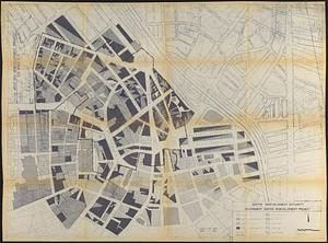
Government Center redevelopment project : land use map
24.
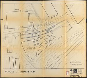
Government Center urban renewal area r-35 : parcel-7 easement plan
25.
Parcel 10 : Sears Crescent, Government Center
26.
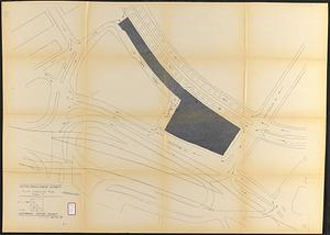
Traffic circulation plan parcel 7 : Government Center project
27.
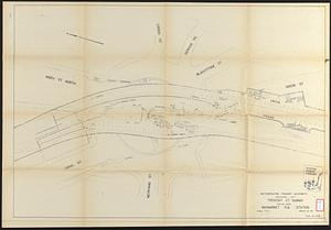
Tremont St. subway Boston, Mass. Haymarket Sq. Station
28.
Back Bay urban renewal area r-47 : land use plan
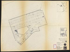
29.
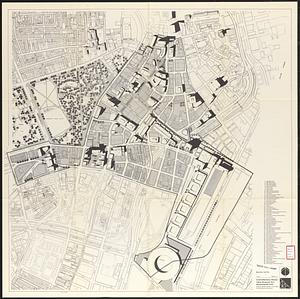
Back Bay urban renewal area r-47 : building conditions
30.
Back Bay urban renewal area r-47 : building conditions
31.
Back Bay urban renewal area r-47 : building conditions
32.
Campus High School urban renewal area Mass. r- : building conditions
33.
Central business district project no Mass r- : existing building condition
34.
Central business district urban renewal area, Massachusetts r-82 : illustrative site plan
35.
Central business district urban renewal area, Massachusetts r-82 : illustrative site plan
36.
Central business district urban renewal area Massachusetts r-82 : illustrative site plan
37.
Central business district urban renewal area r-82 : parcel acquisition map
38.
Central business district urban renewal area r-82 : existing land use
39.
Central business district urban renewal area r-82 : building deficiencies
40.
Charlestown project no. Mass r-42 (GN) : generalized building conditions
‹ Prev
Next ›
1
2
3
4
5
6
…
447
448