Toggle navigation
LMEC Home
Exhibitions
Georeferencing
Tools for Teachers
Collections
My Favorites
Sign Up / Log In
Search
Search the map portal
Map Collection
Map Collection
Map Sets
Search
Search
Search for
Search In
All Fields
Creator
Title
Subject
Place
Search All Digital Collections
Advanced Search
8601 Results
My Search
Start Over
More Like
commonwealth:7h149w855
Remove constraint More Like: commonwealth:7h149w855
Filter your Search
Place
North and Central America
5,887
United States
4,811
Massachusetts
2,052
Europe
1,359
Suffolk (county)
1,034
Boston
1,007
Canada
471
Asia
422
more
Place
»
Topic
Boston (Mass.)--Maps
577
United States--Maps
314
Real property--Massachusetts--Boston--Maps
174
Massachusetts--Maps
160
Landowners--Massachusetts--Boston--Maps
132
New England--Maps
104
North America--Maps--Early works to 1800
103
Europe--Maps
78
more
Topic
»
Date
Date range begin
–
Date range end
Current results range from
1482
to
2023
View distribution
Creator
United States. Hydrographic Office
594
O.H. Bailey & Co
148
Des Barres, Joseph F. W. (Joseph Frederick Wallet), 1722-1824
123
United States. Post Office Dept
120
Ptolemy, 2nd cent
100
Walling, Henry Francis, 1825-1888
94
Geological Survey (U.S.)
87
Jefferys, Thomas, -1771
85
more
Creator
»
Format
Maps/Atlases
8,542
Manuscripts
215
Prints
56
Books
36
Objects/Artifacts
10
Drawings/Illustrations
8
Posters
4
Georeferenced
Yes
871
No
7,730
Collection
Norman B. Leventhal Map & Education Center Collection
8,554
Boston and New England Maps
2,204
Urban Maps
1,936
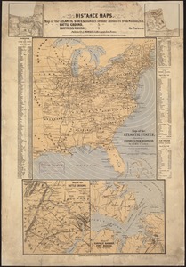
Maritime Charts and Atlases
1,081
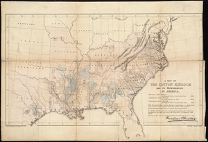
American Revolutionary War-Era Maps
661
Boston Redevelopment Authority Collection
87
American Antiquarian Society Collection
23
William L. Clements Library Collection
20
more
Collection
»
Available to use
No known restrictions
8,411
Creative Commons license
49
Search Constraints
Sort by relevance
relevance
title
date (asc)
date (desc)
Number of results to display per page
20 per page
10
per page
20
per page
50
per page
100
per page
View results as:
grid view
map view
Search Results
121.
Lloyd's new county map of the United States and Canadas showing battle fields, railroads, &c., compiled from the latest...
122.
Lloyd's new map of the United States, the Canadas, and New Brunswick, from the latest surveys showing every railroad & station...
123.
Makers of the U.S.A. : a friendship map
124.
Manuscript map of the United States
125.
Map in commemoration of the travels of Charles A. Lindbergh
126.
Map of all the railroads in the United States in operation and progress
127.
Map of the Atlantic States, showing distances from Washington (in bee line) by 50 mile circles
128.
A map of the British Empire in America with the French and Spanish settlements adjacent throughout
129.
A map of the cotton kingdom and its dependencies in America
130.
A map of the eclipse of Feby. 12th in its passage across the United States
131.
Map of the Mexican National Railway : showing also its relative position to the railway system of the United States, both as to...
132.
Map of the public land states and territories : constructed from the Public Surveys and other official sources in the General...
133.
Map of the United States
134.
Map of the United States : intending chiefly to exhibit the post roads & distances
135.
Map of the United States
136.
Map of the United States
137.
A map of the United States
138.
A map of the United States : compiled chiefly from the state maps, and other authentic information
139.
Map of the United States
140.
A map of the United States and Canada, New-Scotland, New-Brunswick and New-Foundland = Carte des Etats-Unis avec le Canada, la...
‹ Prev
Next ›
1
2
3
4
5
6
7
8
9
10
11
…
430
431