Toggle navigation
LMEC Home
Exhibitions
Georeferencing
Tools for Teachers
Collections
My Favorites
Sign Up / Log In
Search
Search the map portal
Map Collection
Map Collection
Map Sets
Search
Search
Search for
Search In
All Fields
Creator
Title
Subject
Place
Search All Digital Collections
Advanced Search
8813 Results
My Search
Start Over
More Like
commonwealth:7h149w52m
Remove constraint More Like: commonwealth:7h149w52m
Filter your Search
Place
North and Central America
5,992
United States
4,888
Massachusetts
2,079
Europe
1,396
Suffolk (county)
1,046
Boston
1,019
Canada
463
Asia
438
more
Place
»
Topic
Boston (Mass.)--Maps
586
United States--Maps
330
Real property--Massachusetts--Boston--Maps
175
Massachusetts--Maps
162
Landowners--Massachusetts--Boston--Maps
133
North America--Maps--Early works to 1800
103
New England--Maps
102
North America--Maps
85
more
Topic
»
Date
Date range begin
–
Date range end
Current results range from
1482
to
2023
View distribution
Creator
United States. Hydrographic Office
595
O.H. Bailey & Co
148
Des Barres, Joseph F. W. (Joseph Frederick Wallet), 1722-1824
123
United States. Post Office Dept
120
Ptolemy, 2nd cent
100
Walling, Henry Francis, 1825-1888
94
Jefferys, Thomas, -1771
88
Geological Survey (U.S.)
87
more
Creator
»
Format
Maps/Atlases
8,753
Manuscripts
216
Prints
56
Books
36
Objects/Artifacts
10
Drawings/Illustrations
8
Posters
5
Georeferenced
Yes
876
No
7,937
Collection
Norman B. Leventhal Map & Education Center Collection
8,701
Boston and New England Maps
2,233
Urban Maps
2,023
Maritime Charts and Atlases
1,084
American Revolutionary War-Era Maps
725
Boston Redevelopment Authority Collection
87
American Antiquarian Society Collection
54
William L. Clements Library Collection
32
more
Collection
»
Available to use
No known restrictions
8,557
Creative Commons license
61
Search Constraints
Sort by relevance
relevance
title
date (asc)
date (desc)
Number of results to display per page
20 per page
10
per page
20
per page
50
per page
100
per page
View results as:
grid view
map view
Search Results
161.
Hammond's comprehensive map of the United States with portions of Canada and Mexico
162.
Illustrated map of the route of Transcontinental Air Transport, Inc.
163.
Illustrierte karte der Vereinigten Staaten von Amerika : mit darstellung der regionalen bodenschätze, produkte und...
164.
An improved map of the United States
165.
In flight with United Air Lines
166.
Indians of the U.S.A.
167.
Kansas-Nebraska Act, May 22, 1854, Vote on passage
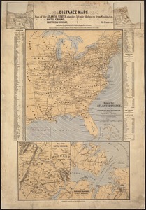
168.
Landing facilities and proposed airway system in the United States, 1923
169.
Lewis' free soil, slavery, and territorial map of the United States
170.
Lloyd's American railroad map
171.
Lloyd's American railroad map
172.
Lloyd's military maps : showing the principal places of interest
173.
Lloyd's new county map of the United States and Canadas showing battle fields, railroads, &c., compiled from the latest...
174.
Lloyd's new map of the United States, the Canadas, and New Brunswick, from the latest surveys showing every railroad & station...
175.
Makers of the U.S.A. : a friendship map
176.
Manuscript map of the United States
177.
Map in commemoration of the travels of Charles A. Lindbergh
178.
Map of all the railroads in the United States in operation and progress
179.
Map of the Atlantic States, showing distances from Washington (in bee line) by 50 mile circles
180.
A map of the British Empire in America with the French and Spanish settlements adjacent throughout
‹ Prev
Next ›
1
2
…
5
6
7
8
9
10
11
12
13
…
440
441