Toggle navigation
LMEC Home
Exhibitions
Georeferencing
Tools for Teachers
Collections
My Favorites
Sign Up / Log In
Search
Search the map portal
Map Collection
Map Collection
Map Sets
Search
Search
Search for
Search In
All Fields
Creator
Title
Subject
Place
Search All Digital Collections
Advanced Search
8760 Results
My Search
Start Over
More Like
commonwealth:6h446t031
Remove constraint More Like: commonwealth:6h446t031
Filter your Search
Place
North and Central America
5,991
United States
4,908
Massachusetts
2,082
Europe
1,396
Suffolk (county)
1,110
Boston
1,083
Canada
449
Asia
438
more
Place
»
Topic
Boston (Mass.)--Maps
589
United States--Maps
282
Real property--Massachusetts--Boston--Maps
192
Massachusetts--Maps
163
Landowners--Massachusetts--Boston--Maps
143
City planning--Massachusetts--Boston--Maps
115
North America--Maps--Early works to 1800
103
New England--Maps
102
more
Topic
»
Date
Date range begin
–
Date range end
Current results range from
1482
to
2023
View distribution
Creator
United States. Hydrographic Office
595
O.H. Bailey & Co
148
Des Barres, Joseph F. W. (Joseph Frederick Wallet), 1722-1824
123
United States. Post Office Dept
120
Boston Redevelopment Authority
115
Ptolemy, 2nd cent
100
Walling, Henry Francis, 1825-1888
94
Geological Survey (U.S.)
87
more
Creator
»
Format
Maps/Atlases
8,700
Manuscripts
215
Prints
56
Books
36
Objects/Artifacts
10
Drawings/Illustrations
8
Posters
5
Georeferenced
Yes
871
No
7,889
Collection
Norman B. Leventhal Map & Education Center Collection
8,697
Boston and New England Maps
2,287
Urban Maps
2,076
Maritime Charts and Atlases
1,083
American Revolutionary War-Era Maps
616
Boston Redevelopment Authority Collection
139
Massachusetts Real Estate Atlases
11
Applied Geographics, Inc. Records
1
more
Collection
»
Available to use
No known restrictions
8,606
Creative Commons license
48
Search Constraints
Sort by relevance
relevance
title
date (asc)
date (desc)
Number of results to display per page
20 per page
10
per page
20
per page
50
per page
100
per page
View results as:
grid view
map view
Search Results
681.
Barron County, Wis.
682.
Bartholomew's chart of the world on Mercator's projection
683.
Bartholomew's contour motoring map of Central Europe showing the best touring roads with heights and distances in metres and...
684.
Bartholomew's pocket plan of Edinburgh & suburbs
685.
Bartholomew's tourist's map of South Africa prepared from the latest surveys
686.
Bartlett's illustrated map of Boston, or, Stranger's guide showing the public buildings, places of amusement & its'...
687.
Barton Street, West End
688.
Barton, Vt
689.
Base map of Illinois
690.
Base-map of the United States
691.
Bataan
692.
Batavia
693.
Bath, Penn
694.
Baton Rouge
695.
The battle fields and military positions in the Virginian peninsula : from surveys supplied by officers of the army
696.
Battle of Brandywine in which the rebels were defeated, September the 11th. 1777, by the army under the command of General Sr....
697.
Battle of Cerro Gordo, April 17th & 18th 1847
698.
Battle of Gravelotte, August 18th, 1870
699.
Battle of Zorndorf
700.
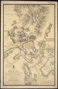
Battlefield in front of Franklin, Tenn. where the United States forces, consisting of the 4th & 23rd Corps and the Cavalry...
‹ Prev
Next ›
1
2
…
31
32
33
34
35
36
37
38
39
…
437
438