Toggle navigation
LMEC Home
Exhibitions
Georeferencing
Tools for Teachers
Collections
My Favorites
Sign Up / Log In
Search
Search the map portal
Map Collection
Map Collection
Map Sets
Search
Search
Search for
Search In
All Fields
Creator
Title
Subject
Place
Search All Digital Collections
Advanced Search
8662 Results
My Search
Start Over
More Like
commonwealth:6h446r80q
Remove constraint More Like: commonwealth:6h446r80q
Filter your Search
Place
North and Central America
5,957
United States
4,881
Massachusetts
2,062
Europe
1,359
Suffolk (county)
1,146
Boston
1,119
Canada
448
Asia
422
more
Place
»
Topic
Boston (Mass.)--Maps
598
United States--Maps
273
Real property--Massachusetts--Boston--Maps
252
Landowners--Massachusetts--Boston--Maps
169
Massachusetts--Maps
160
City planning--Massachusetts--Boston--Maps
138
North America--Maps--Early works to 1800
103
New England--Maps
99
more
Topic
»
Date
Date range begin
–
Date range end
Current results range from
1482
to
2023
View distribution
Creator
United States. Hydrographic Office
594
O.H. Bailey & Co
148
Boston Redevelopment Authority
140
Des Barres, Joseph F. W. (Joseph Frederick Wallet), 1722-1824
123
United States. Post Office Dept
120
Ptolemy, 2nd cent
100
Walling, Henry Francis, 1825-1888
94
Geological Survey (U.S.)
86
more
Creator
»
Format
Maps/Atlases
8,603
Manuscripts
215
Prints
56
Books
36
Objects/Artifacts
10
Drawings/Illustrations
8
Posters
4
Georeferenced
Yes
870
No
7,792
Collection
Norman B. Leventhal Map & Education Center Collection
8,551
Boston and New England Maps
2,281
Urban Maps
2,013
Maritime Charts and Atlases
1,081
American Revolutionary War-Era Maps
616
Boston Redevelopment Authority Collection
163
Massachusetts Real Estate Atlases
35
Mapping Boston Collection
1
Available to use
No known restrictions
8,485
Creative Commons license
47
Search Constraints
Sort by date (asc)
relevance
title
date (asc)
date (desc)
Number of results to display per page
20 per page
10
per page
20
per page
50
per page
100
per page
View results as:
grid view
map view
Search Results
8241.
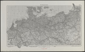
Norddeutschland
8242.
Pampanga
8243.
Philippine Islands : [outline map]
8244.
A pictorial map of North America
8245.
Pictorial map of the American continent : featuring the Pan American Highway and showing some of the natural resources, scenic...
8246.
Süddeutschland, Österreich, Schweiz und östliches Frankreich
8247.
Sumatra wegenkaart
8248.
Tayabas (northern part)
8249.
Tayabas (southern part)
8250.
Uprooted people of the U.S.A.
8251.
Ward lines and voting precincts circa 1945
8252.
Zambales
8253.
Aaron Bohrod's America, its history
8254.
Atlas of the city of Newton Massachusetts : assessors block system
8255.
Boston Elevated Railway system route map
8256.
Boston Elevated Railway track lengths of surface lines and subway
8257.
Catholic America : a pictorial map portraying the contribution of Catholics in the development of the United States of America...
8258.
Paul Sample's America, its soil
8259.
Shíjú tú
8260.
William Gropper's America, its folklore
‹ Prev
Next ›
1
2
…
409
410
411
412
413
414
415
416
417
…
433
434